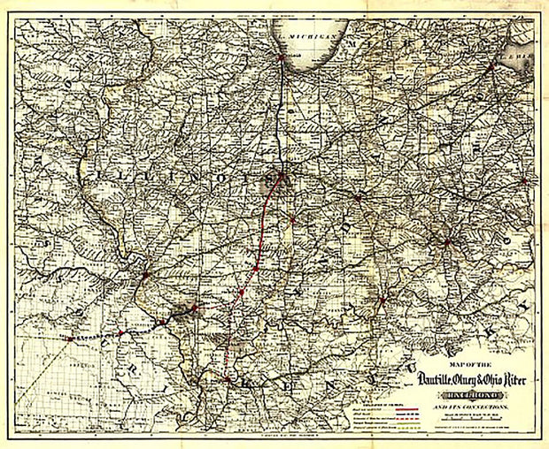
Danville, Olney & Ohio River Railroad, 1881 This beautiful antique map reproduction is printed on heavy acid-free stock with fade proof inks and is excellent for framing.
27"W x 22"H
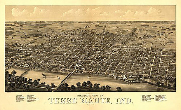
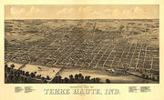
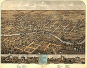
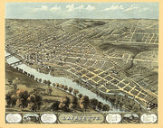
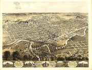
Panoramic view of Terre Haute, Indiana by Beck & Pauli, 1880
IN00033
Regular price
$39.95
0 in stock
Panoramic view of Terre Haute, Indiana by Beck & Pauli, 1880 This beautiful antique map reproduction is printed on heavy acid-free stock with fade proof inks and is excellent for framing.
35"W x 21"H
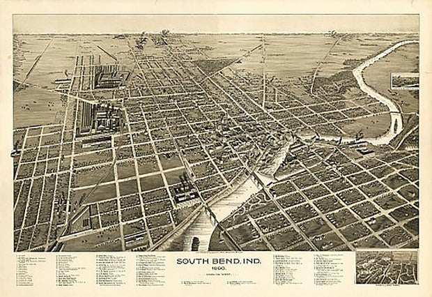
South Bend, Indiana by C. J. Pauli, 1890
IN00030
Regular price
$39.95
0 in stock
South Bend, Indiana by C. J. Pauli, 1890 This beautiful antique map reproduction is printed on heavy acid-free stock with fade proof inks and is excellent for framing.
34”W X 23”H
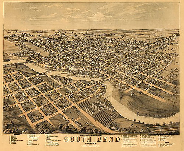
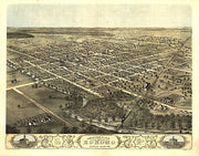
South Bend, Indiana by A. Ruger, 1874
IN00029
Regular price
$39.95
0 in stock
South Bend, Indiana by A. Ruger, 1874 This beautiful antique map reproduction is printed on heavy acid-free stock with fade proof inks and is excellent for framing.
28”W X 22”H
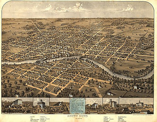
South Bend, Indiana by A. Ruger, 1866
IN00028
Regular price
$39.95
0 in stock
South Bend, Indiana by A. Ruger, 1866 This beautiful antique map reproduction is printed on heavy acid-free stock with fade proof inks and is excellent for framing.
28”W X 22”H
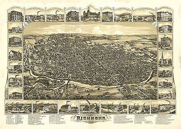
Richmond, Indiana by Albert Downs, 1884
IN00027
Regular price
$39.95
0 in stock
Richmond, Indiana by Albert Downs, 1884 This beautiful antique map reproduction is printed on heavy acid-free stock with fade proof inks and is excellent for framing.
23”W X 32”H
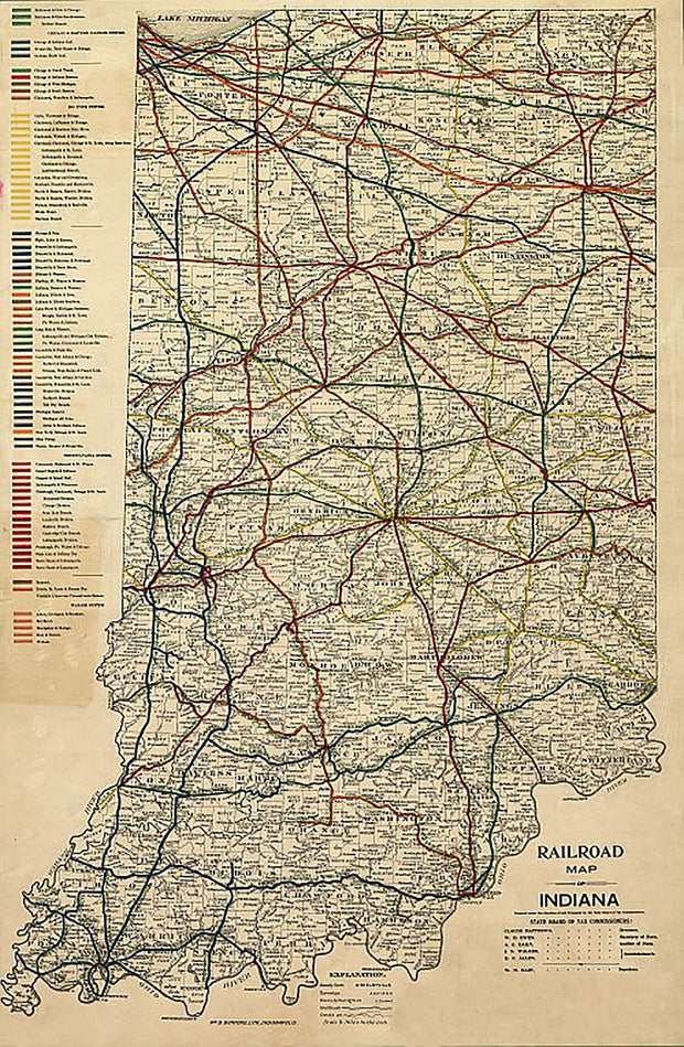
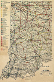
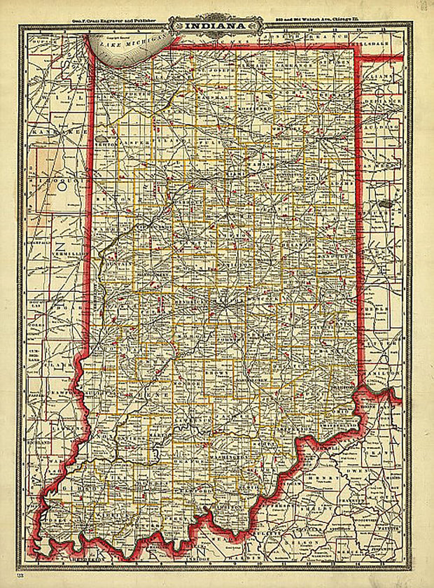
Railroad Map of Indiana, 1896
IN00026
Regular price
$39.95
0 in stock
Railroad Map of Indiana, 1896 This beautiful antique map reproduction is printed on heavy acid-free stock with fade proof inks and is excellent for framing.
22"W x 35"H
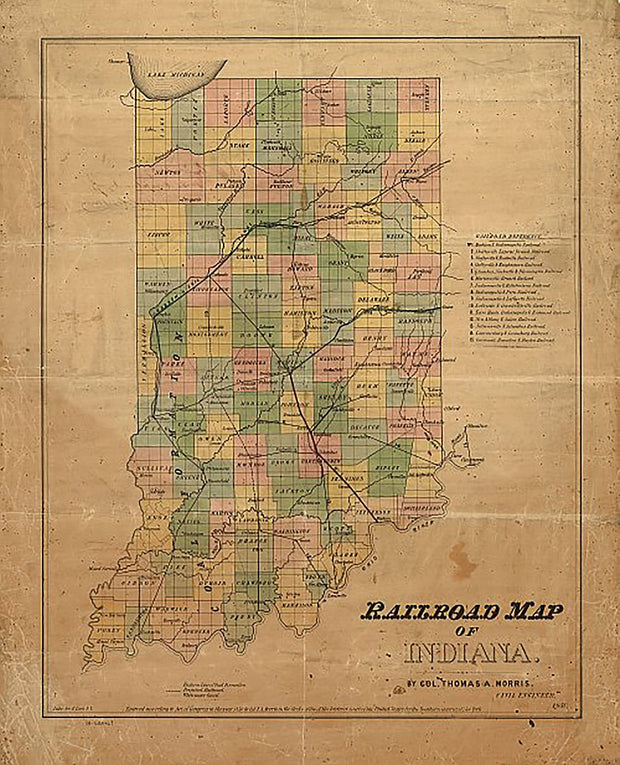
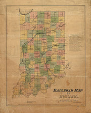
Railroad Map of Indiana, by Col. Thomas A. Morris, 1850
IN00025
Regular price
$39.95
0 in stock
Railroad Map of Indiana, by Col. Thomas A. Morris, 1850 This beautiful antique map reproduction is printed on heavy acid-free stock with fade proof inks and is excellent for framing.
19"W x 25"H
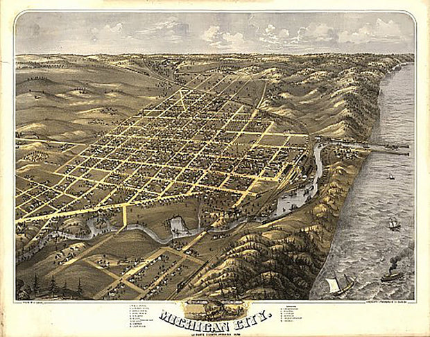
Bird's eye view of the city of Michigan City, Indiana by A. Ruger, 1869
IN00018
Regular price
$39.95
0 in stock
Bird's eye view of the city of Michigan City, Indiana by A. Ruger, 1869 This beautiful antique map reproduction is printed on heavy acid-free stock with fade proof inks and is excellent for framing.
28"W x 22"H
Bird's eye view of the city of Lafayette, Indiana by A. Ruger, 1868
IN00015
Regular price
$39.95
0 in stock
Bird's eye view of the city of Lafayette, Indiana by A. Ruger, 1868 This beautiful antique map reproduction is printed on heavy acid-free stock with fade proof inks and is excellent for framing.
28"W x 22"H
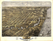
Birds eye view of the city of Kokomo, Indiana by A. Ruger, 1868
IN00013
Regular price
$39.95
0 in stock
Birds eye view of the city of Kokomo, Indiana by A. Ruger, 1868 This beautiful antique map reproduction is printed on heavy acid-free stock with fade proof inks and is excellent for framing.
28"W x 22"H
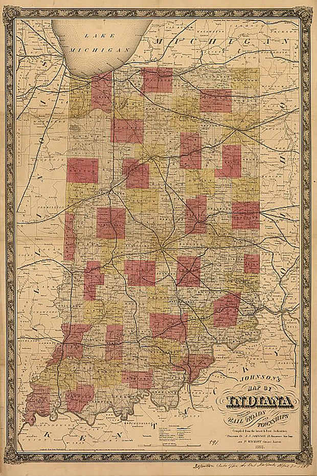
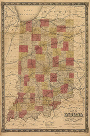
Johnson's map of Indiana, 1858
IN00012
Regular price
$39.95
0 in stock
Johnson's map of Indiana, 1858 This beautiful antique map reproduction is printed on heavy acid-free stock with fade proof inks and is excellent for framing.
24"W x 34"H
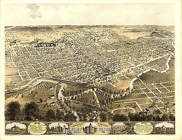
Bird's eye view of the city of Fort Wayne, Indiana by A. Ruger, 1868
IN00009
Regular price
$39.95
0 in stock
Bird's eye view of the city of Fort Wayne, Indiana by A. Ruger, 1868 This beautiful antique map reproduction is printed on heavy acid-free stock with fade proof inks and is excellent for framing.
29"W x 22"H
Fort Wayne, Indiana by P.M. Neff, 1795
IN00008
Regular price
$39.95
0 in stock
Fort Wayne, Indiana by P.M. Neff, 1795 This beautiful antique map reproduction is printed on heavy acid-free stock with fade proof inks and is excellent for framing.
16"W x 25"H
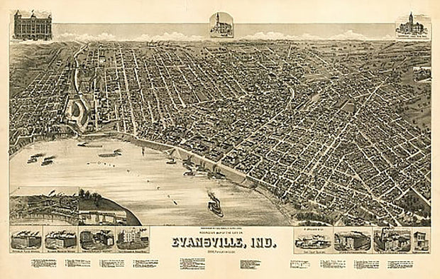
Perspective map of the city of Evansville, Indiana by Henry Wellge, 1888
IN00007
Regular price
$39.95
0 in stock
Perspective map of the city of Evansville, Indiana by Henry Wellge, 1888 This beautiful antique map reproduction is printed on heavy acid-free stock with fade proof inks and is excellent for framing.
35"W x 23"H
Cram's Township and Rail Road Map of Indiana, 1888
IN00005
Regular price
$39.95
0 in stock
Cram's Township and Rail Road Map of Indiana, 1888 This beautiful antique map reproduction is printed on heavy acid-free stock with fade proof inks and is excellent for framing.
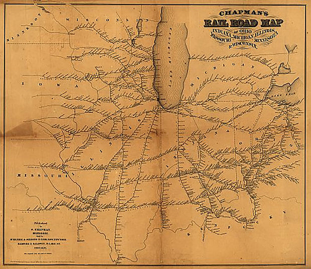
Chapman's Rail Road Map of Ohio, Indiana, Michigan, Illinois, Missouri, Minnesota, & Wisconsin, 1859 This beautiful antique map reproduction is printed on heavy acid-free stock with fade proof inks and is excellent for framing.