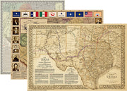
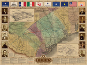
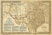
This well known, iconic, historical map of Texas was created by Texas artist and master cartographer John Davis to commemorate the 150th anniversary of the Texas Revolution. Hand drawn and exquisitely colored, it became a classic for its unparalleled drama, accuracy, and beauty.
Depicting the Republic of Texas as it was in 1845, just before its annexation by the United States, this map renders the original 36 counties of Texas, the 78 Spanish land grants along the Rio Grande (present day New Mexico), and the vast region claimed by Texas from the Mexican border through present day Wyoming.
Davis's study of the Santa Fe Trail has been hailed as the most accurate ever published, attesting to the artists scholarship as well as fine art. Davis maps have become the favorite of governors, celebrities, and transplanted Texans everywhere.
Printed on a 26" W x 31.5" H sheet of sturdy, art-gallery quality parchment stock it is especially suitable for framing.
In order to make sure it arrives safely we carefully roll the map and insert it in to a protective poly tubing sleeve and then it is inserted in a heavy cardboard tube for safe handling all the way to its destination.
Revolutionary Texas 1836
HIST030
Regular price
$44.95
-49 in stock
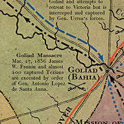
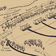
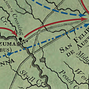
This beautiful map, commissioned in 1986 to commemorate the Texas Sesquicentennial by artist and master cartographer John Davis, depicts the historic events that transpired during the turbulent years of the Texas revolution. Hand drawn, with exquisite color and detail, it features battle sites, roads and trails and hundreds of early settlements.
Celebrating the storied days of 1835-1836, Davis meticulously locates each of the 48 battles of the Texas Revolution and territory controlled by Native American tribes such as the Comanche, Cherokee, Caddo, Kickapoo, Pawnee and Alabama Coushatta.
The map also contains an inset view of the full Republic of Texas at that time and a table in the lower-right which lists facts about important battles.
Printed on a 26" W x 32" H sheet of sturdy, art-gallery quality parchment stock it is especially suitable for framing.
In order to make sure it arrives safely we carefully roll the map and insert it in to a protective poly tubing sleeve and then it is inserted in a heavy cardboard tube for safe handling all the way to its destination.
Early Maps of Texas CD
HIST005
Regular price
$17.95
-5 in stock
This CD contains 155 beautiful high-resolution images of historic maps of Texas, Texas cities and counties and early North American maps showing Texas in relation to the growing United States. Print at full size or zoom in to browse the smallest details, these maps are a wonderful resource for historians, teachers, researchers and map lovers of all ages. No installation required - runs directly from the CD. PC or Mac compatible.
Texas 1841 by John Arrowsmith
HIST780-01
Regular price
$39.95
-11 in stock
This fascinating map published during the period of The Republic by the London firm of John Arrowsmith is quite literally covered with hand written notes by an Englishman named Wm. Bollaert who had come to Texas at the behest of his friend William Kennedy who was subsequently appointed British consul at Galveston. Mr. Bollaert was commissioned to write a report for the British Admiralty and hoped to someday write a commercial book (he never did) about his travels in Texas. This beautiful reproduction is printed on heavy parchment style paper and is excellent for framing.
26"W x 31"H
Interested in a framed version of this map? Click HERE
Texas 1835 by J. H. Young
HIST790
Regular price
$39.95
-9 in stock
This striking map produced just before Texas declared it's independence from Mexico shows colonies and land grants, the Neuces River as the border between Texas and Mexican states, Indian Territory attached to Arkansas, Santa Fe area, towns, rivers, and roads. The three text boxes discuss at some length the land grant system (Land Grants), the physical nature, political environment and emigrant status (Remarks on Texas), and the nature and navigability of Texas rivers (Texas Rivers). This beautiful reproduction is printed on heavy parchment style paper and is excellent for framing.
28"W x23"H
Interested in a framed version of this map? Click HERE
Any Current USGS TOPO Map - Select Your Quadrangle
TOPO100-01
Regular price
$24.95
-32 in stock
The current USGS topographic maps are scaled at 1:24,000 also know as the 7.5 series. Each map is referred to as a quadrangle. If you are not sure which quadrangle you need click the link at the bottom and follow these instructions:
Once you arrive at the USGS site type in the name of the location (city and state, mountain, national park, etc) you are searching in the search bar in the upper right corner.
Click on the round 24k red button and the list will display the names of the quadrangles associated with that area.
Use the zoom in and out button to see the quadrangle grids and names in an overlay of the map.
Once you have located the quadrangle you need simply type the name in the Quadrangle name field above , add it to your cart and we will get it printed up and shipped to you. It is that easy.
If you have any questions please feel free to give us a call anytime at 830-438-4080 and we will be happy to assist you with the process of identifying the map you need.
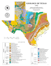
Geology of Texas
GEOL020-02
Regular price
$59.95
-23 in stock
Paper or laminated
36" W x 47" H
Source: UT Bureau of Economic Geology
Depicts Surface Geology for Texas
Includes a Cross Referenced Stratigraphic Column
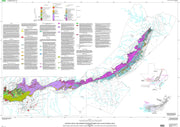
This attractive map/poster from the University of Texas Bureau of Economic Geology depicts surface geology for the state and includes a cross referenced stratigraphic column.
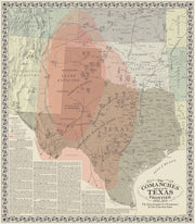
The Comanches and Texas
HIST180
Regular price
$42.95
-39 in stock
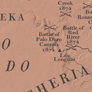
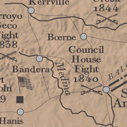
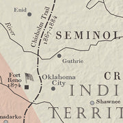
In the mid-nineteenth century westward settlement in Texas was stopped in its tracks by the Comanches, widely recognized at the time as the best mounted warriors in the world. The half-century struggle that ensued between the fledging state and Americas most fierce Indian tribe is depicted on this map. Battle sites, forts, trails and much more are shown on this graphically pleasing and historically rich map. This map is printed on heavy acid free stock and is perfect for framing.
25"W x 28"H
Interested in a framed version of this map? Click HERE
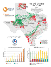
Oil and Gas Map of Texas
GEOL040-02
Regular price
$59.95
-14 in stock
Paper or laminated
36" W x 47" H
Source: UT Bureau of Economic Geology
Includes Top Oil and Top Gas Plays
Data from the Railroad Commission of Texas
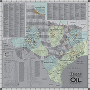
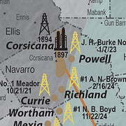
Texas has produced more oil and natural gas than any other state and to date remains the largest daily producer. Oil and natural gas are found in most parts of the state. No state or any other region worldwide has been as heavily explored or drilled for oil and natural gas as Texas. This beautiful laminated map/poster shows the oil and gas developement in Texas in great detail and will be a compliment to any office or classroom.
Geological Highway Map of Texas
GEOL010
Regular price
$29.95
-19 in stock
Learn more about the geological history of the rocks around you! This full-color map presents surface rock outcrop information - age, depositional environment, rock type, and names of formations - and includes major highways, towns, and landmarks. A stratigraphic column and mileage chart fill out the front of the map and various cross sections, inset maps showing gemstone locations, places of geological interest, fossil localities and much more, cover the back.
Austin 1887 by Augustus Koch
HIST360
Regular price
$39.95
-12 in stock
This dramatic birds eye view map of Austin shows a growing and dynamic city at the end of the 19th century. Many streets are labeled and there is an excellent legend at the bottom that identifies many prominent business, schools and churches. This beautiful reproduction is printed on heavy parchment style paper and is excellent for framing.
24" x 34"
Interested in a framed version of this map? Click HERE
Major Texas Rivers Wall Map
TXWM013-03
Regular price
$44.95
-16 in stock
Paper or laminated
36" W x 36" H
Source: Texas Water Development Board
Includes Rivers, Basins, Aquifers, Cities and Counties
Great Resource to Study Texas Hydrology
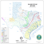
This wonderful laminated map from the Texas Water Development Board not only shows the major rivers of Texas and their basins, but also includes reserviors, major aquifers, major cities and counties . An excellent resource for anyone wanting to understand Texas hydrology.
Published by the United States War Department, this map was part of the accompanying documentation sent to the Senate in 1844 when the Texas annexation treaty was debated. The Republic of Texas covered much of present-day New Mexico including Santa Fe, Albuquerque and Taos as well as parts of Colorado that cover many of the popular ski resorts. Another interesting historical note: the area north of present-day Oklahoma is shown as "Proposed NE-BRAS-KA Territory". This beautiful reproduction is printed on heavy parchment style paper that is excellent for framing.
34"W x 22"H
Interested in a framed version of this map? Click HERE
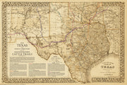
1881 Lonesome Dove/Comanche Moon Wars & Great Cattle Trails Map
HIST090-02
Regular price
$35.00
-85 in stock
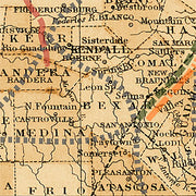
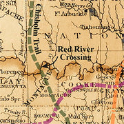
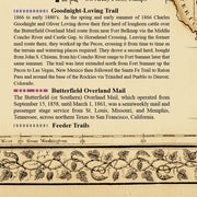
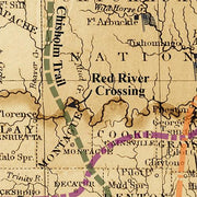
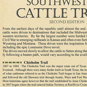
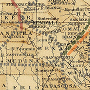
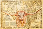
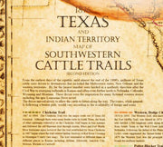
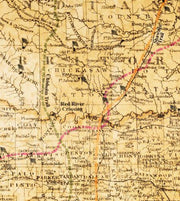
The Lonesome Dove Trail/Comanche Moon Wars & Great Cattle Trails Map is an exclusive copyrighted design based on an original 1881 US map by S.A. Mitchell. In addition to the Lonesome Dove trail and place names, this map has most of the Texas locations and place names from Larry McMurtrys great "Comanche Moon" novel which follows Gus & Call during their Texas Ranger days before the Civil War and is the preface to Lonesome Dove. The Chisholm, Great Western, Goodnight-Loving, Shawnee and the other major overland cattle trails are also shown in their correct positions.
The map is printed on heavy (65lb) parchment style paper that is excellent for framing. Or for you can treat yourself or someone else to a canvas gallery wrap or framed canvas version for a more exquisite piece.
Texas Raised Relief Map
TOPO005
Regular price
$69.95
-5 in stock
This three-dimensional Texas State Raised Relief map uses the beautiful base map from Raven Maps & Images and shows cities, highways, rivers and creeks in addition to the altitude gradation and topographic diversity represented by the artistic use of soft colors. Excellent for framing.
28" W x 26" H
Houston 1891
HIST230
Regular price
$39.95
-4 in stock
This wonderful bird's eye view depicts Houston in all it's booming glory at the end of the 19th century. It features excellent drawings of some of the more important buildings in the city as well as a directory of 'Public Buildings, Hotels, Railroads and Some of the Leading Manufacturers'. A church directory occupies the lower right-hand corner. This beautiful reproduction is printed on heavy parchment style paper and is excellent for framing.
36"W x 22"H
Interested in a framed version of this map? Click HERE
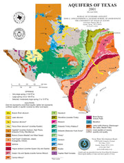
Aquifers of Texas Map/Poster
GEOL050-02
Regular price
$59.95
-9 in stock
Paper or laminated
36" W x 48" H
Source: UT Bureau of Economic Geology
Depicts all Major and Minor Aquifers in Texas
Data from Texas Water Development Board
This beautiful laminated map/poster depicts the major and minor aquifers in Texas and describes their importance as part of the water cycle in supplying ground water for Texas. Information used in making this map was compiled primarily from maps and data at the Texas Water Development Board, the State agency charged with oversight of ground-water resources.
Map of Texas with Parts of Adjoining States by Stephen F. Austin, 1837
HIST120
Regular price
$39.95
-1 in stock
In 1829, after spending six years exploring Texas and gleaning information from travelers and surveyors, Stephen F. Austin sent the information to Henry S. Tanner, a prominent Philadelphia publisher, who used it to created a forerunner of this map in 1830.This 1837 edition was regarded as the most accurate of the day and was copied by many other publishers and cartographers. This beautiful reproduction is printed on heavy parchment style paper that is excellent for framing.
24"W x 29"H
Interested in a framed version of this map? Click HERE
Railroad and County Map of Texas 1893
HIST290
Regular price
$39.95
-2 in stock
This extremely detailed map shows rivers, mountainous areas, counties, cities, towns, forts, roads, and railroads. Stops along the railroads are also given. This beautiful reproduction is printed on heavy parchment style paper and is excellent for framing.
26" x 30"
Interested in a framed version of this map? Click HERE