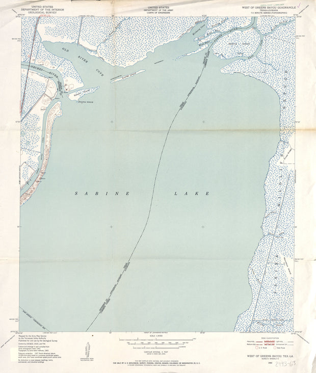
This is a high-resolution reproduction printed on 24 lb. bond paper.
PLEASE NOTE: This map does not cover the entire county. The principle county within which the map coverage lies is listed first with partial coverage as noted.
This is a high-resolution reproduction printed on 24 lb. bond paper.
PLEASE NOTE: This map does not cover the entire county. The principle county within which the map coverage lies is listed first with partial coverage as noted.
22"W x 30"H
West of Greens Bayou 1943, USGS
HST0961
Regular price
$29.95
0 in stock
COUNTY: Jefferson; SCALE: 1:24,000
This is a high-resolution reproduction printed on 24 lb. bond paper.
PLEASE NOTE: This map does not cover the entire county. The principle county within which the map coverage lies is listed first with partial coverage as noted.
22"W x 30"H
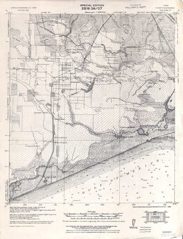
Fannett 1928, US Army Corps of Engineers
HST0813
Regular price
$29.95
-1 in stock
COUNTY: Jefferson (partial Chambers, Liberty); SCALE: 1:125,000
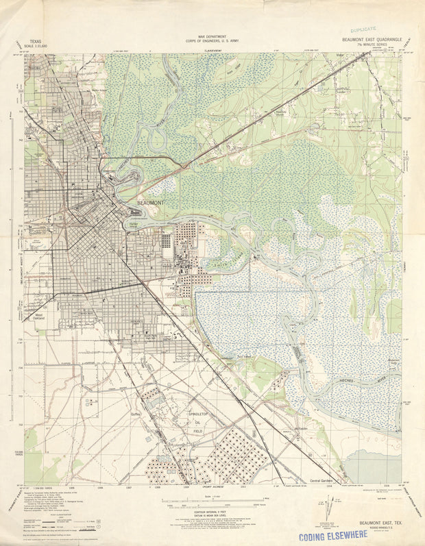
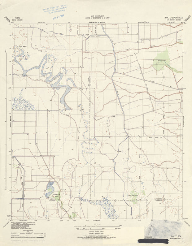
This is a high-resolution reproduction printed on 24 lb. bond paper.
PLEASE NOTE: This map does not cover the entire county. The principle county within which the map coverage lies is listed first with partial coverage as noted.
22"W x 30"H
Voth 1943, US Army Corps of Engineers
HST0400
Regular price
$29.95
-1 in stock
COUNTY: Jefferson/Hardin; SCALE: 1:31,680
This is a high-resolution reproduction printed on 24 lb. bond paper.
PLEASE NOTE: This map does not cover the entire county. The principle county within which the map coverage lies is listed first with partial coverage as noted.
22"W x 30"H
Texas Point 1943, US Army Corps of Engineers
HST0381
Regular price
$29.95
0 in stock
COUNTY: Jefferson; SCALE: 1:31,680
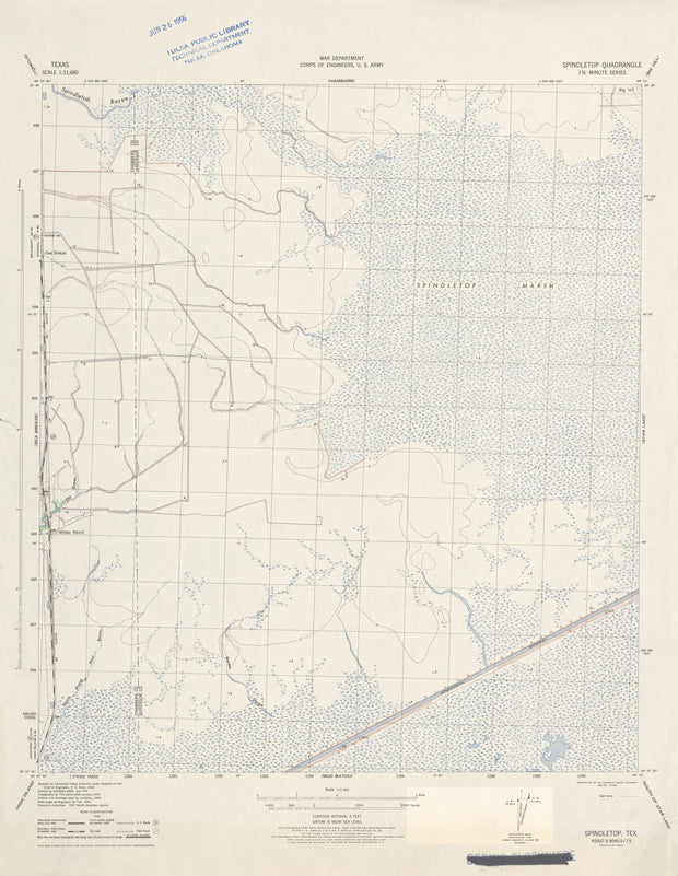
This is a high-resolution reproduction printed on 24 lb. bond paper.
PLEASE NOTE: This map does not cover the entire county. The principle county within which the map coverage lies is listed first with partial coverage as noted.
22"W x 30"H
Spindletop 1943, US Army Corps of Engineers
HST0362
Regular price
$29.95
0 in stock
COUNTY: Jefferson (partial Chambers); SCALE: 1:31,680
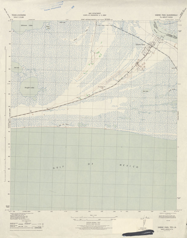
This is a high-resolution reproduction printed on 24 lb. bond paper.
PLEASE NOTE: This map does not cover the entire county. The principle county within which the map coverage lies is listed first with partial coverage as noted.
22"W x 30"H
Sabine Pass 1943, US Army Corps of Engineers
HST0330
Regular price
$29.95
0 in stock
COUNTY: Jefferson; SCALE: 1:31,680
This is a high-resolution reproduction printed on 24 lb. bond paper.
PLEASE NOTE: This map does not cover the entire county. The principle county within which the map coverage lies is listed first with partial coverage as noted.
22"W x 30"H
Port Acres 1943, US Army Corps of Engineers
HST0308
Regular price
$29.95
0 in stock
COUNTY: Jefferson; SCALE: 1:31,680
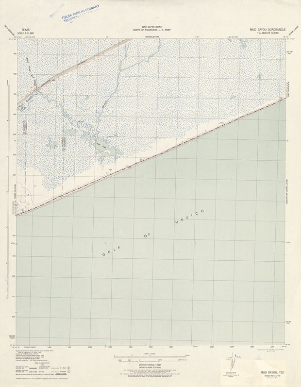
This is a high-resolution reproduction printed on 24 lb. bond paper.
PLEASE NOTE: This map does not cover the entire county. The principle county within which the map coverage lies is listed first with partial coverage as noted.
This is a high-resolution reproduction printed on 24 lb. bond paper.
PLEASE NOTE: This map does not cover the entire county. The principle county within which the map coverage lies is listed first with partial coverage as noted.
22"W x 30"H
Mud Bayou 1943, US Army Corps of Engineers
HST0275
Regular price
$29.95
0 in stock
COUNTY: Jefferson (partial Chambers, Galveston); SCALE: 1:31,680
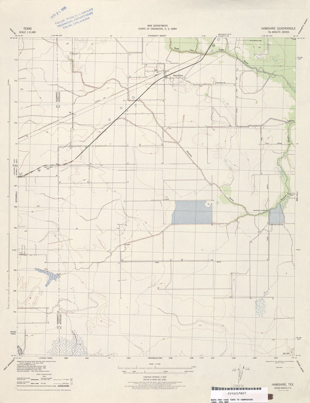
This is a high-resolution reproduction printed on 24 lb. bond paper.
PLEASE NOTE: This map does not cover the entire county. The principle county within which the map coverage lies is listed first with partial coverage as noted.
22"W x 30"H
Hamshire 1942, US Army Corps of Engineers
HST0195
Regular price
$29.95
0 in stock
COUNTY: Jefferson (partial Chambers); SCALE: 1:62,500
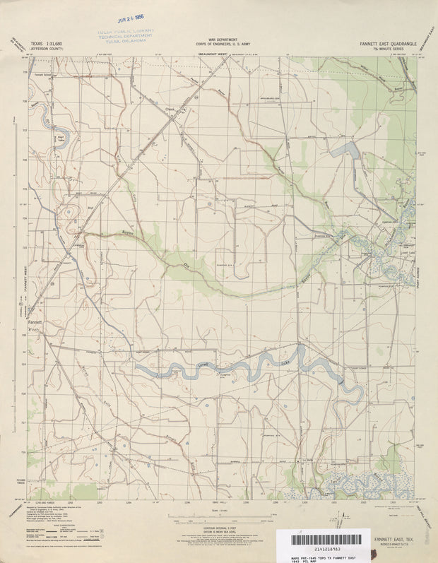
This is a high-resolution reproduction printed on 24 lb. bond paper.
PLEASE NOTE: This map does not cover the entire county. The principle county within which the map coverage lies is listed first with partial coverage as noted.
22"W x 30"H
Fannett East 1943, US Army Corps of Engineers
HST0160
Regular price
$29.95
0 in stock
COUNTY: Jefferson; SCALE: 1:31,680
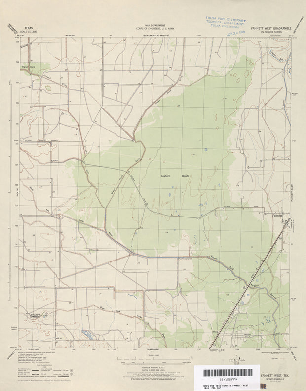
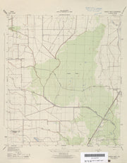
This is a high-resolution reproduction printed on 24 lb. bond paper.
PLEASE NOTE: This map does not cover the entire county. The principle county within which the map coverage lies is listed first with partial coverage as noted.
22"W x 30"H
Fannett West 1943, US Army Corps of Engineers
HST0161
Regular price
$29.95
0 in stock
COUNTY: Jefferson (partial Chambers); SCALE: 1:31,680
This is a high-resolution reproduction printed on 24 lb. bond paper.
PLEASE NOTE: This map does not cover the entire county. The principle county within which the map coverage lies is listed first with partial coverage as noted.