Kentucke [sic] by John Filson, 1784 This beautiful antique map reproduction is printed on heavy acid-free stock with fade proof inks and is excellent for framing.
21”W X 24”H
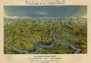
Panorama of the seat of war; Birds eye view of Kentucky and Tennessee...by John Bachmann, 1862
KYCW018
Regular price
$39.95
0 in stock
Panorama of the seat of war; Birds eye view of Kentucky and Tennessee...by John Bachmann, 1862 This beautiful antique map reproduction is printed on heavy acid-free stock with fade proof inks and is excellent for framing.
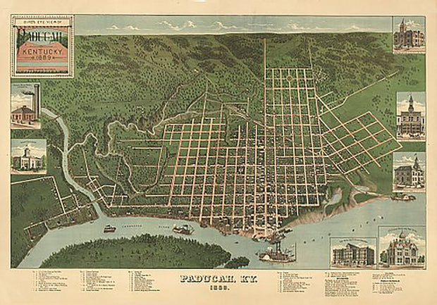
Bird's eye view of Paducah, Kentucky by J. Blanton Postlethwaite, 1889
KY00014
Regular price
$39.95
0 in stock
Bird's eye view of Paducah, Kentucky by J. Blanton Postlethwaite, 1889 This beautiful antique map reproduction is printed on heavy acid-free stock with fade proof inks and is excellent for framing.
33”W X 23”H
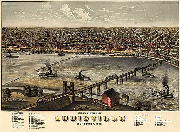
Bird's eye view of Louisville, Kentucky by A. Ruger, 1876
KY00012
Regular price
$39.95
0 in stock
Bird's eye view of Louisville, Kentucky by A. Ruger, 1876 This beautiful antique map reproduction is printed on heavy acid-free stock with fade proof inks and is excellent for framing.
30”W X 22”H
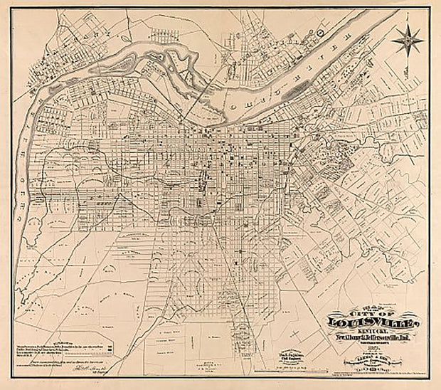
Map of the city of Louisville, Kentucky, New Albany & Jeffersonville, Indiana by Wm. C. Coghlan, 1873
KY00011
Regular price
$39.95
0 in stock
Map of the city of Louisville, Kentucky, New Albany & Jeffersonville, Indiana by Wm. C. Coghlan, 1873 This beautiful antique map reproduction is printed on heavy acid-free stock with fade proof inks and is excellent for framing.
19”W X 23”H
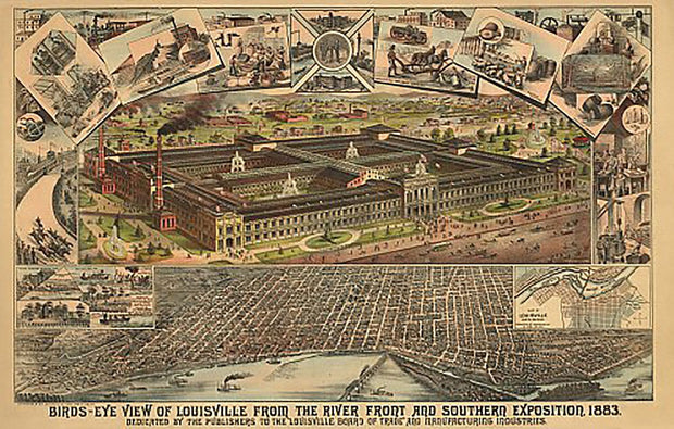
Birds-eye view of Louisville from the river front and Southern Exposition, 1883
KY00010
Regular price
$39.95
0 in stock
Birds-eye view of Louisville from the river front and Southern Exposition, 1883 This beautiful antique map reproduction is printed on heavy acid-free stock with fade proof inks and is excellent for framing.
35”W X 22”H
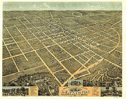
Bird's eye view of the Lexington, Kentucky by A. Ruger, 1871
KY00009
Regular price
$39.95
0 in stock
Bird's eye view of the Lexington, Kentucky by A. Ruger, 1871 This beautiful antique map reproduction is printed on heavy acid-free stock with fade proof inks and is excellent for framing.
29”W X 23”H
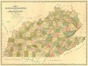
Kentucky & Tennessee by David H. Burr, 1839
KY00008
Regular price
$39.95
0 in stock
Kentucky & Tennessee by David H. Burr, 1839 This beautiful antique map reproduction is printed on heavy acid-free stock with fade proof inks and is excellent for framing.
35”W X 26”H
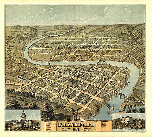
Bird's eye view of the city of Frankfort, the capital of Kentucky by A. Ruger, 1871
KY00005
Regular price
$39.95
0 in stock
Bird's eye view of the city of Frankfort, the capital of Kentucky by A. Ruger, 1871 This beautiful antique map reproduction is printed on heavy acid-free stock with fade proof inks and is excellent for framing.
22”W X 25”H
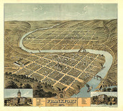
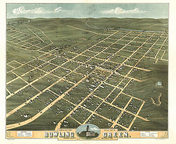
Bird's eye view of the city of Bowling Green, Kentucky by A. Ruger, 1871
KY00003
Regular price
$39.95
0 in stock
Bird's eye view of the city of Bowling Green, Kentucky by A. Ruger, 1871 This beautiful antique map reproduction is printed on heavy acid-free stock with fade proof inks and is excellent for framing.
23”W X 28”H
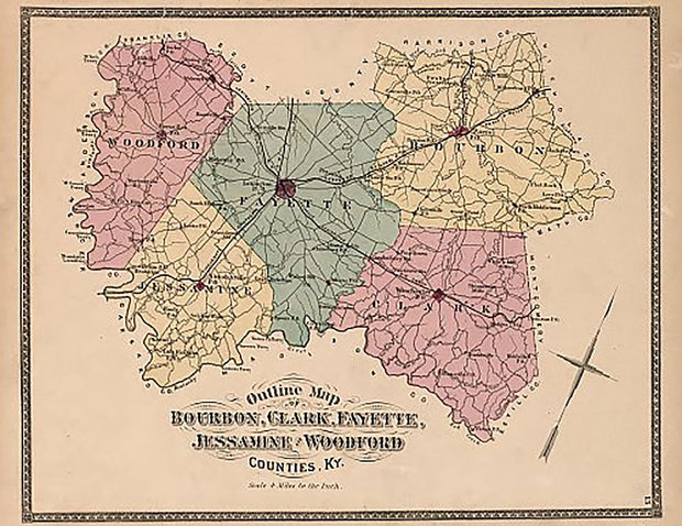
Bourbon, Clark, Fayette, Jessamine and Woodford Counties, Kentucky by Beers and Company, 1877
KY00002
Regular price
$39.95
0 in stock
Bourbon, Clark, Fayette, Jessamine and Woodford Counties, Kentucky by Beers and Company, 1877 This beautiful antique map reproduction is printed on heavy acid-free stock with fade proof inks and is excellent for framing.
![Kentucke [sic] by John Filson, 1784](http://texasmapstore.com/cdn/shop/products/KY00006-2_{width}x.jpg?v=1634080308)


![Kentucke [sic] by John Filson, 1784](http://texasmapstore.com/cdn/shop/products/KY00006-2_620x.jpg?v=1634080308)
![Kentucke [sic] by John Filson, 1784](http://texasmapstore.com/cdn/shop/products/KY00006-2_180x.jpg?v=1634080308)