This is a high-resolution reproduction printed on 24 lb. bond paper.
PLEASE NOTE: This map does not cover the entire county. The principle county within which the map coverage lies is listed first with partial coverage as noted.
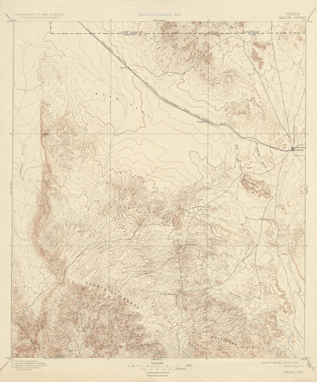
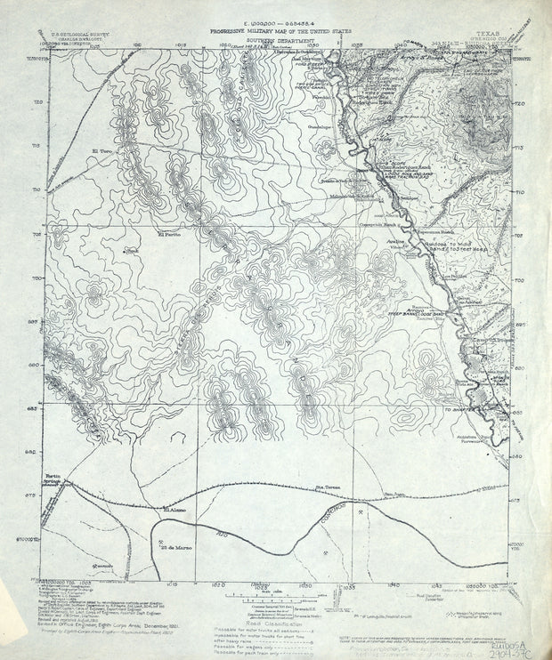
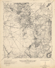
Marfa 1893, USGS
HST0253
Regular price
$29.95
-1 in stock
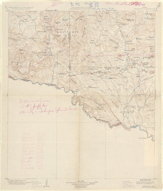
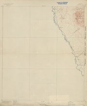
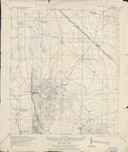
COUNTY: Presidio (partial Jeff Davis); SCALE: 1:125,000
This is a high-resolution reproduction printed on 24 lb. bond paper.
PLEASE NOTE: This map does not cover the entire county. The principle county within which the map coverage lies is listed first with partial coverage as noted.
22"W x 30"H
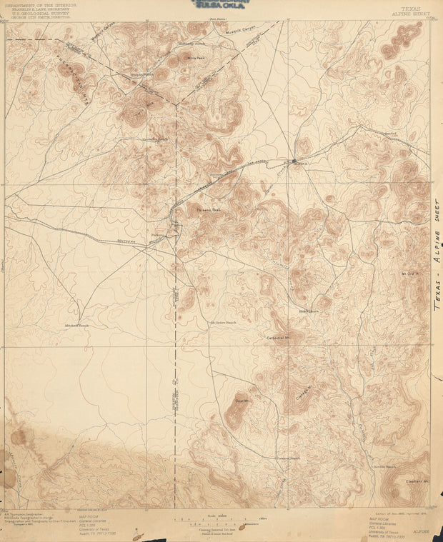
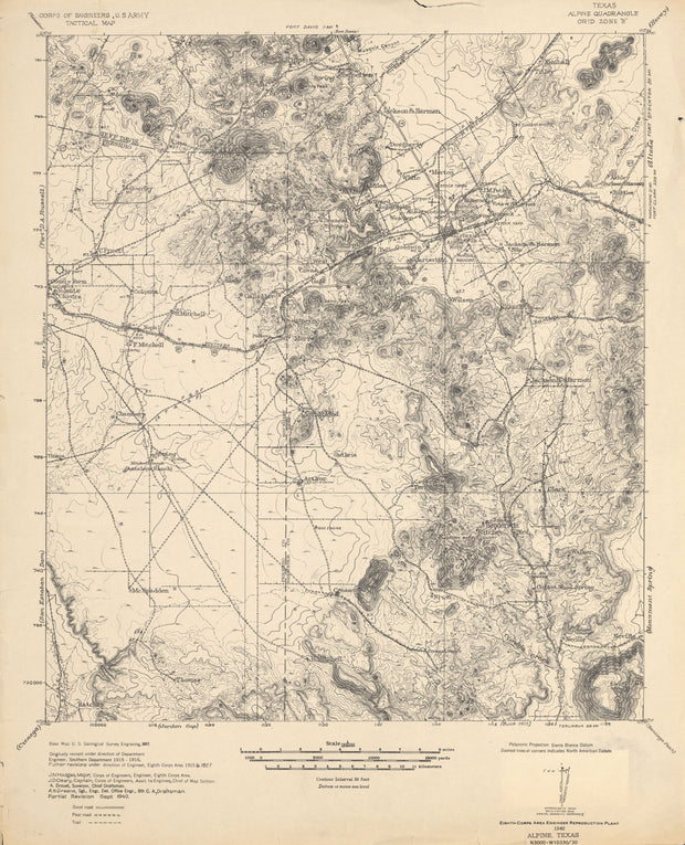
Alpine 1893, USGS
HST0055
Regular price
$29.95
0 in stock
COUNTY: Brewster (partial Jeff Davis, Presidio); SCALE: 1:125,000 This is a high-resolution reproduction printed on 24 lb. bond paper. PLEASE NOTE: This map does not cover the entire county. The principle county within which the map coverage lies is listed first with partial coverage as noted.
22"W x 30"H
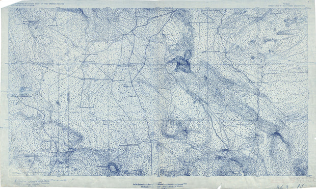
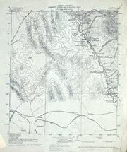
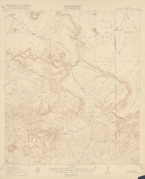
Santiago Mountains 1906, US Army Corps of Engineers
This is a high-resolution reproduction printed on 24 lb. bond paper.
PLEASE NOTE: This map does not cover the entire county. The principle county within which the map coverage lies is listed first with partial coverage as noted.
This is a high-resolution reproduction printed on 24 lb. bond paper.
PLEASE NOTE: This map does not cover the entire county. The principle county within which the map coverage lies is listed first with partial coverage as noted.
22"W x 30"H
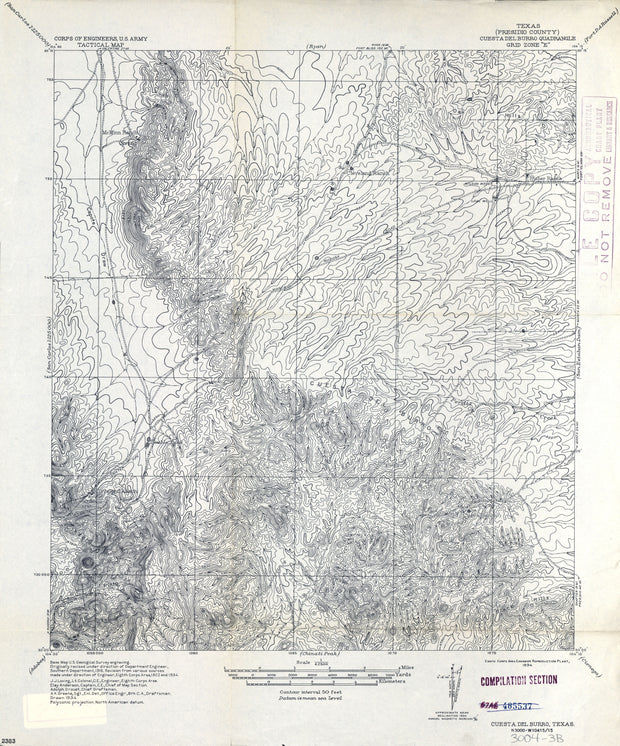
Cuesta del Burro 1934, US Army Corps of Engineers
HST0792
Regular price
$29.95
0 in stock
COUNTY: Presidio; SCALE: 1:62,500
This is a high-resolution reproduction printed on 24 lb. bond paper.
PLEASE NOTE: This map does not cover the entire county. The principle county within which the map coverage lies is listed first with partial coverage as noted.
22"W x 30"H
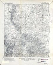
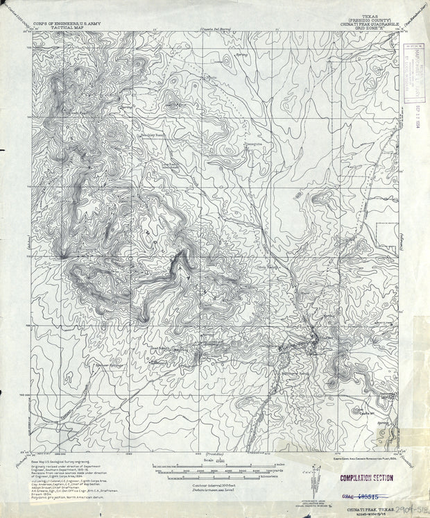
Chinati Peak 1934, US Army Corps of Engineers
HST0782
Regular price
$29.95
0 in stock
COUNTY: Presidio; SCALE: 1:62,500
This is a high-resolution reproduction printed on 24 lb. bond paper.
PLEASE NOTE: This map does not cover the entire county. The principle county within which the map coverage lies is listed first with partial coverage as noted.
This is a high-resolution reproduction printed on 24 lb. bond paper.
PLEASE NOTE: This map does not cover the entire county. The principle county within which the map coverage lies is listed first with partial coverage as noted.
This is a high-resolution reproduction printed on 24 lb. bond paper.
PLEASE NOTE: This map does not cover the entire county. The principle county within which the map coverage lies is listed first with partial coverage as noted.
22"W x 30"H
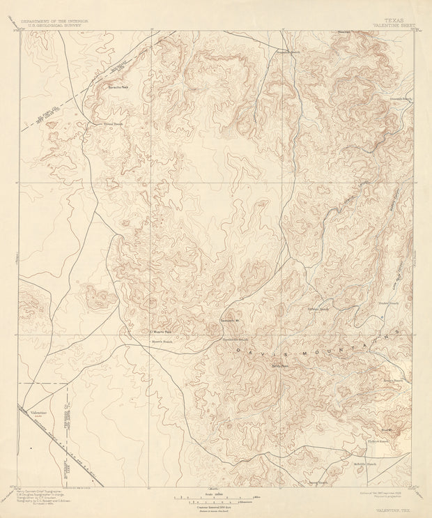
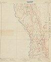
Valentine 1894, USGS
HST0392
Regular price
$29.95
0 in stock
COUNTY: Jeff Davis (partial El Paso, Presidio); SCALE: 1:125,000
This is a high-resolution reproduction printed on 24 lb. bond paper.
PLEASE NOTE: This map does not cover the entire county. The principle county within which the map coverage lies is listed first with partial coverage as noted.
This is a high-resolution reproduction printed on 24 lb. bond paper.
PLEASE NOTE: This map does not cover the entire county. The principle county within which the map coverage lies is listed first with partial coverage as noted.
22"W x 30"H
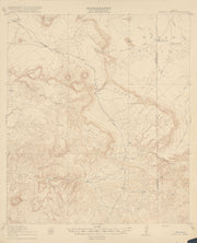
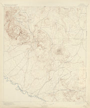
Shafter 1895, USGS
HST0350
Regular price
$29.95
0 in stock
COUNTY: Presidio; SCALE: 1:125,000
This is a high-resolution reproduction printed on 24 lb. bond paper.
PLEASE NOTE: This map does not cover the entire county. The principle county within which the map coverage lies is listed first with partial coverage as noted.
22"W x 30"H
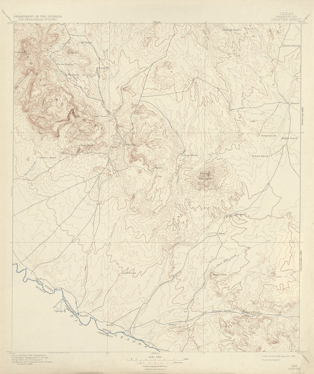
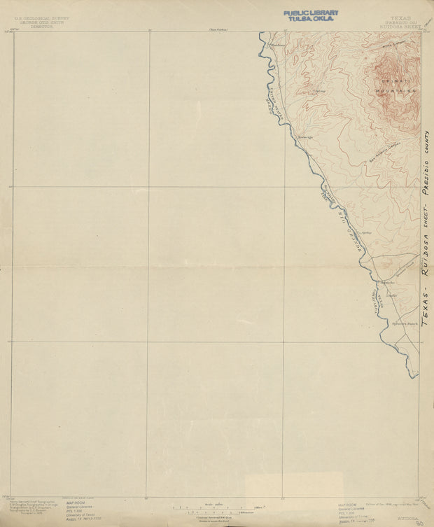
Ruidosa 1895, USGS
HST0326
Regular price
$29.95
0 in stock
COUNTY: Presidio; SCALE: 1:125,000
This is a high-resolution reproduction printed on 24 lb. bond paper.
PLEASE NOTE: This map does not cover the entire county. The principle county within which the map coverage lies is listed first with partial coverage as noted.
22"W x 30"H
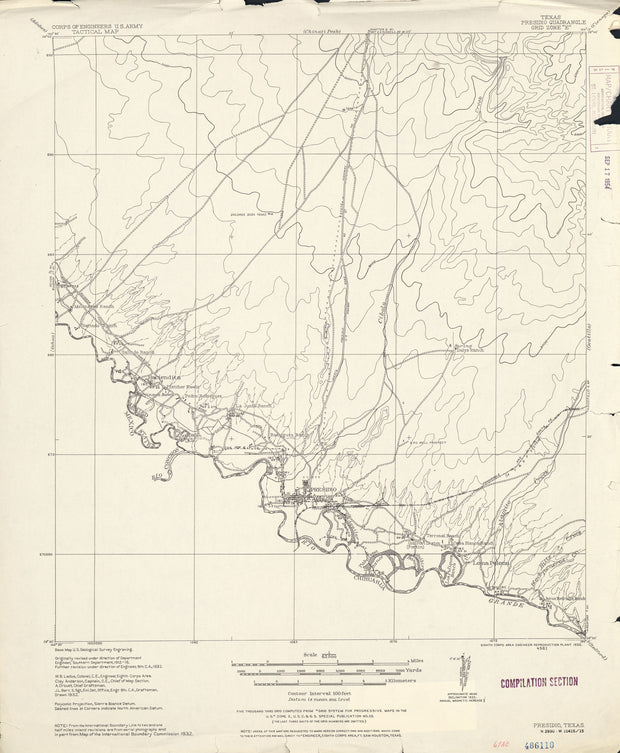
Presidio 1932, US Army Corps of Engineers
HST0310
Regular price
$29.95
0 in stock
COUNTY: Presidio; SCALE: 1:62,500
This is a high-resolution reproduction printed on 24 lb. bond paper.
PLEASE NOTE: This map does not cover the entire county. The principle county within which the map coverage lies is listed first with partial coverage as noted.
22"W x 30"H
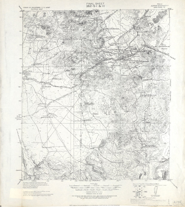
Alpine 1940, US Army Corps of Engineers
HST0056
Regular price
$29.95
0 in stock
COUNTY: Brewster (partial Jeff Davis, Presidio); SCALE: 1:125,000 This is a high-resolution reproduction printed on 24 lb. bond paper. PLEASE NOTE: This map does not cover the entire county. The principle county within which the map coverage lies is listed first with partial coverage as noted.
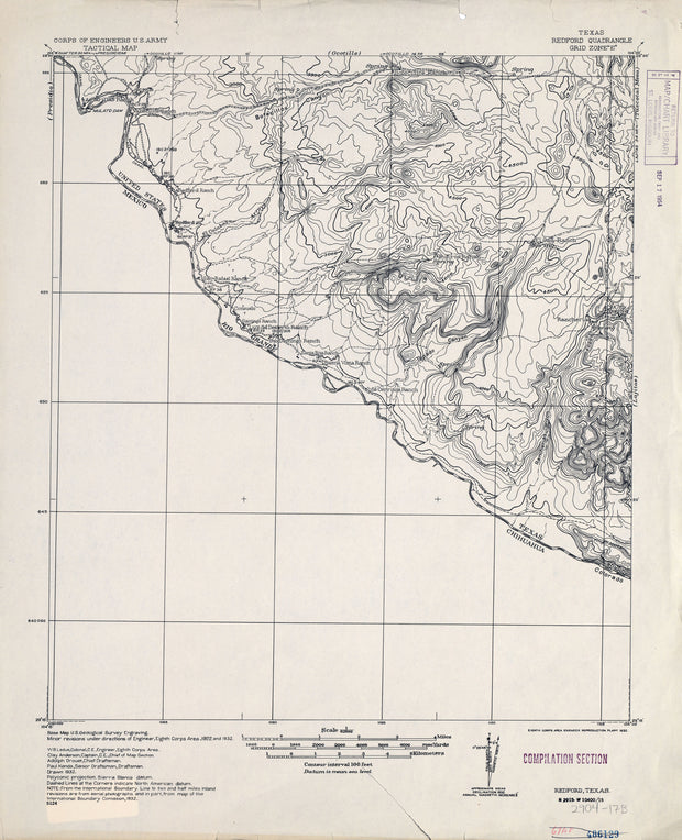
Redford 1932, US Army Corps of Engineers
HST0914
Regular price
$29.95
0 in stock
COUNTY: Presidio; SCALE: 1:62,500
This is a high-resolution reproduction printed on 24 lb. bond paper.
PLEASE NOTE: This map does not cover the entire county. The principle county within which the map coverage lies is listed first with partial coverage as noted.
22"W x 30"H
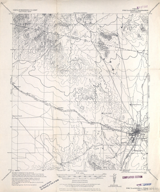
Fort D A Russell 1932, US Army Corps of Engineers
HST0820
Regular price
$29.95
-1 in stock
COUNTY: Presidio (partial Jeff Davis); SCALE: 1:62,500
This is a high-resolution reproduction printed on 24 lb. bond paper.
PLEASE NOTE: This map does not cover the entire county. The principle county within which the map coverage lies is listed first with partial coverage as noted.
22"W x 30"H
San Carlos 1895, USGS
HST0335
Regular price
$29.95
0 in stock
COUNTY: Presidio; SCALE: 1:125,000
This is a high-resolution reproduction printed on 24 lb. bond paper.
PLEASE NOTE: This map does not cover the entire county. The principle county within which the map coverage lies is listed first with partial coverage as noted.
22"W x 30"H
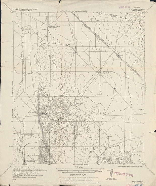
Ryan 1932, US Army Corps of Engineers
HST0328
Regular price
$29.95
0 in stock
COUNTY: Presidio (partial Jeff Davis); SCALE: 1:62,500
This is a high-resolution reproduction printed on 24 lb. bond paper.
PLEASE NOTE: This map does not cover the entire county. The principle county within which the map coverage lies is listed first with partial coverage as noted.