Skip to content
  • Texas Maps
    • Road Atlases
    • Wall Maps
    • Folded Maps
  • City Maps
    • Texas City Wall Maps
    • Street Guides
    • Folded Maps
  • Historical Maps
    • Texas
    • Topographic
    • County
    • War
  • Topographic Maps
    • Any Current US Topographic Map
    • Current Texas Topographic Maps
    • Historical Texas Topographic Maps
  • Classroom Maps
    • Earth Sciences
    • Educational
    • Historical
  • Outdoor Maps
    • Fishing Maps
    • Birding Maps
    • Current Topo Maps
  • Decorative Maps
    • Historical
    • Reference
  • Everything Else
    • Other State
      • Other State Historical Maps
    • USA
      • USA Historical Maps
      • USA Road Atlases
      • USA Wall Maps
    • Country Maps
    • World
      • World Wall Maps
    • Globes
    • Custom
      • Custom Design Maps
  • Log in
Cart
Texas Map Store | Have a question? | email: truenorth@gvtc.com
  • My Account
    • Login
    • Contact Us
  • View Cart
Texas Map Store Texas Map Store Texas Map Store Texas Map Store
Log in Search Cart
  • Texas Maps
    • Road Atlases
    • Wall Maps
    • Folded Maps
  • City Maps
    • Texas City Wall Maps
    • Street Guides
    • Folded Maps
  • Historical Maps
    • Texas
    • Topographic
    • County
    • War
  • Topographic Maps
    • Any Current US Topographic Map
    • Current Texas Topographic Maps
    • Historical Texas Topographic Maps
  • Classroom Maps
    • Earth Sciences
    • Educational
    • Historical
  • Outdoor Maps
    • Fishing Maps
    • Birding Maps
    • Current Topo Maps
  • Decorative Maps
    • Historical
    • Reference
  • Everything Else
    • Other State
      • Other State Historical Maps
    • USA
      • USA Historical Maps
      • USA Road Atlases
      • USA Wall Maps
    • Country Maps
    • World
      • World Wall Maps
    • Globes
    • Custom
      • Custom Design Maps
Home / USA Wall Maps / USA Maps. USA Maps: USA Wall Maps

USA Wall Maps

  • View all
  • Compart. Compart: Wall Maps
  • Decorative Maps
  • Earth Sciences
  • Educational Maps
  • USA Maps
  • USA Maps. USA Maps: USA Wall Maps
Quick view
USA Highways Map
USA Highways Map
from $49.95
Quick view
USA Wall Map
USA Wall Map
from $69.95
Quick view
USA Large Scale Wall Map by Kappa Map Group
$299.00
Quick view
USA Antiqued Wall Map
from $59.95
Quick view
USA Dispatcher's Wall Map by Kappa Map Group
$299.00
Quick view
USA Wall Map by Compart Maps
from $59.95
Quick view
USA National Parks Map
from $59.95
Quick view
USA Legacy Wall Map by Globe Turner
from $59.95
Quick view
USA County Wall Map by Rand McNally
$229.00
Quick view
USA Classic Wall Map by Globe Turner
from $59.95
Quick view
USA Wall Map by Rand McNally
$229.00
Quick view
USA Contemporary Wall Map by Globe Turner
from $59.95
Quick view
Eastern US Wall Map by Rand McNally
$229.00
Quick view
USA Contemporary Wall Map with Flags by Globe Turner
from $59.95
Quick view
Western US Wall Map by Rand McNally
$229.00
USA Highways Map
USA Highways Map
USA Highways Map
USA Highways Map
USA Highways Map
USA Highways Map
USA Highways Map
USA Highways Map
USA Highways Map
USA Highways Map
USA Highways Map
USA Highways Map
USA Highways Map
USA Highways Map
USA Highways Map
USA Highways Map

USA Highways Map

USWM010

Regular price $49.95
-12 in stock

  • Federal and state highways, tollways
  • National Parks and time zones
  • Cities and towns

Perfect for home, business, or school, this US Interstate Highways wall map shows the Interstate Highway System of the United States, along with other important Federal and state highways. Details included on this wall map consist of: international and state/provincial boundaries;freeways, tollways and other major roads; cities and towns; time zones; and all National Parks in the United States. Insets of Alaska and Hawaii are also included on this map. Also includes topography in colored relief and a white decorative border.

This map is printed on 36 lb premium coated paper or choose laminated at checkout.

This map comes rolled and ships in a sturdy cardboard tube.

USA Wall Map
USA Wall Map

USA Wall Map

USWM005

Regular price $69.95
-5 in stock

  • Paper or laminated
  • States labeled and outlined
  • Black and white
  • Perfect for educational or general business purposes

This US Map is a simple US Map which labels all the states. This map is perfect for educational purposes or general business use such as identifying sales territories. Choose laminated at checkout and mark it up and erase with ease to facilitate discussion.

This map is printed on 36lb heavyweight coated bond. This map comes rolled and ships in a sturdy cardbaord tube.


USA Large Scale Wall Map by Kappa Map Group

USA Large Scale Wall Map by Kappa Map Group

USWM001

Regular price $299.00
-12 in stock

  • Laminated with wood hanging rails
  • 77" W x 54" H
  • Highways, Cities and Town, Time Zones
  • Inset Maps of Alaska, Hawaii and Puerto Rico
  • Contrasting colors highlight geographic divisions

Bright, contrasting colors clearly identify political divisions on this Wall Map of the United States by Kappa Map Group which measures 6'5"[w] x 4'6"[h] or 77" W x 54" H with a scale of 1" + approximately 40 miles.

The special features and data contained on this large scale wall map of the United States are as follows: Cities and Towns, Freeways, Interchange & Exit Numbers, Interstate Highways, Longitude and Latitude lines, Mountain Ranges, National Forests, Rivers and Lakes, State Highways, State Lines & Time Zones.

Map insets Include: Alaska, Hawaii, and Puerto Rico. Additional features of this map include color coded states and a Mileage chart between major cities. The map is protected with a laminated finish, which is both markable and washable. Framing rails are included on top and bottom for easy wall mounting.

Click
HERE to see a detailed view of a section of the map.


USA Antiqued Wall Map

USA Antiqued Wall Map

USWM003

Regular price $59.95
-4 in stock

  • Cities, State Borders, Highways, Latitude, Longitude, Points of Interest, Capitols
  • Classic Antique Atlas Style
  • Works beautifully with dark wood furniture and trim, a designers delight

This Antiqued USA Wall Map is beautifully illustrated with subtle earth tone hues. The detail is highly legible with state borders clearly defined. In classic Antique Atlas style, this map can be used for general reference, to track current events, or as a piece of art. Decorators will find the color scheme works beautifully with dark wood furniture and trim. This map is a designer's delight.

This map comes rolled and ships in a sturdy cardboard tube.


USA Dispatcher's Wall Map by Kappa Map Group

USA Dispatcher's Wall Map by Kappa Map Group

USWM002-1

Regular price $299.00
-7 in stock

  • Laminated with wood hanging rails
  • 77" W x 54" H
  • Weigh stations, Cities, Freeways, State Lines, Time Zones
  • Inset maps of Alaska, Hawaii and Puerto Rico
  • Perfect for trucking companies, dispatchers

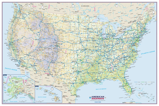
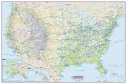
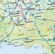
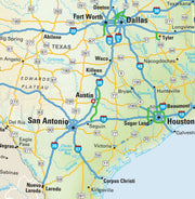
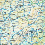
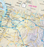
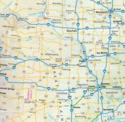
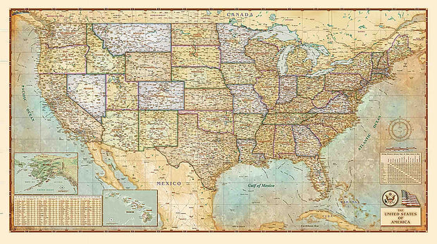
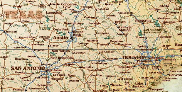
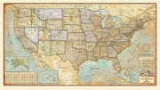
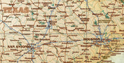
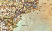
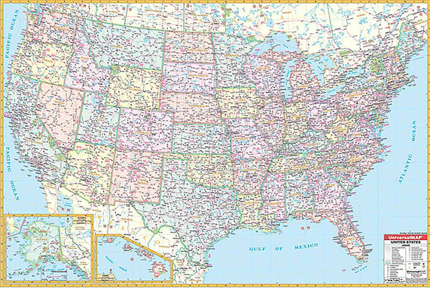
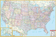
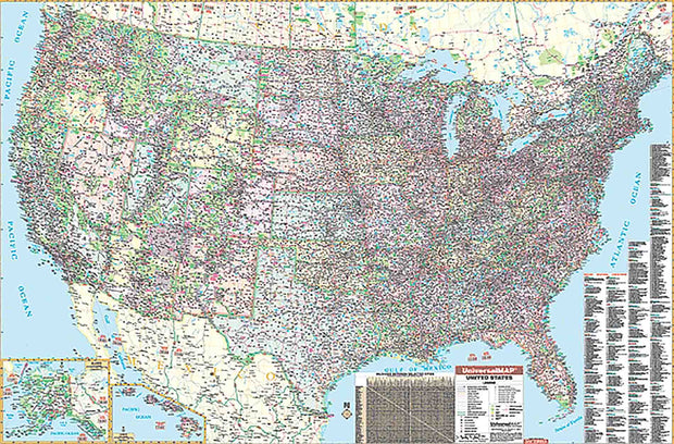
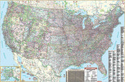
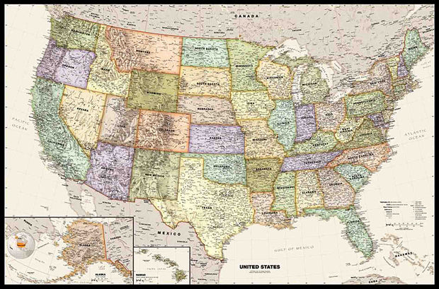
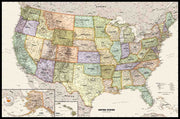
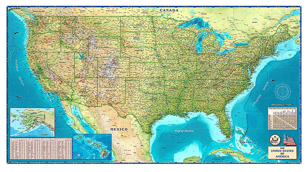
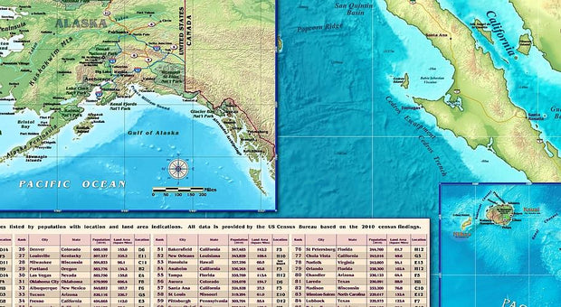
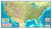
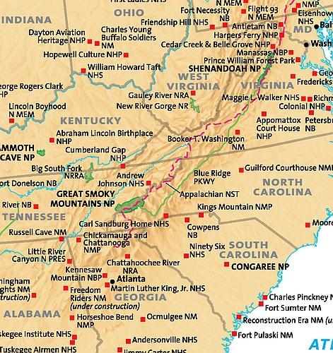
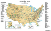
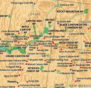
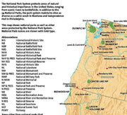
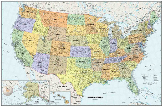
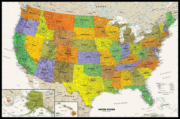
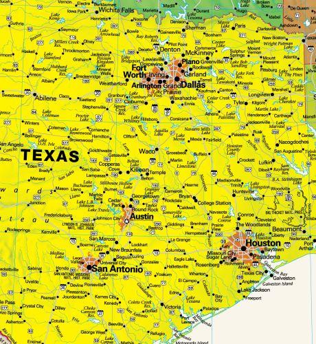
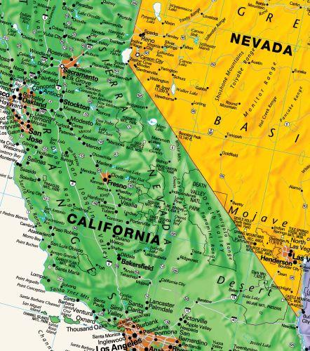
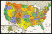
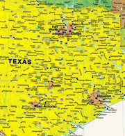
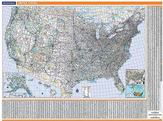
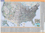
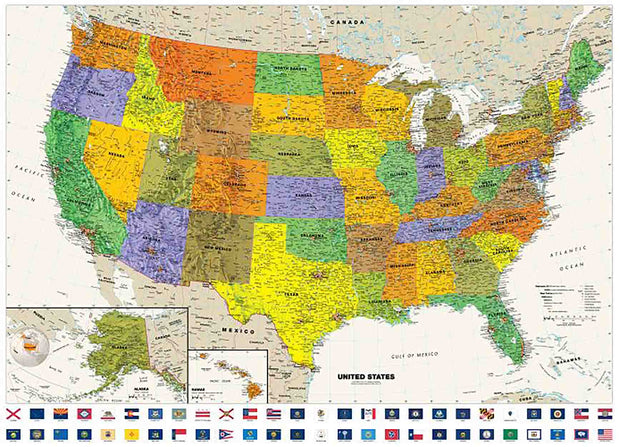
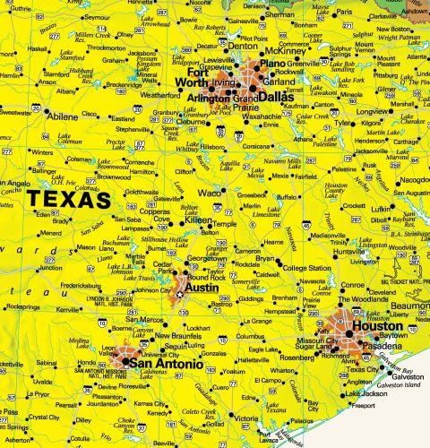
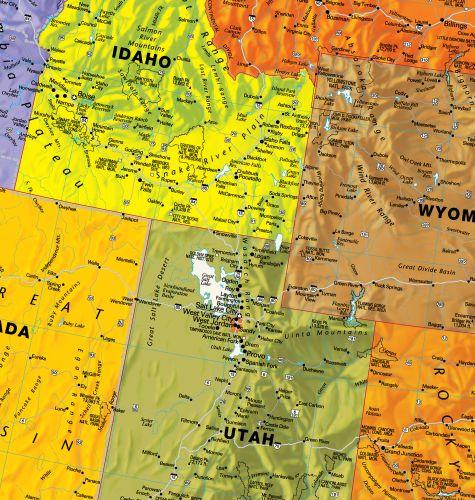
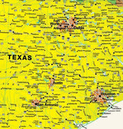
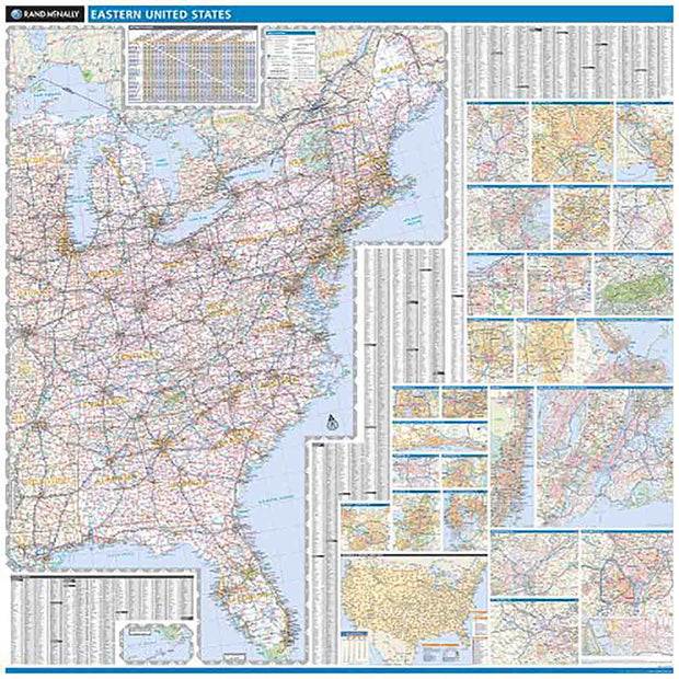
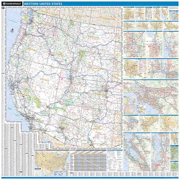
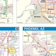
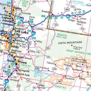
The 2nd edition United States Dispatchers Wall Map by Kappa Map Group shows Weigh Station locations. Uses up-to-date cartography at a scale of 1 = approximately 40 miles. Surface is laminated, markable, and washable. Indexed in a separate book, has hanging rails mounted on top and bottom, and measures 77 x 54.

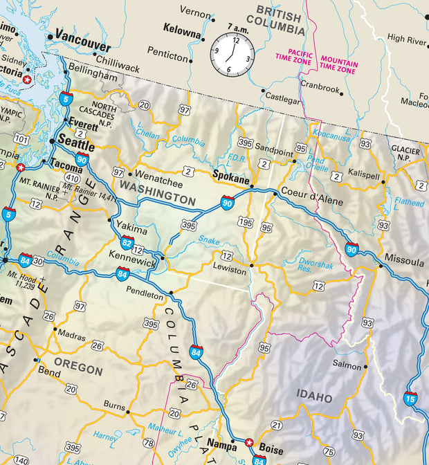
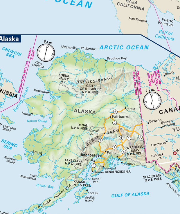
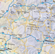
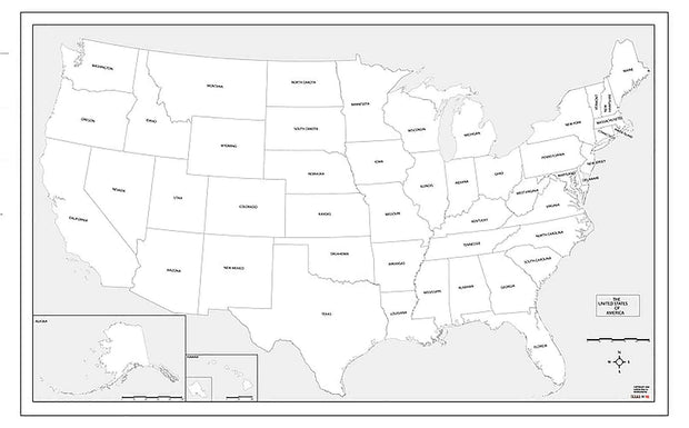
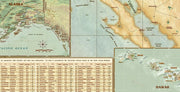
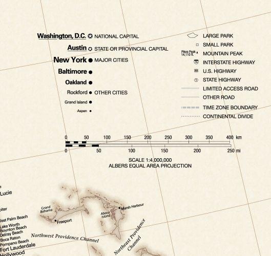
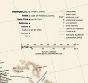
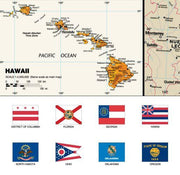
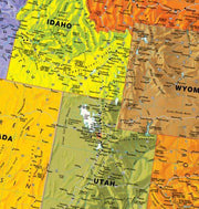
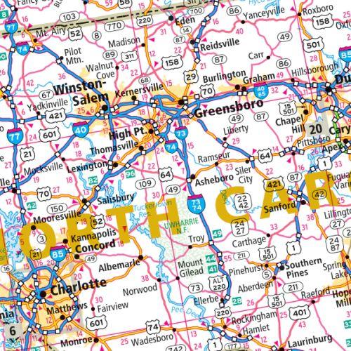
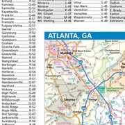
Special features include color coded states, a mileage chart between major cities, insets of Alaska, Hawaii, and Puerto Rico, and a list of weigh station locations on the face of the map.
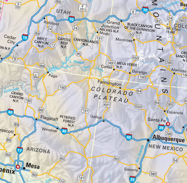
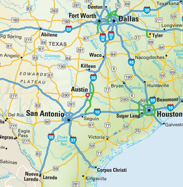
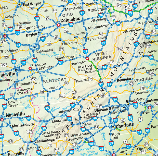
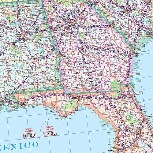
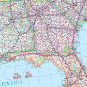
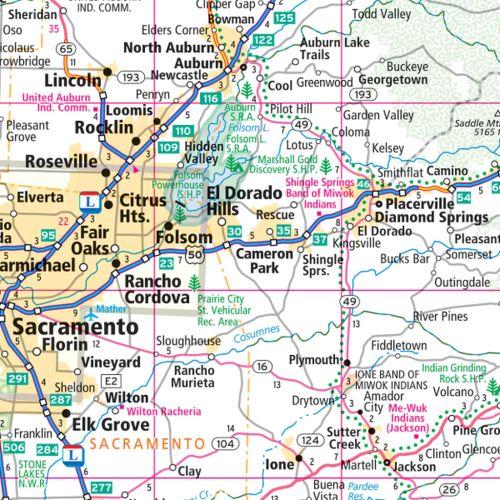
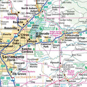
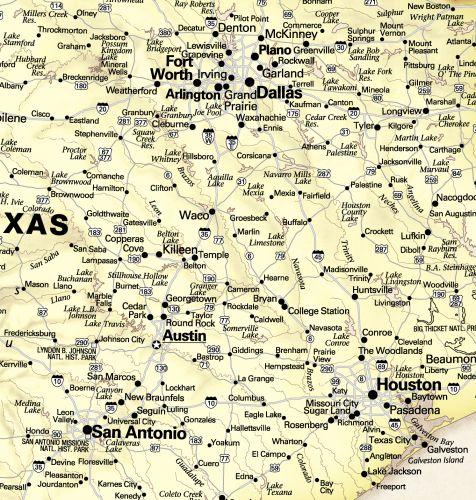
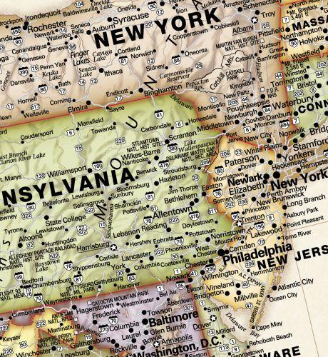
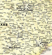
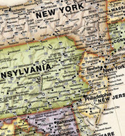
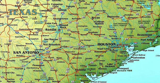
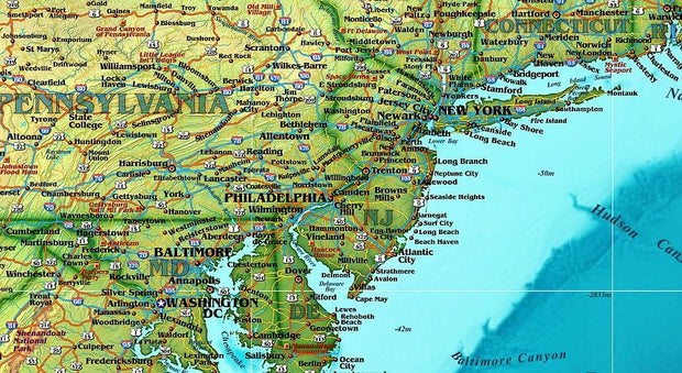
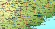
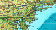
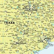
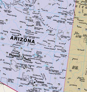
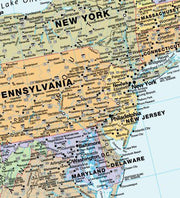
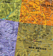
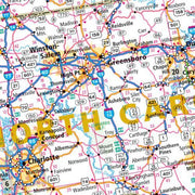
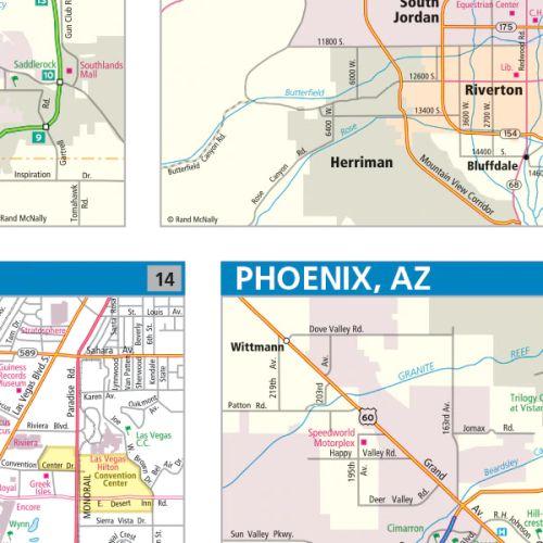
Details include state highways, interstate highways, freeways, rivers and lakes, national forests, mountain ranges, cities and towns, state lines, time zones, longitude & latitude lines, and interchange & exit numbers.


USA Wall Map by Compart Maps

USA Wall Map by Compart Maps

USWM004

Regular price $59.95
0 in stock

  • Cities, State Borders, HIghways, Latitude, Longitude, Points of Interest, Capitols
  • Illustrated using vibrant greens, blues and browns
  • Perfect for an office, classroom or library

The Compart Maps USA Wall Map is beautifully illustrated with vibrant greens, browns and blues. The detail is highly legible with state borders clearly defined. In classic Antique Atlas style, this map can be used for general reference, to track current events, or as a piece of art. Perfect for an office, classroom or decorating a library, this map is a designer's delight.

This map is printed on 36 lb premium coated paper and comes rolled and shipped in a sturdy cardboard tube. 

USA National Parks Map

USA National Parks Map

USWM011

Regular price $59.95
-6 in stock

  • National Parks
  • Inset maps of Alaska, Hawaii and Puerto Rico
  • Glossary of National Park abbreviations

Perfect for home, business, or school, this US National Park Service wall map shows the location of all sites operated by the National Park system in the continental United States, Alaska, Hawaii, Puerto Rico and the U.S. Virgin Islands.

This map is printed on 36 lb premium coated paper or choose laminated at checkout.

This map comes rolled and ships in a sturdy cardboard tube.

USA Legacy Wall Map by Globe Turner

USA Legacy Wall Map by Globe Turner

USWM012

Regular price $59.95
-3 in stock

  • Capitals, Interstate Highway Systems
  • Inset maps of Alaska, Hawaii and Puerto Rico
  • Major physical features

Perfect for home, business, or school, this Legacy USA Wall Map combines bright, attractive colors with high-detailed cartography in an antique style. Details on this United States Wall Map include: state boundaries and capitals along with other major cities and towns; major physical features such as mountain ranges and major mountain peaks; major water features such as oceans, seas, gulfs, and rivers; the Interstate highway system and other major roads; and all National Parks as well as other large National Park Service sites.

Special features include ivory-colored oceans and a black decorative border. This map of the United States uses the Albers Equal Area projection.

This map is printed on 36 lb premium coated paper or choose laminated at checkout.

USA County Wall Map by Rand McNally

USA County Wall Map by Rand McNally

USWM007

Regular price $229.00
-2 in stock

  • Laminated with hanging rails
  • 60" W x 46" H
  • Rand McNally cartography
  • Includes highways, rivers/lakes, National parks
  • Fully indexed counties
Rand McNally's ProSeries United States Wall Map is an irreplaceable reference tool for anyone needing a comprehensive representation of the country for planning, routing, or reference. The large size and detailed laminated map make it a great addition to any office or board room.


Map indications include:
  • Interstates, federal highways, and state highways
  • Major rivers/lakes
  • National forests, parks, and monuments
  • Major geographic features
  • Full index of cities
  • National mileages & driving times map
  • National physical relief map

Map specs:

  • Dimensions: 6'7" W x 5' H (80" x 60")
  • Scale: 1" = approximately 42 miles


USA Classic Wall Map by Globe Turner

USA Classic Wall Map by Globe Turner

USWM013

Regular price $59.95
-2 in stock

  • Capitals, Interstate Highway Systems
  • Inset maps of Alaska, Hawaii and Puerto Rico
  • Major physical features

Perfect for home, business, or school, this Classic USA Wall Map combines warm, attractive colors with high-detailed cartography. Details on this United States Wall Map
include: state boundaries and capitals along with other major cities and towns; major physical features such as mountain ranges and major mountain peaks; major water features such as oceans, seas, gulfs, and rivers; the Interstate highway system and other major roads; and all National Parks as well as other large National Park Service sites. 

Special features include traditional, blue-colored oceans and a white decorative border. This map of the United States uses the Albers Equal Area projection.

This map is printed on 36 lb premium coated paper or choose laminated at checkout.

USA Wall Map by Rand McNally

USA Wall Map by Rand McNally

USWM006

Regular price $229.00
0 in stock

  • Laminated
  • 80" W x 60" H
  • Rand McNally cartography
  • Includes highways, rivers/lakes, National parks
  • Fully indexed


Rand McNally's ProSeries United States Wall Map is an irreplaceable reference tool for anyone needing a comprehensive representation of the country for planning, routing, or reference. The large size and detailed laminated map make it a great addition to any office or board room.


Map indications include:
  • Interstates, federal highways, and state highways
  • Major rivers/lakes
  • National forests, parks, and monuments
  • Major geographic features
  • Full index of cities
  • National mileages & driving times map
  • National physical relief map

Map specs:

  • Dimensions: 6'7" W x 5' H (80" x 60")
  • Scale: 1" = approximately 42 miles


USA Contemporary Wall Map by Globe Turner

USA Contemporary Wall Map by Globe Turner

USWM014

Regular price $59.95
-1 in stock

  • Paper or laminated
  • 55" W x 36" H
  • Capitals, Interstate Highway Systems
  • Inset maps of Alaska, Hawaii and Puerto Rico
  • Major physical features


Perfect for home, business, or school, this Contemporary USA Wall Map combines bright, attractive colors with high-detailed cartography. Details on this United States Wall Map include: state boundaries and capitals along with other major cities and towns; major physical features such as mountain ranges and major mountain peaks; major water features such as oceans, seas, gulfs, and rivers; the Interstate highway system and
other major roads; and all National Parks as well as other large National Park
Service sites. Special features include ivory-colored oceans and a black decorative border.This map of the United States uses the Albers Equal Area projection.

This map is printed on 36 lb premium coated paper or choose laminated at checkout.

Eastern US Wall Map by Rand McNally

Eastern US Wall Map by Rand McNally

USWM008

Regular price $229.00
-2 in stock

  • Laminated with hanging rails
  • 60" W x 60" H
  • Rand McNally cartography
  • Includes highways, rivers/lakes, National parks
  • Fully indexed cities
  • Inset Maps of Major Cities


Rand McNally's ProSeries wall map of the Eastern United States is ideal for anyone needing a comprehensive representation of the region for planning, routing, or reference. It's a great choice for business and sales strategy, urban development, social work outreach, education, and marketing.
  • Durable (3 mm thick) lamination for writing on and wiping off
  • Easy-to-read map with clear city and highway detail
  • UV-resistant ink to help prevent color fading
  • Comprehensive city index
  • Mileage chart and driving times map between main cities
  • Hanging kit with rails for easy mounting just about anywhere
  • Ideal for business, education, planning, or reference planning
Map indications include:
  • Interstates, federal highways, and state highways
  • Cities and towns
  • Major waterways, rivers, and lakes
  • State and national parks
  • National forests and monuments
  • Universities
  • Military installations
  • Airports
  • Major geographic features

COVERAGE AREA

  • Coverage area: Alabama, Connecticut, Delaware, District of Columbia, Florida, Georgia, Indiana, Kentucky, Maine, Maryland, Massachusetts, Michigan, New Hampshire, New Jersey, New York, North Carolina, Ohio, Pennsylvania, Rhode Island, South
  • City maps: Atlanta, GA; Baltimore, MD; Boston, MA; Buffalo/Niagara Falls, NY; Charlotte, NC; Cincinnati, OH; Cleveland, OH; Columbus, OH; Detroit, MI; Hampton Roads (Norfolk/Virginia Beach), VA; Indianapolis, IN; Jacksonville, FL; Louisville, KY; Memphis, TN; Miami, FL; Myrtle Beach, SC; Nashville, TN; New York, NY; Orlando, FL; Philadelphia, PA; Pittsburgh, PA; Raleigh/Durham, NC; Tampa/St. Petersburg, FL; Washington, DC; The Great Smoky Mountains National Park, NC/TN


USA Contemporary Wall Map with Flags by Globe Turner

USA Contemporary Wall Map with Flags by Globe Turner

USWM015

Regular price $59.95
0 in stock

  • Capitals, Interstate Highway Systems
  • Inset maps of Alaska, Hawaii and Puerto Rico
  • State Flags

Perfect for home, business, or school, this Contemporary USA Wall Map with Flags combines bright, attractive colors with high-detailed cartography. Details on this United States Wall Map include: state boundaries and capitals along with other major cities and towns; major physical features such as mountain ranges and major mountain peaks; major water features such as oceans, seas, gulfs, and rivers; the Interstate highway system and other major roads; all National Parks as well as other large National Park Service sites; and flags of all 50 states and the District of Columbia.

Special features include ivory-colored oceans and a white decorative border. This map of the United States uses the Albers Equal Area projection.

This map is printed on 36 lb premium coated paper or choose laminated at checkout.

Western US Wall Map by Rand McNally

Western US Wall Map by Rand McNally

USWM009

Regular price $229.00
-1 in stock

  • Laminated with hanging rails
  • 60" W x 60" H
  • Rand McNally cartography
  • Includes highways, rivers/lakes, National parks
  • Fully indexed cities
  • Inset Maps of Major Cities

Rand McNally's ProSeries wall map of the Eastern United States is ideal for anyone needing a comprehensive representation of the region for planning, routing, or reference. It's a great choice for business and sales strategy, urban development, social work outreach, education, and marketing.
  • Durable (3 mm thick) lamination for writing on and wiping off
  • Easy-to-read map with clear city and highway detail
  • UV-resistant ink to help prevent color fading
  • Comprehensive city index
  • Mileage chart and driving times map between main cities
  • Hanging kit with rails for easy mounting just about anywhere
  • Ideal for business, education, planning, or reference planning
Map indications include:
  • Interstates, federal highways, and state highways
  • Cities and towns
  • Major waterways, rivers, and lakes
  • State and national parks
  • National forests and monuments
  • Universities
  • Military installations
  • Airports
  • Major geographic features

COVERAGE AREA

  • Coverage area: Alabama, Connecticut, Delaware, District of Columbia, Florida, Georgia, Indiana, Kentucky, Maine, Maryland, Massachusetts, Michigan, New Hampshire, New Jersey, New York, North Carolina, Ohio, Pennsylvania, Rhode Island, South
  • City maps: Atlanta, GA; Baltimore, MD; Boston, MA; Buffalo/Niagara Falls, NY; Charlotte, NC; Cincinnati, OH; Cleveland, OH; Columbus, OH; Detroit, MI; Hampton Roads (Norfolk/Virginia Beach), VA; Indianapolis, IN; Jacksonville, FL; Louisville, KY; Memphis, TN; Miami, FL; Myrtle Beach, SC; Nashville, TN; New York, NY; Orlando, FL; Philadelphia, PA; Pittsburgh, PA; Raleigh/Durham, NC; Tampa/St. Petersburg, FL; Washington, DC; The Great Smoky Mountains National Park, NC/TN


Texas Map Store

Powered by Shopify


True North Publishing dba Texas Map Store has been publishing and selling maps for Texas since 1997. We continually strive to produce the most accurate and up-to-date maps available. We heartily welcome your suggestions, so please feel free to call, write or email any time.

More Stuff

  • Custom Maps
  • Purchase Orders
  • Tax Exempt Purchases
  • Contact Us
  • About Us
  • Shipping
  • Refunds and returns
  • Privacy Policy
  • Terms of Service

Categories

  • Texas Maps
  • City Maps
  • Historical Maps
  • Topographic Maps
  • Classroom Maps
  • Outdoor Maps
  • Decorative Maps
  • Everything Else

Join TMS Newsletter

Sign-up for Discounts, Coupons, New Product Arrivals and Recent News.

Texas Map Store

Powered by Shopify

  • american express
  • apple pay
  • diners club
  • discover
  • google pay
  • master
  • paypal
  • visa

All of our maps have a Free Shipping Option!