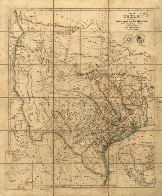
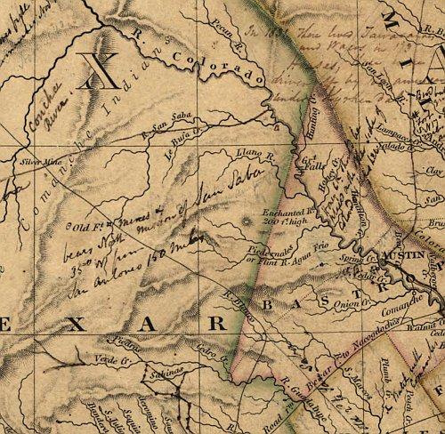
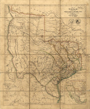
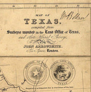
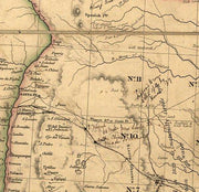
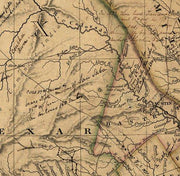
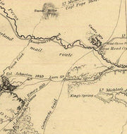
This fascinating map published during the period of The Republic by the London firm of John Arrowsmith is quite literally covered with hand written notes by an Englishman named Wm. Bollaert who had come to Texas at the behest of his friend William Kennedy who was subsequently appointed British consul at Galveston. Mr. Bollaert was commissioned to write a report for the British Admiralty and hoped to someday write a commercial book (he never did) about his travels in Texas. This beautiful reproduction is printed on heavy parchment style paper and is excellent for framing.
26"W x 31"H
Interested in a framed version of this map? Click HERE
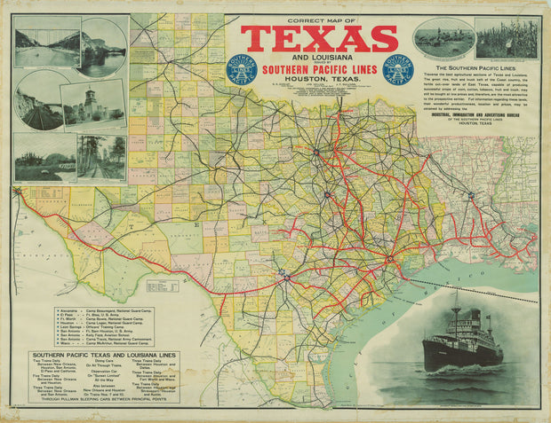
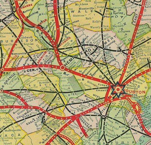
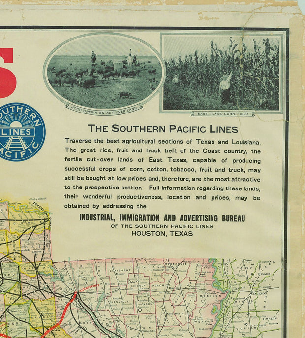
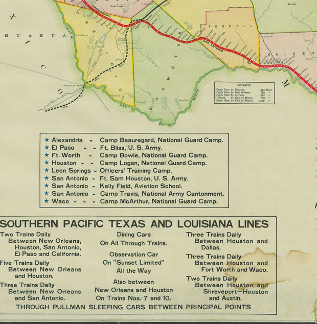
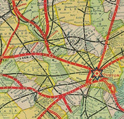
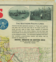
Correct Map of Texas and Louisiana 1917
HIST770
Regular price
$39.95
-1 in stock
From a time when railroads were still the main mode of long distance travel, this extremely detailed map depicts rail lines operated by the Southern Pacific Railway as well as blocks of land that the company had for sale. Wonderful period images in the upper corners promote Texas agriculture and sightseeing. This beautiful reproduction is printed on heavy parchment style paper and is excellent for framing.
33"W x 26"H
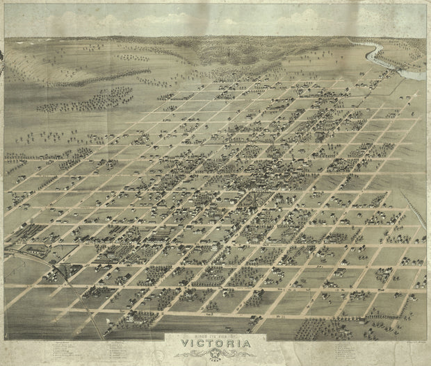
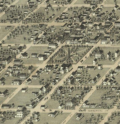
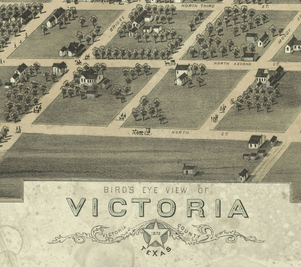
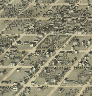
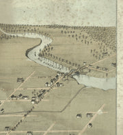
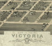
Victoria 1873 by Herman Brosius
HIST760
Regular price
$39.95
-1 in stock
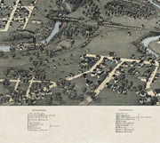
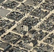
This wonderful bird's eye view has labeled streets and a legend on the bottom that lists 22 churches, businesses, public buildings and, unique for this type of map, private residences! This beautiful reproduction is printed on heavy, acid-free stock and is excellent for framing.
28"W x 23"H
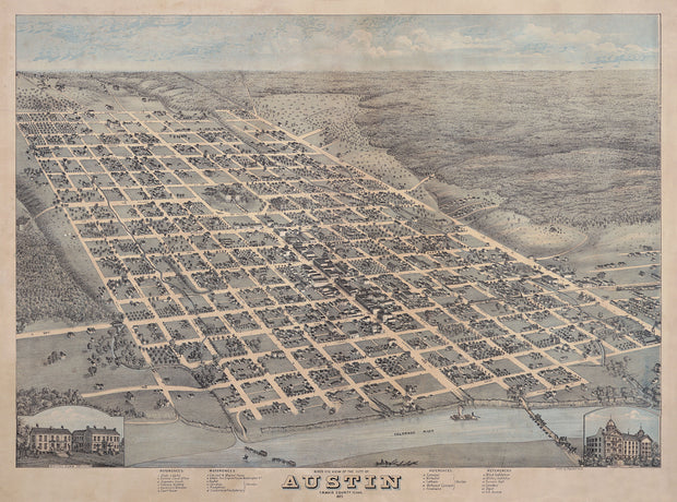
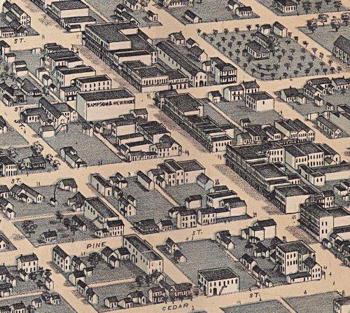
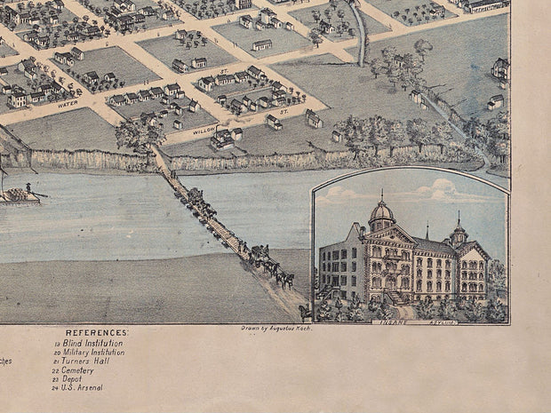
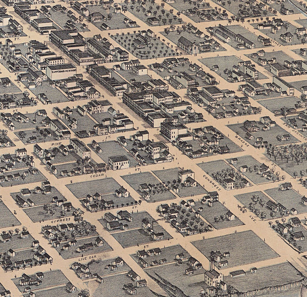
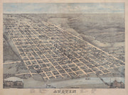
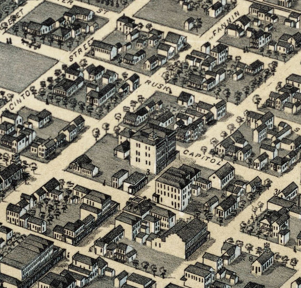
Austin 1873 by Augustus Koch
HIST750
Regular price
$39.95
-6 in stock
By 1873 Austin was coming into it's own as the capital of one of the fastest growing states in the Union. On this great bird's eye view streets are labeled and there is an excellent legend at the bottom that identifies 24 prominent business, schools and churches. This beautiful reproduction is printed on heavy parchment style paper and is excellent for framing.
32"W x 24"H
Interested in a framed version of this map? Click HERE
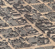
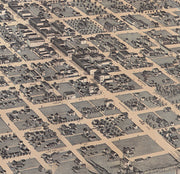
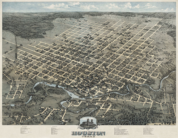
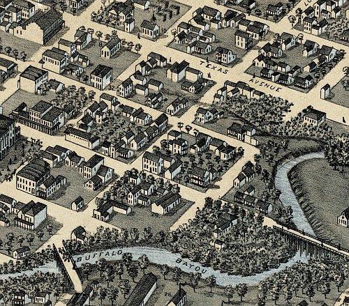
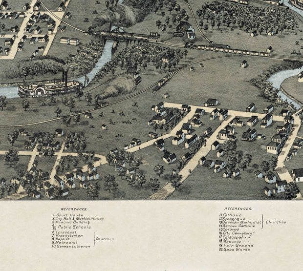
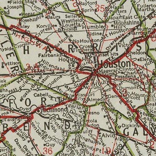
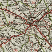
Houston 1873 by Augustus Koch
HIST740
Regular price
$39.95
-7 in stock
In 1873 Houston was already a bustling center of commerce with a growing and vibrant business district. This beautiful bird's eye view has labeled streets and a legend along the bottom locating 39 churches, businesses and public buildings. This excellent reproduction is printed on heavy parchment style paper and is excellent for framing.
31"W x 24"H
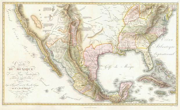
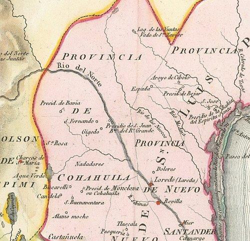
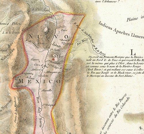
Carte du Mexique 1811
HIST730
Regular price
$39.95
-2 in stock
This beautiful map drawn by the famous German Baron, Alexander von Humboldt represents a synthesis of state-of-the-art cartographic knowledge of Mexico in the early years of the 19th century. It bears the full title "Carte du Mexique et des Pays Limitropher Situres ou Nort et E'est" and although the text is in French, American place names have English (or very close equivalent) spellings. This beautiful reproduction is printed on heavy parchment style paper and is excellent for framing.
36"W x 22'H
Interested in a framed version of this map? Click HERE
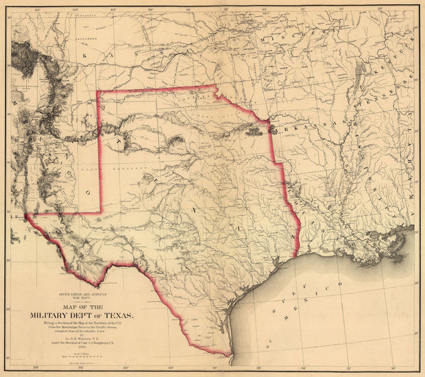
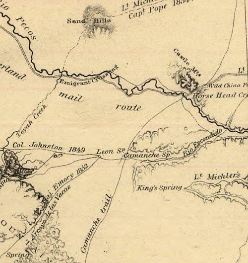
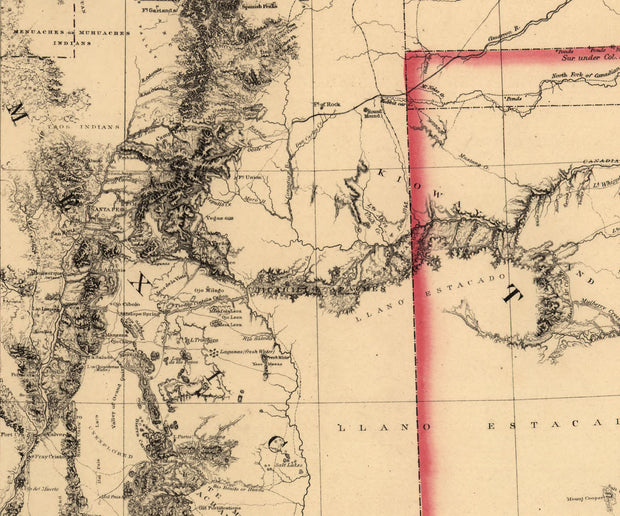
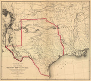
Military Department of Texas, War Dep't 1859
HIST720
Regular price
$39.95
-3 in stock
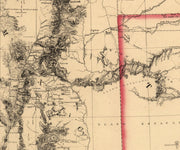
FULL TITLE: Map of the Military Dep't of Texas - Being a Section of the Map of the Territory of the U.S. from the Mississippi River to the Pacific Ocean - compiled from all the reliable data by Lt. G.K. Warren, T.E., under the direction of Capt. A.A. Humphreys, T.E. 1859. This amazingly detailed map shows every military post, expedition route, Indian tribal location and trail known at the time. Printed on heavy parchment style paper, this beautiful reproduction is excellent for framing.
29"W x 26"H
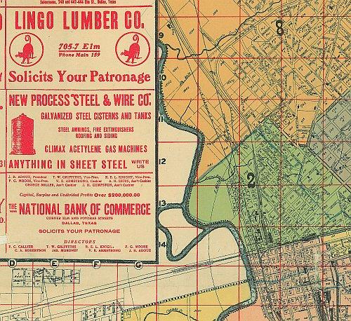
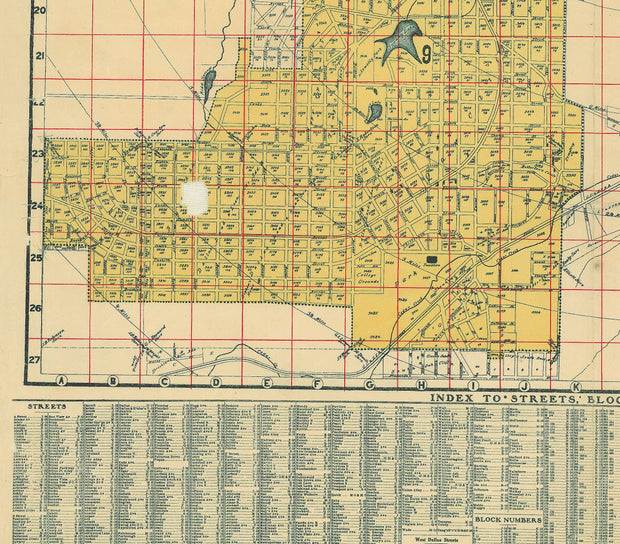
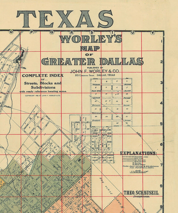
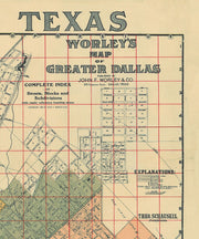
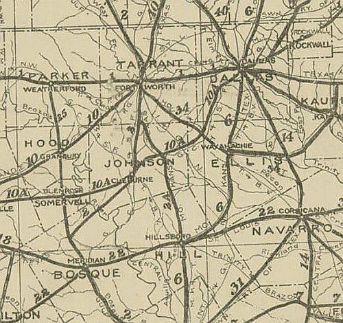
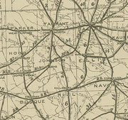
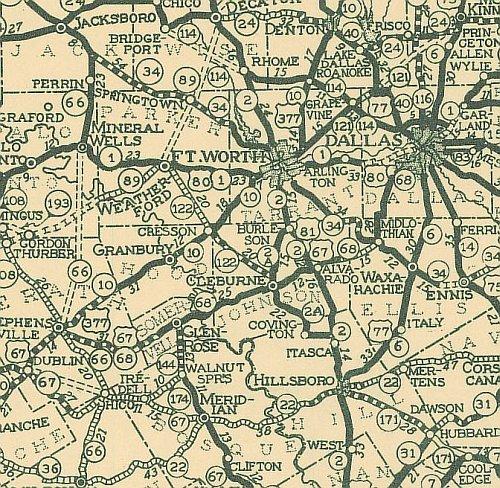
Worley's Map of Greater Dallas 1905
HIST710
Regular price
$39.95
-1 in stock
The advertising on this great map (see detail) is as interesting as the street info and a comprehensive index of "Streets", "Block Numbers" and "Additions" across the bottom give it added interest. This excellent reproduction is printed on heavy acid-free stock and is perfect for framing.
23'W x 29'H
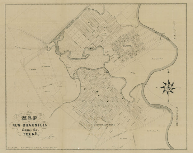
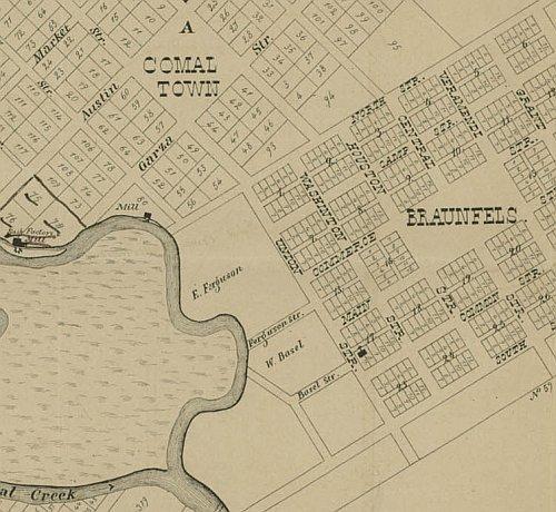
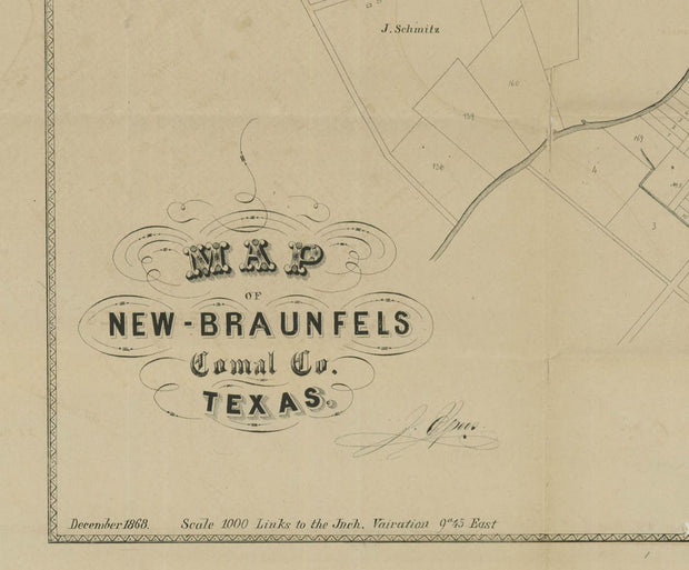
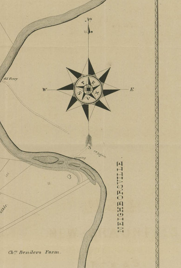
New Braunfels 1868
HIST705
Regular price
$39.95
-3 in stock
Founded in 1845 by German immigrants, New Braunfels soon emerged as a manufacturing center supplying wagons, farm implements, leather goods, furniture, and clothing for pioneers settling the hills of Central Texas. The town also figured as an important market for the expanding agricultural frontier. This excellent reproduction is printed on heavy parchment style paper and is perfect for framing.
23"W x 18"H
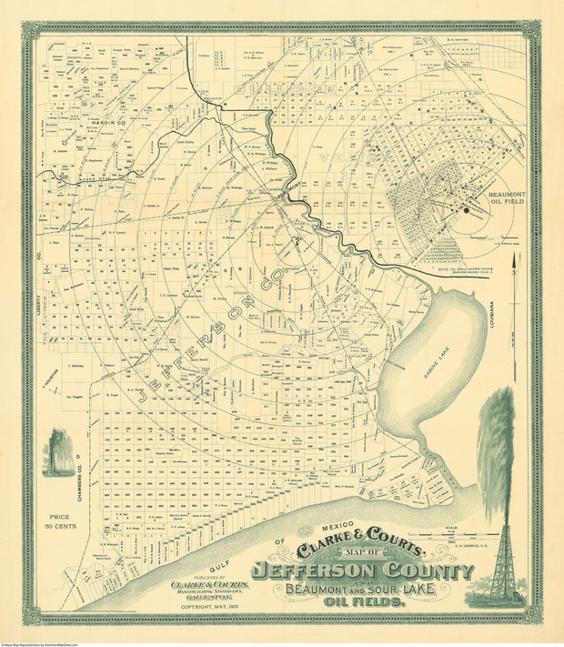
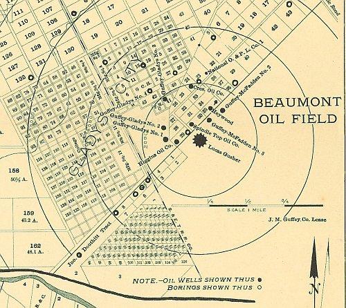
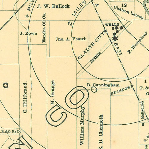
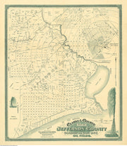
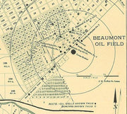
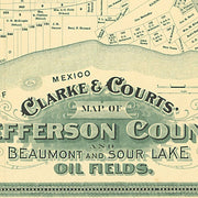
Spindletop: Jefferson Co., Beaumont and Sour Lake Oil Fields 1901
HIST700
Regular price
$39.95
-3 in stock
This wonderfully preserved map centered on the Spindletop oilfield (then Beaumont Oil Filed at Gladys City*, just south of Beaumont) marks the birth of the modern petroleum industry and beginning of the oil boom in Texas. On top of that, the wildly intricate border and title block (see detail) make it almost a work of art. This excellent reproduction is printed on heavy parchment style paper and is excellent for framing.
*NOTE: The upper right-hand portion of the map is an inset detail of the area just south of Beaumont.
23"W x 27"H
Interested in a framed version of this map? Click HERE
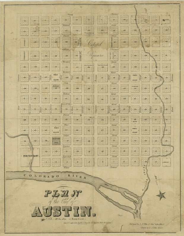
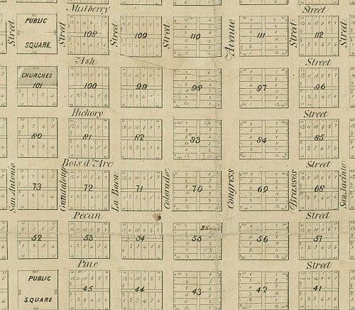
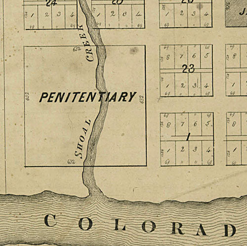
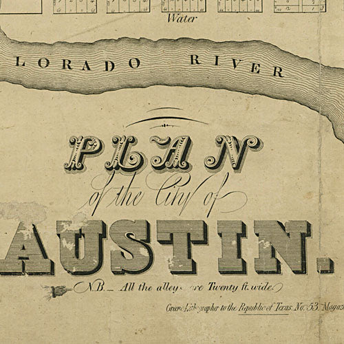
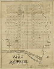
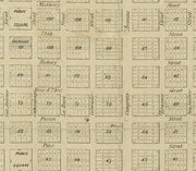
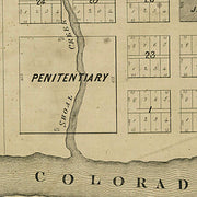
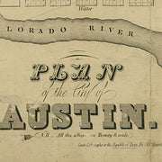
Austin 1839
HIST690
Regular price
$39.95
-1 in stock
This well preserved map of Austin from the early days of the Republic shows that, although some spellings have changed, the names of the north-south "river" streets have persisted to this day. The modern east-west numbered streets, however, were once named after trees. You may draw your own conclusions from the fact that the same amount of land was set aside for a "Penitentiary" (lower left) as was dedicated to the "Capital Square". This excellent reproduction is printed on heavy parchment style paper and is excellent for framing.
17"W x 22"H
Interested in a framed version of this map? Click HERE
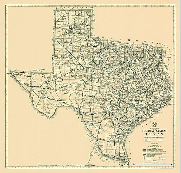
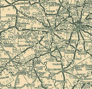
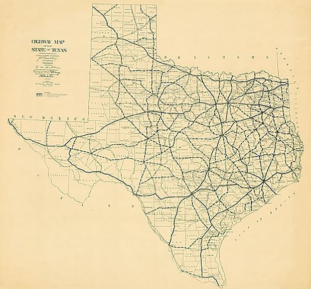
Texas 1919, Texas Highway Department
HIST680
Regular price
$39.95
-8 in stock
This is the official map published by the then Texas Highway Department (now Texas Department of Transportation) in 1919. This excellent reproduction is printed on heavy, acid-free bond and is excellent for framing.
31" x 33"
Interested in a framed version of this map? Click HERE
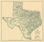
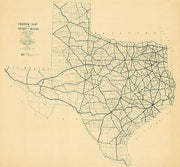
Texas 1933, Texas Highway Department
HIST670
Regular price
$39.95
-4 in stock
This is the official map published by the then Texas Highway Department (now Texas Department of Transportation) in 1933. This excellent reproduction is printed on heavy, acid-free bond and is excellent for framing.
31" x 33"
Interested in a framed version of this map? Click HERE
Texas 1922, Texas Highway Department
HIST660
Regular price
$39.95
-4 in stock
This is the official map published by the then Texas Highway Department (now Texas Department of Transportation) in 1922. This excellent reproduction is printed on heavy, acid-free bond and is excellent for framing.
31" x 33"
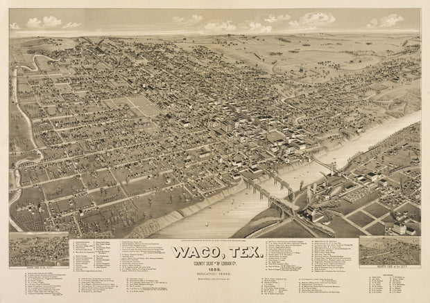
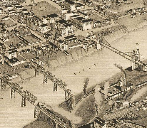
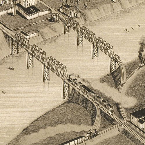
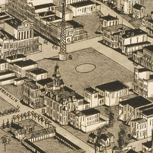
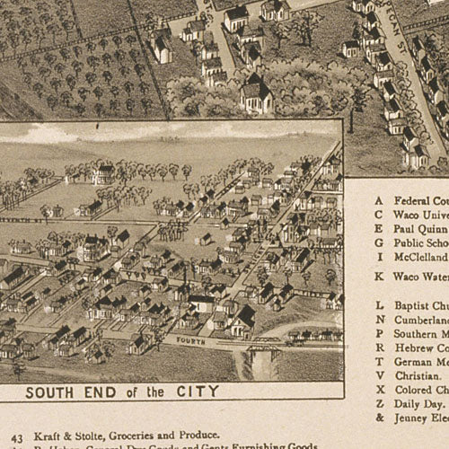
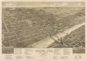
Waco 1886 by Henry Wellge
HIST650
Regular price
$39.95
-2 in stock
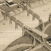
This great bird's eye view has labeled streets and an amazingly comprehensive legend along the bottom locating well over 100 churches, businesses, private residences and public buildings. This beautiful reproduction is printed on heavy parchment style paper and is excellent for framing.
33"W x 23"H
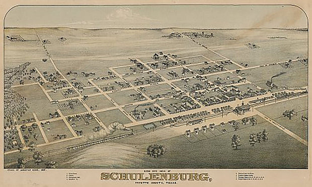
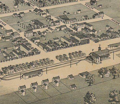
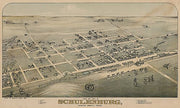
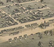
Schulenburg 1881 by Augustus Koch
HIST640
Regular price
$39.95
0 in stock
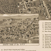
This great bird's eye view has labeled streets and a legend along the bottom locating 8 churches, businesses and public buildings. This beautiful reproduction is printed on heavy, acid-free stock and is excellent for framing.
27"W x 18"H
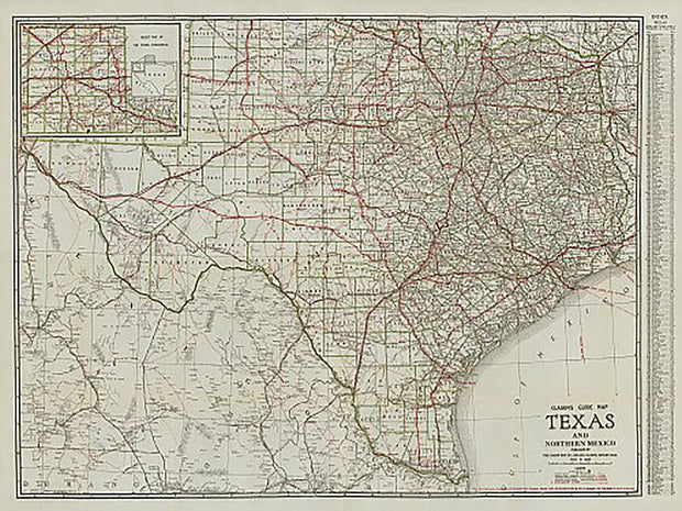
Clasons Texas Guide Map 1931
HIST630
Regular price
$39.95
-1 in stock
In the 1930s railroads were still important in transporting people, but increased automobile ownership led to a demand for paved roads and highways. Many of the highways on the map are by name only such as "Old Spanish Trail" and "Puget Sound to Gulf Hwy". The index on the right side lists "Cities and Towns with population over 1250". This great reproduction is an excellent resource for historians and will make an interesting conversation piece in any room.
46"W x 36"H
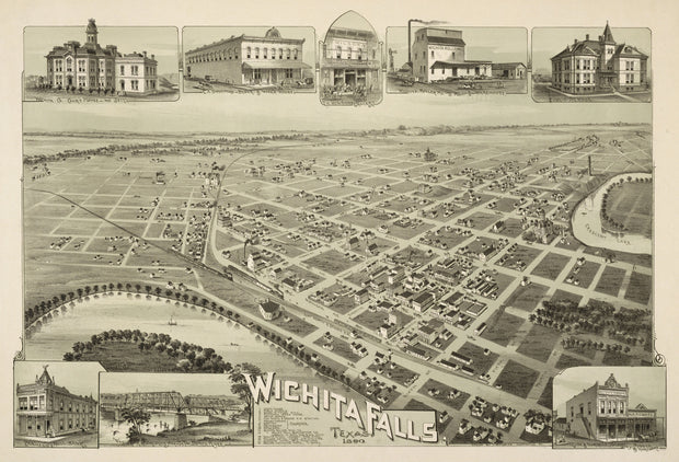
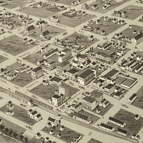
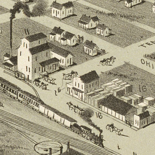
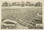
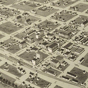
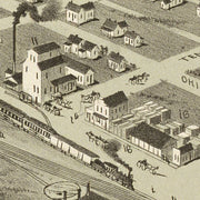
Wichita Falls 1890
HIST620
Regular price
$39.95
-2 in stock
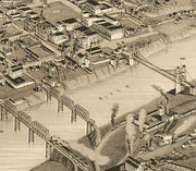
This great bird's eye view has wonderful images of prominent buildings as well as labeled streets and a legend on the bottom locating 16 churches, businesses and public buildings. This beautiful reproduction is printed on heavy parchment style paper and is excellent for framing.
30"W x 21"H
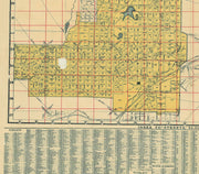
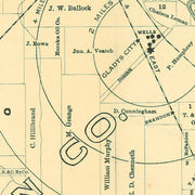
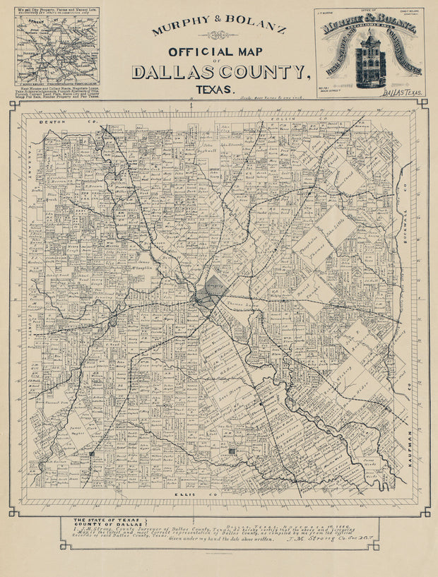
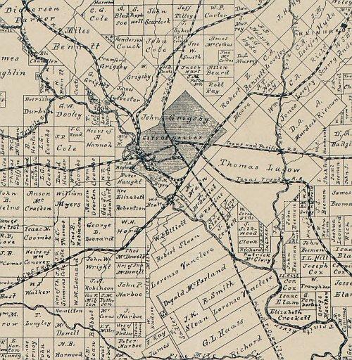
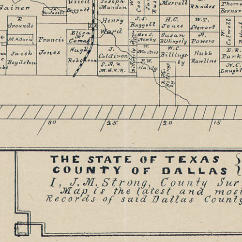
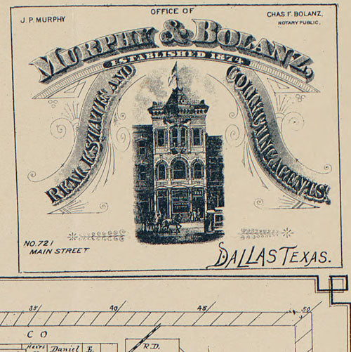
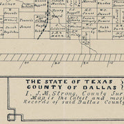
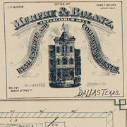
Official map of Dallas County 1886 by Murphy & Bolanz
1 review
HIST610
Regular price
$39.95
-9 in stock
This ownership map carries the statement "Dallas, Texas, November 1st, 1886. I, J.M. Strong, County Surveyor of Dallas County, Texas, do hereby certify that the above and foregoing map is the latest and most correct representation of Dallas County, as compiled by me from the official records of said Dallas County, Texas." This perfectly preserved reproduction is printed on heavy parchment style paper and is excellent for framing.