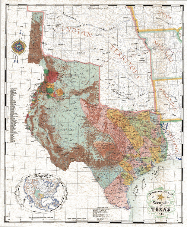
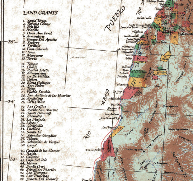
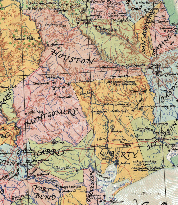
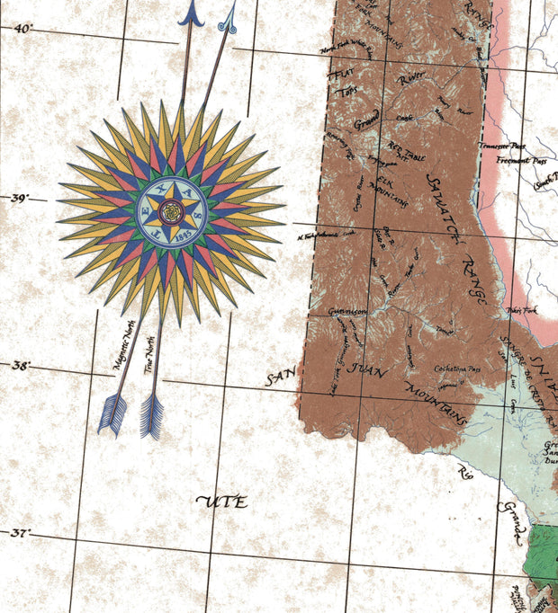
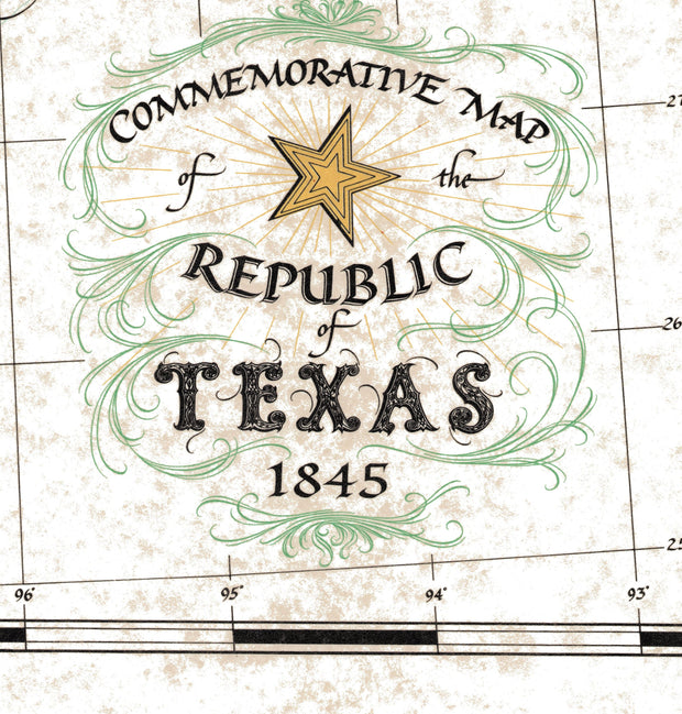
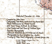
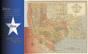
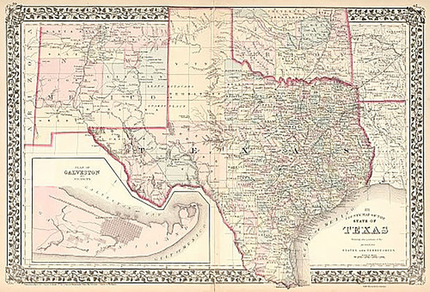
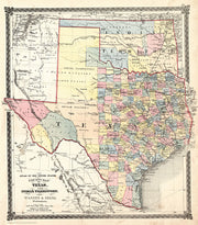
This well known, iconic, historical map of Texas was created by Texas artist and master cartographer John Davis to commemorate the 150th anniversary of the Texas Revolution. Hand drawn and exquisitely colored, it became a classic for its unparalleled drama, accuracy, and beauty.
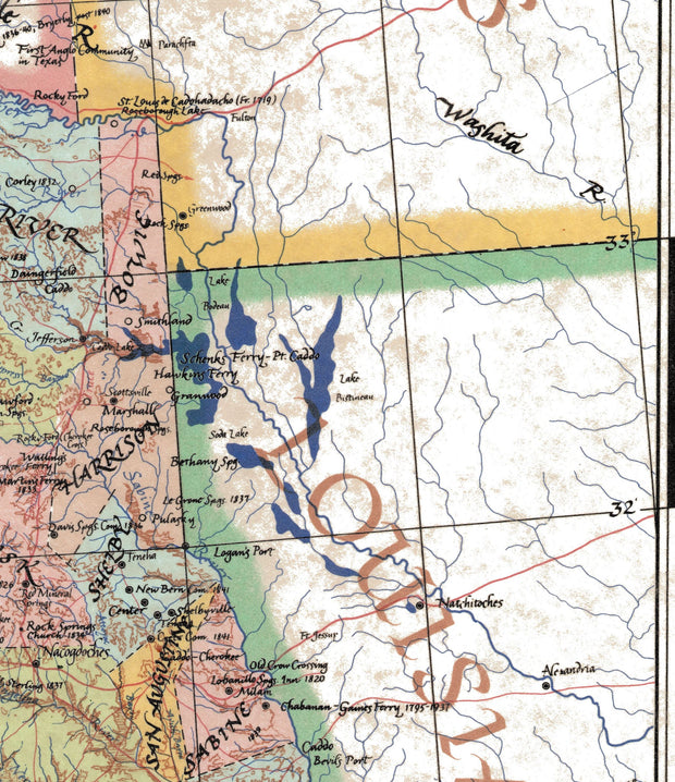
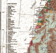
Depicting the Republic of Texas as it was in 1845, just before its annexation by the United States, this map renders the original 36 counties of Texas, the 78 Spanish land grants along the Rio Grande (present day New Mexico), and the vast region claimed by Texas from the Mexican border through present day Wyoming.
Davis's study of the Santa Fe Trail has been hailed as the most accurate ever published, attesting to the artists scholarship as well as fine art. Davis maps have become the favorite of governors, celebrities, and transplanted Texans everywhere.
Printed on a 26" W x 31.5" H sheet of sturdy, art-gallery quality parchment stock it is especially suitable for framing.
In order to make sure it arrives safely we carefully roll the map and insert it in to a protective poly tubing sleeve and then it is inserted in a heavy cardboard tube for safe handling all the way to its destination.
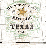
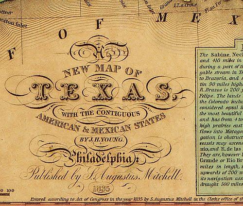
This stunning, exclusive design features the Republic of Texas as taken from a map of the United States originally drawn by J.H. Young and published by Augustus Mitchell in 1836.
From there, we adjoined a portion of the Texas Flag as well as perhaps the most iconic Texas quote ever and brought the three elements together in what can only be described as a fantastic piece portraying the proud history of Texas at this symbolic time in history.
Sized ready for framing it is printed on a 36" wide x 24" high 65lb Mohawk parchment stock using HP 100 year inks. An even 3/4" border along the edges makes framing or hanging worry free. In order to make sure it arrives safely we carefully roll the map and insert it in to a protective poly tubing sleeve and then it is inserted in a heavy cardboard tube for safe handling all the way to its destination.
Perfect gift for a history enthusiast this piece looks stunning hanging in an office, living room or anywhere you want to showcase a bit of history
Revolutionary Texas 1836
2 reviews
HIST030
Regular price
$44.95
-72 in stock
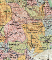
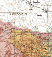
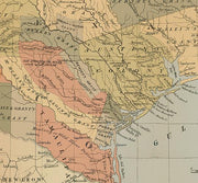
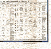
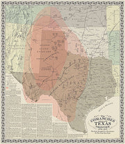
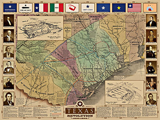
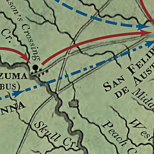
This beautiful map, commissioned in 1986 to commemorate the Texas Sesquicentennial by artist and master cartographer John Davis, depicts the historic events that transpired during the turbulent years of the Texas revolution. Hand drawn, with exquisite color and detail, it features battle sites, roads and trails and hundreds of early settlements.
Celebrating the storied days of 1835-1836, Davis meticulously locates each of the 48 battles of the Texas Revolution and territory controlled by Native American tribes such as the Comanche, Cherokee, Caddo, Kickapoo, Pawnee and Alabama Coushatta.
The map also contains an inset view of the full Republic of Texas at that time and a table in the lower-right which lists facts about important battles.
Printed on a 26" W x 32" H sheet of sturdy, art-gallery quality parchment stock it is especially suitable for framing.
In order to make sure it arrives safely we carefully roll the map and insert it in to a protective poly tubing sleeve and then it is inserted in a heavy cardboard tube for safe handling all the way to its destination.
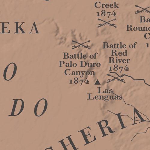
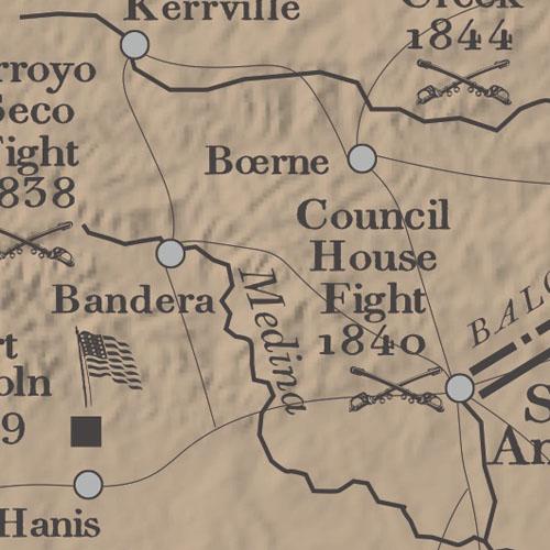
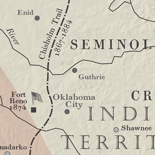
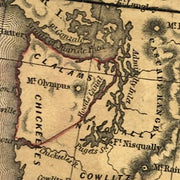
In the mid-nineteenth century westward settlement in Texas was stopped in its tracks by the Comanches, widely recognized at the time as the best mounted warriors in the world. The half-century struggle that ensued between the fledging state and Americas most fierce Indian tribe is depicted on this map. Battle sites, forts, trails and much more are shown on this graphically pleasing and historically rich map. This map is printed on heavy acid free stock and is perfect for framing.
25"W x 28"H
Interested in a framed version of this map? Click HERE
I will mount it under glass on the back porch of my house. Will be a great conversation piece.
Texas Revolution
HIST140
Regular price
$42.95
-11 in stock
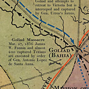
The Texas Revolution is depicted on this map in great detail from the first shots fired off the Texas coast by the Texas Navy schooner San Felipe to the crushing defeat of Santa Annas forces at the battle of San Jacinto. The colorful flags of the revolution are displayed across the top and key participants are shown down the sides. This is a must have for any Texas history buff.
This map is printed on heavy acid free stock and is perfect for framing.
34"W x 25.5"H
Interested in a framed version of this map? Click HERE
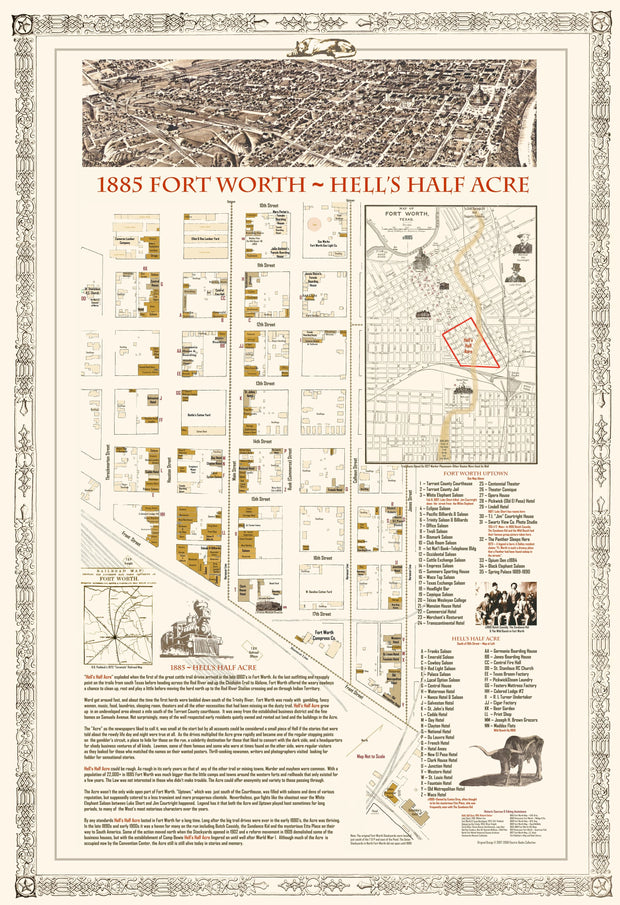
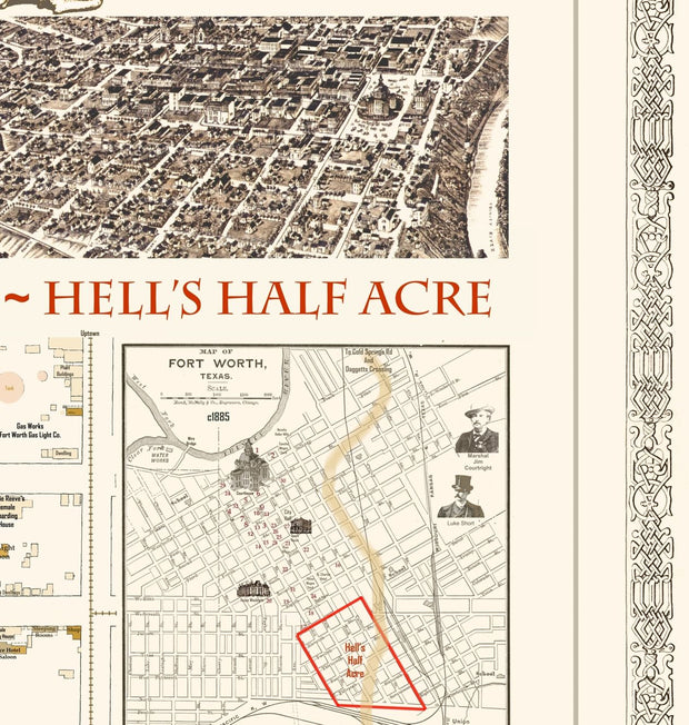
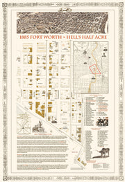
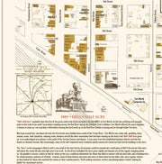
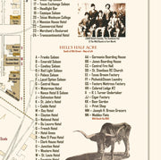
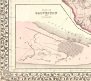
1885 Fort Worth - Hell's Half Acre
1 review
HIST220
Regular price
$39.95
-32 in stock
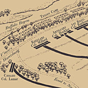
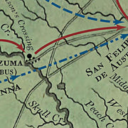
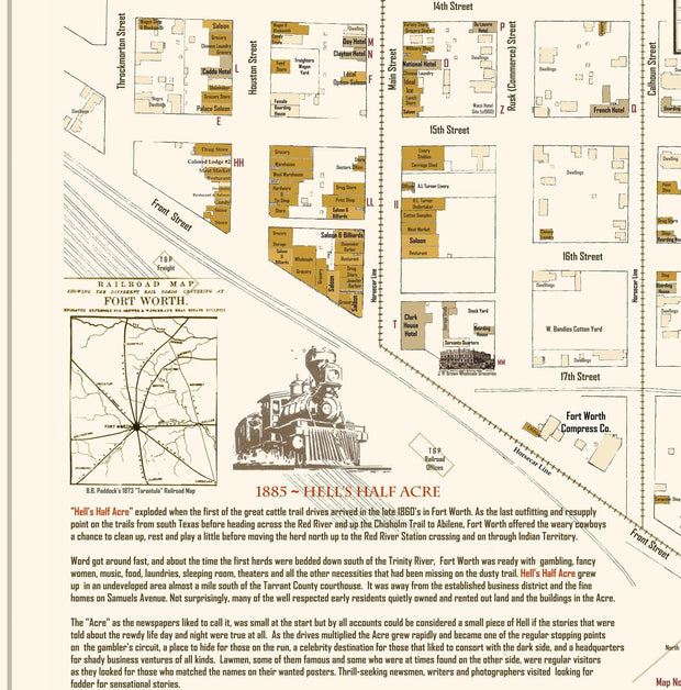
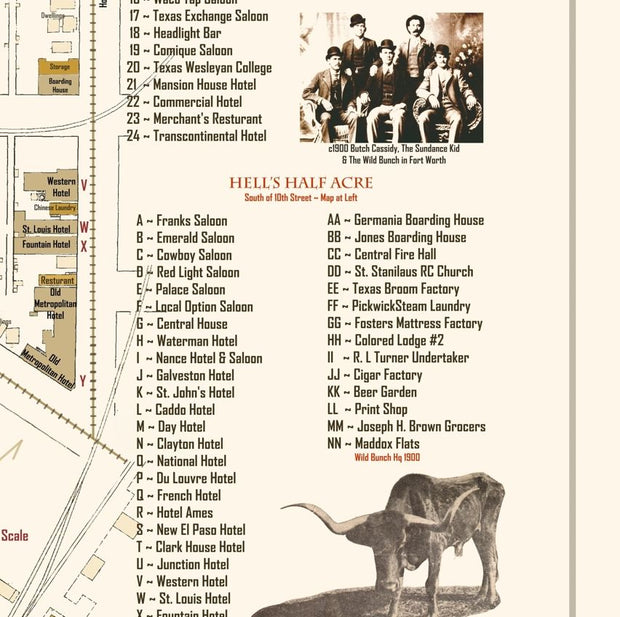
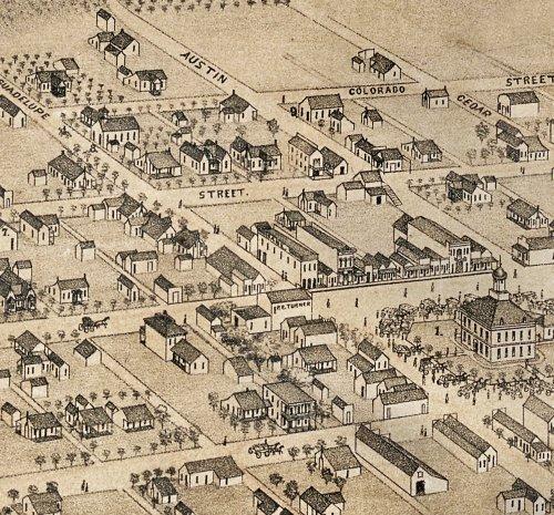
Our highly detailed map of old Ft. Worth and the notorious Hell's Half Acre district is filled with detail about the history starting with the early cattle drives around 1866 to 1885 and then with much additional information about the later days. Hell's Half Acre and Fort Worth were on the "Sin Circuit" and fancy women, gamblers and gunmen like Bat Masterson, James and Wyatt Earp and later Butch Cassidy and the Sundance Kid with their Hole-In-the-Wall Gang were frequent visitors. Less well known but equally active was the "Uptown" area south of the Tarrant County courthouse that also was filled with saloons and pleasure palaces but catered to a sometimes less rowdy clientele. Many famous and notorious places are shown: The White Elephant Saloon near which dapper gambler Luke Short and ex-Marshal Jim Courtright shot it out. The track of the herds as they entered Fort Worth from the south and made their way north to the Cold springs area on the Trinity River to bed down on their way north to the Red River and the Chisholm Trail in Indian Territory. Historical Note: In spite of some popular misinformation, Hell's Half Acre was NOT in the North Fort Worth Stockyard district. The Fort Worth Stockyards did not begin to operate until about 1900. Instead, the Acre was at the southern end of the Fort Worth business district bounded on the south by the Texas & Pacific Railroad reservation in later years. Also, Fort Worth was a sizeable city for its time with a population of over 22,000 compared to the few hundreds or few thousands in many of the forts, camps and railhead's of the period.
Just what I was looking for! I love history and maps help to look back in time!
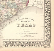
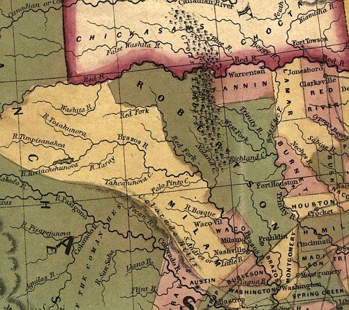
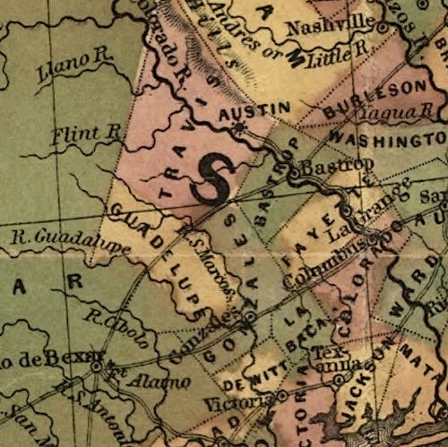
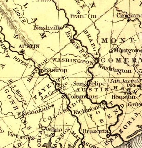
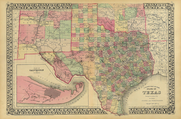
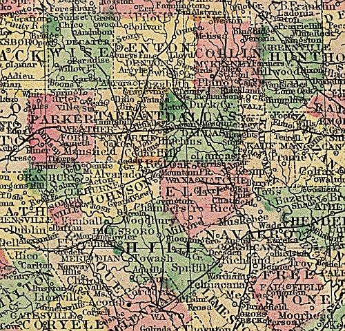
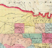
1876 County Map of Texas by S.A. Mitchell
HIST070
Regular price
$48.00
Sale price
$39.95
-3 in stock
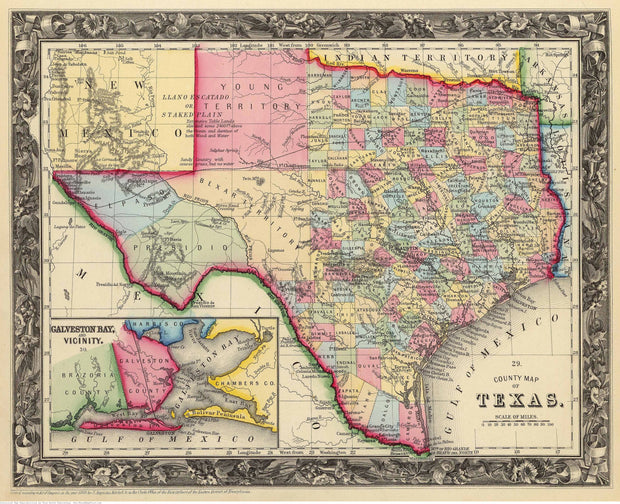
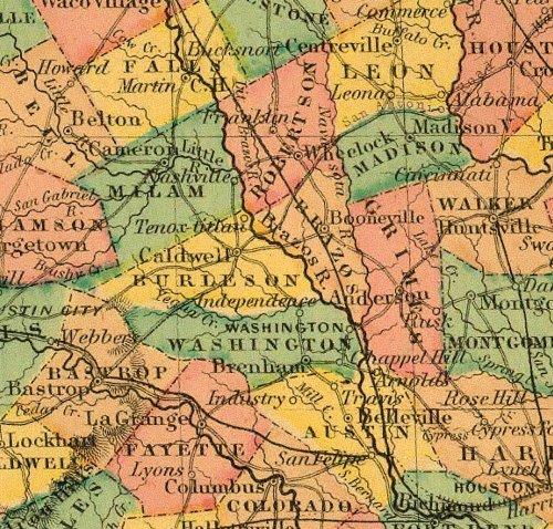
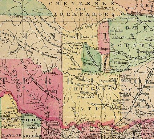
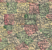
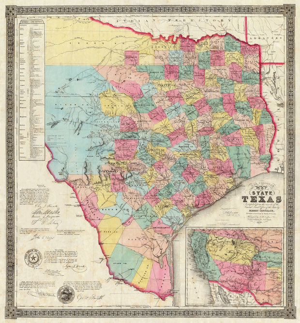
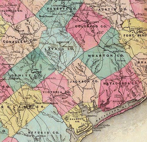
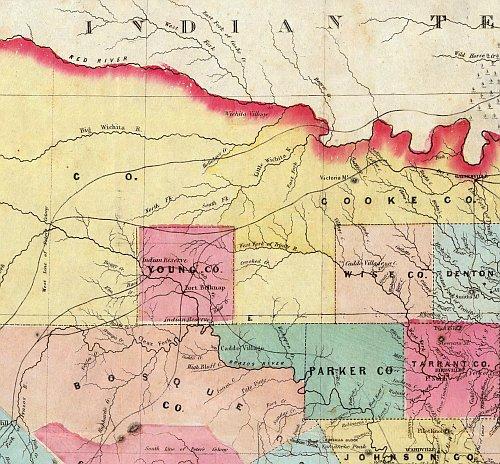
In 1876 when this superb folio map of Texas was published by the S.A. Mitchell Co., the frontier was still in flux and the western counties including those on the barren and little known Llano Estacado had not yet been formed from the early territories. This reproduction brings out many normally hard to see features. In this transitional period, the railroads had only reached as far west as Fort Worth & San Antonio. Shown are the major Indian war trails, the military roads still connecting all the frontier forts and many now-forgotten place names. In addition, a very large part of Indian Territory and New Mexico is shown in full color and detail. The map features the trademark grapevine border coupled with effective but subtle hand wash coloring and is printed on heavy parchment style paper that is excellent for framing.
34"W x 24"H
Interested in a framed version of this map? Click HERE
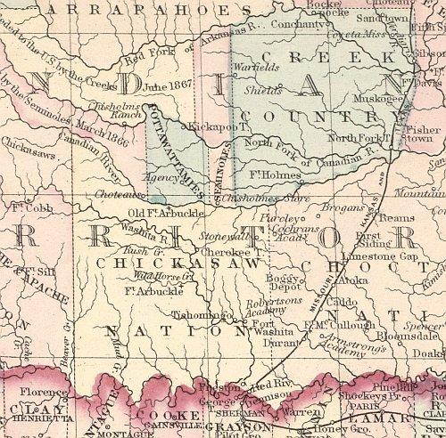
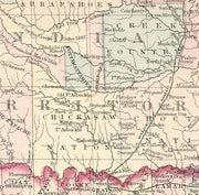
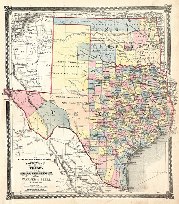
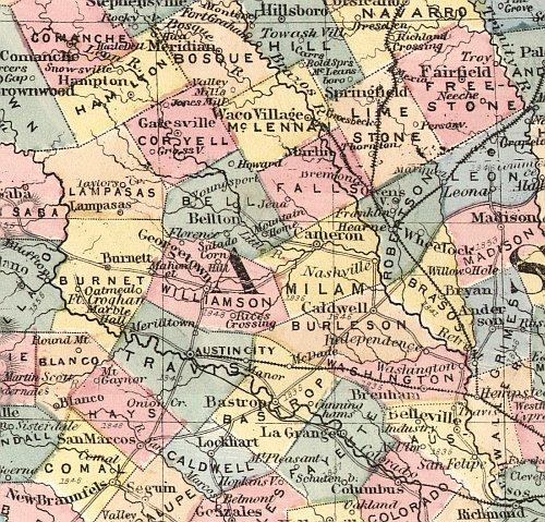
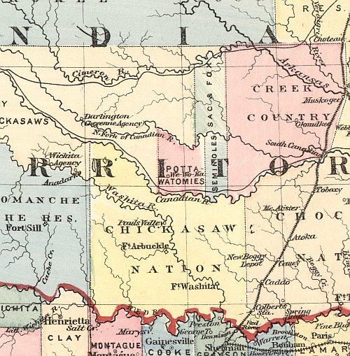
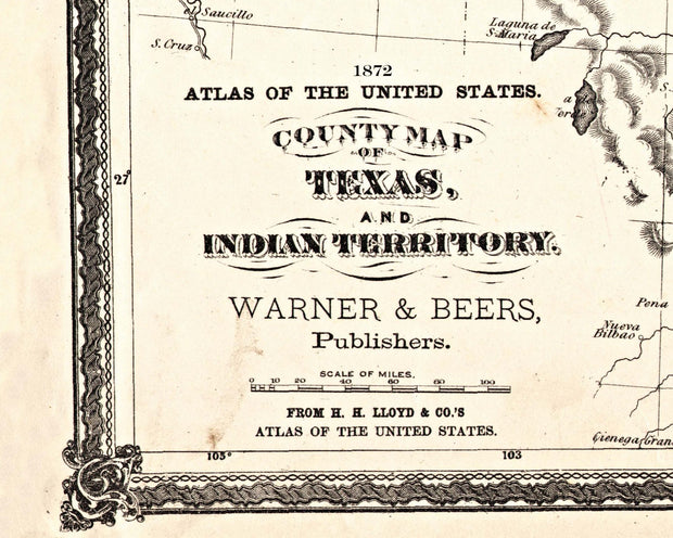
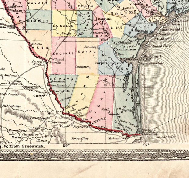
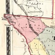
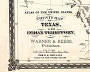
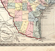
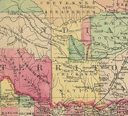
1872 Texas Counties and Indian Territory Map
HIST060
Regular price
$48.00
Sale price
$39.95
-7 in stock
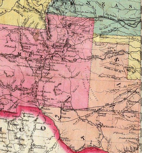
This reproduction is from The National Atlas of the United States copyrighted in 1872 and published in 1876 by Warner & Beers. In this transitional period, the railroads had only reached as far west as Dallas & Austin. There are a number of projected but never built fantasy railroads shown as well as major Indian war trails, the military roads connecting the frontier forts and many now-forgotten place names. In addition, a very large part of Indian Territory and New Mexico is shown in full color and detail. This is one of the few Texas maps that shows Wigefarth County in the lower Panhandle next to Indian Territory. This county was in existence for only a short time. The map features an intricate border coupled with effective but subtle handwash coloring and is printed on heavy parchment style paper that is excellent for framing.
23"W x 26"H
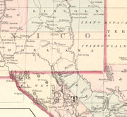
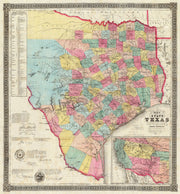
1860 Pre-Civil War County Map of Texas by S.A. Mitchell
HIST050
Regular price
$39.95
-6 in stock
The intricate border on this beautiful hand-colored map make it stand out as one of the most popular early maps available. Just prior to the Civil War, Texas was growing fast, pushing railroads westward to accommodate her booming commerce and population growth. This excellent reproduction is printed on heavy parchment style paper is perfect for framing.
28"W x 23"H
Interested in a framed version of this map? Click HERE
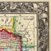
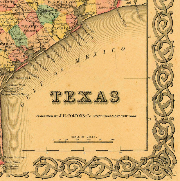
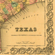
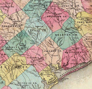
1855 Texas County Map by J.H. Colton
HIST560
Regular price
$39.95
-9 in stock
In the decade after statehood Texas was developing fast with most of the counties in the eastern half of the state having been established with little change according to present-day boundaries. This beautiful reproduction is printed on heavy parchment style paper and is excellent for framing.
26"W x 21"H
Interested in a framed version of this map? Click HERE
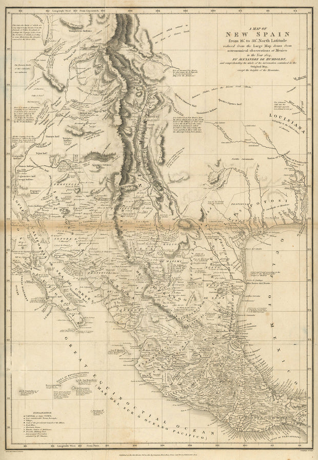
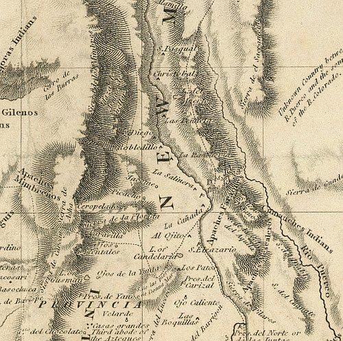
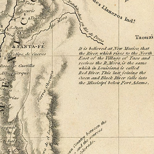
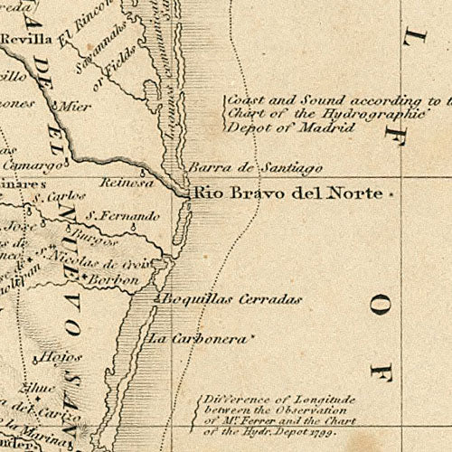
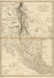
A Map of New Spain 1810
HIST400
Regular price
$39.95
-8 in stock
Drawn by Alexander von Humbolt, this great map dates from the period just after the Louisiana Purchase in 1803 when little was known about the "provincia" of Texas. Interesting note: longitude is shown as degrees "West from Paris". This beautiful reproduction is printed on heavy parchment style paper and is excellent for framing.
23" x 31"
Interested in a framed version of this map? Click HERE
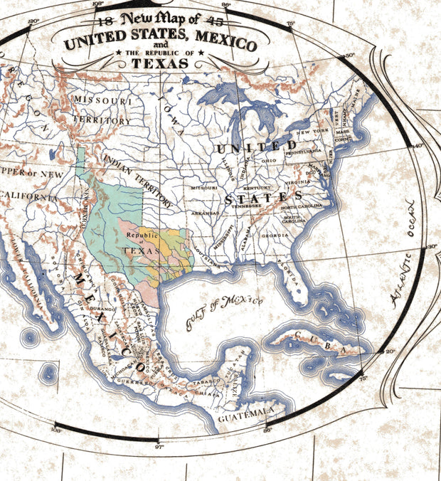
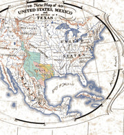
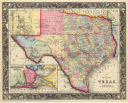
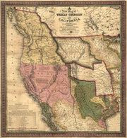
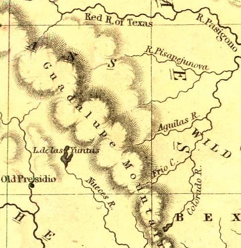
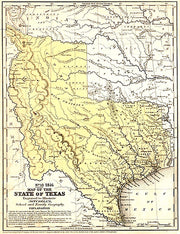
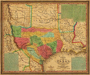
A New Map of Texas, Oregon and California with the Regions Adjoining, 1846
HIST100
Regular price
$39.95
-3 in stock
This is a beautiful reproduction of one of the most important maps of it's day. Published by Samuel A. Mitchell at a time when war was imminent with Mexico, it is one of the first maps to depict Texas as a state. Useful as well as informative, it was published as a pocket map and depicts all of the important emigrant trails including the Oregon Route, Fremont's Route, Lewis & Clarkes Route, the Great Spanish Trail from P. Angelos to Santa Fe, and the Caravan Route to Santa Fe. It was even reportedly used by Brigham Young in 1847 on his trek to The Great Salt Lake. The map is printed on heavy parchment style paper that is excellent for framing.
26"W x 28"H
Interested in a framed version of this map? Click HERE
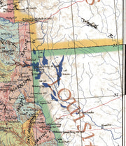
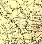
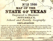
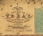
1846 Texas "Stovepipe" Map by Augustus Mitchell
HIST160
Regular price
$39.95
-6 in stock
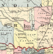
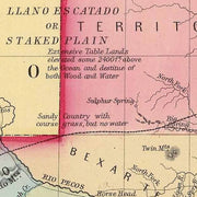
In 1846 when this historic Texas reproduction map was published by S.A. Mitchell, Sr. the boundaries of the state were still unsettled. The "stovepipe" extension reaching to the 42nd parallel is shown and the boundaries around El Paso in far west Texas are still unresolved and would be until 1850. The area west of Dallas and Fort Worth was almost entirely wild and the llano Estacado atop the Caprock was largely unknown territory. This early map also shows Indian Territory which had been formed in the 1830's as well as Taos and Santa Fe which had been claimed by the Texas Repulic. This is one of the few early maps that shows the entire state of Texas without truncation, which adds greatly to visual appeal.
20"W x 26'H
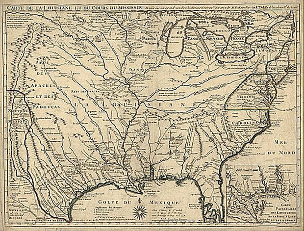
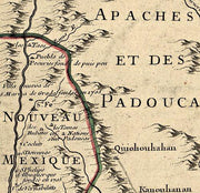
Carte de la Louisiane et du cours du Mississipi 1718
HIST840
Regular price
$39.95
-1 in stock
Known for its detailed depiction of the states adjacent to the Gulf of Mexico region and the Mississippi River, this map is also the first printed map to show a variant name for Texas (from the note "Mission de los Teijas etablie en 1716" in what is now East Texas) and has been called "the map that named Texas". It depicts the great French explorations of the era and was copied for decades. By Guillaume de L'Isle.
26"W x 18"H
Interested in a framed version of this map? Click HERE
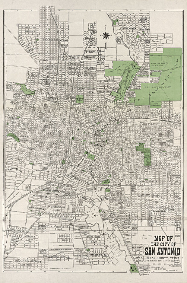
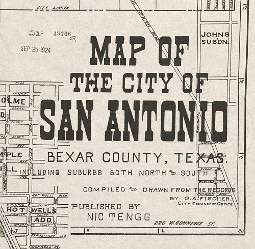
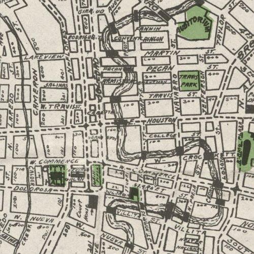
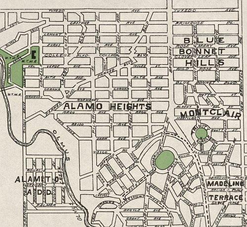
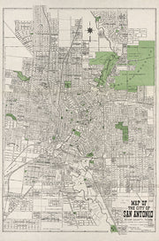
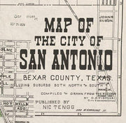
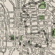
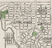
San Antonio 1924 by Nic Tengg
1 review
HIST830
Regular price
$39.95
-6 in stock
This is a great snapshot of San Antonio when it was beginning to grow into one of Texas' major cities. Alamo Heights is the subdivision at the northeastern edge of the map. This beautiful reproduction is printed on heavy parchment style paper and is excellent for framing.
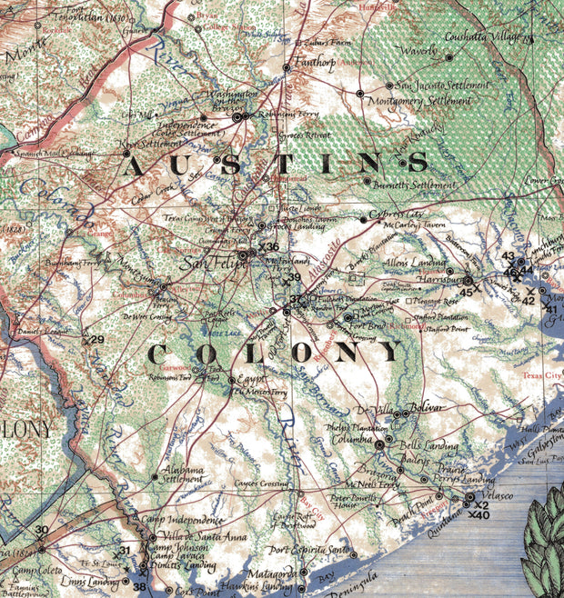
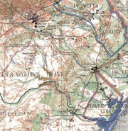
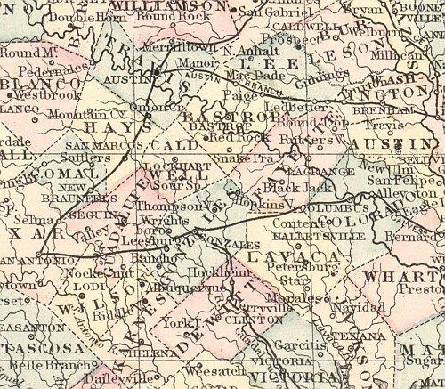
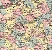
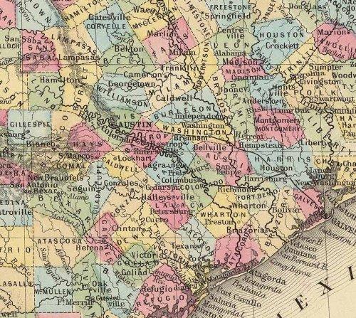
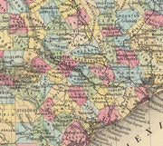
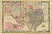
The mapmaking firm of S. A. Mitchell published this county map of Texas in 1881. At this time, Texas was experiencing explosive growth in terms of immigration and railroad development. The map was published in one of Mitchell’s popular commercial atlases, and clearly shows the steady westward movement of the Texas populace by charting county development. This reproduction is printed on heavy parchment style paper and is excellent for framing.
31"W x 21"H
San Marcos 1881 by Augustus Koch
HIST810
Regular price
$39.95
-3 in stock
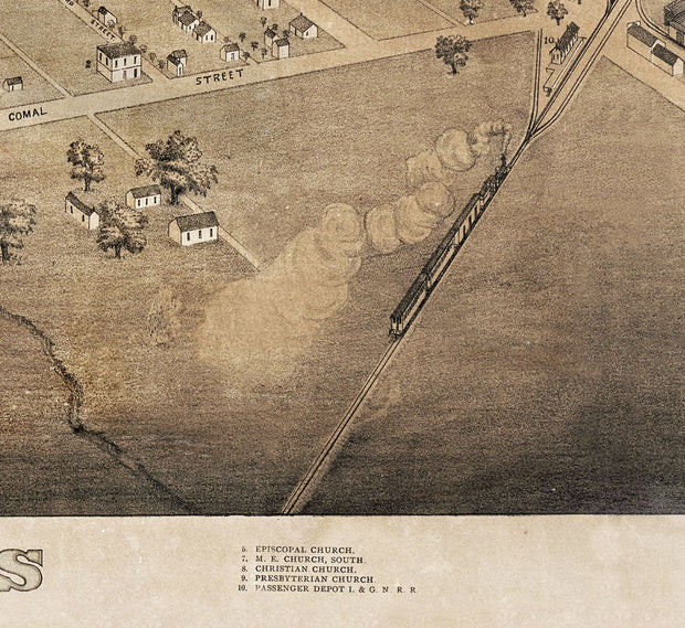
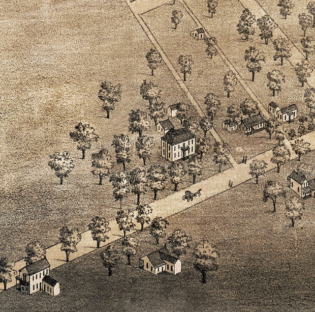
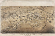
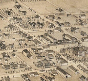
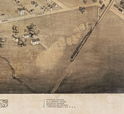
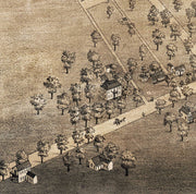
Settled in 1846 at the headwaters of the San Marcos river, by 1881 when the International-Great Northern Railroad (lower right) arrived, San Marcos was on its way to becoming a center for commerce and education. Every street is labeled on this bird's eye view and an index across the bottom identifies 10 schools, churches and public buildings. This beautiful reproduction is printed on heavy parchment style paper and is excellent for framing.
26"W x 18"H
Texas 1856 by J. De Cordova
HIST800
Regular price
$39.95
-3 in stock
This colorful map is rich in detail. In the lower left the map is signed and endorsed by Texas founding fathers Sam Houston and Thomas J. Rusk; George T. Wood, 2nd governor of Texas; Washington D. Miller, governor Wood's secretary of state; George W. Smyth, 2nd commissioner of the General Land Office; John C. Hays, legendary Texas Ranger; and others. This beautiful reproduction is printed on heavy parchment style paper and is excellent for framing.
26"W x 30"H
Interested in a framed version of this map? Click HERE
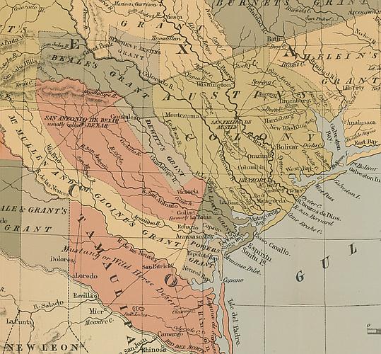
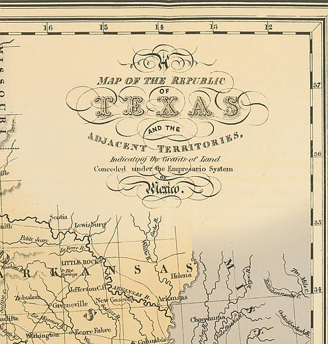
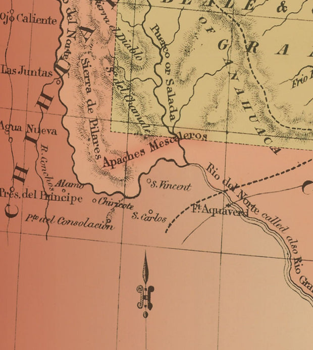
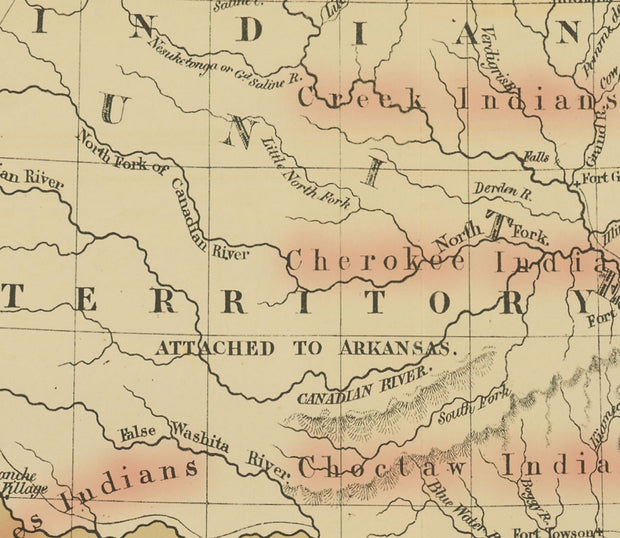
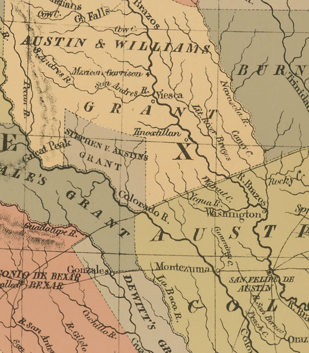
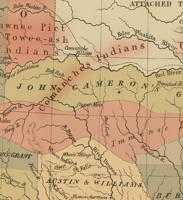
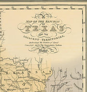
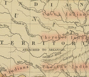
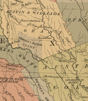
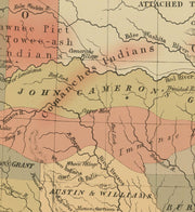
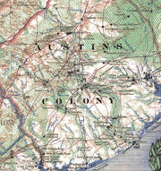
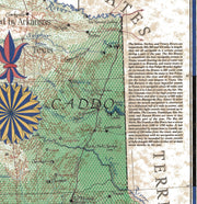
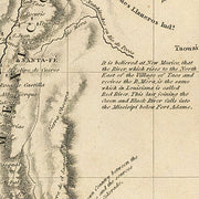
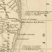
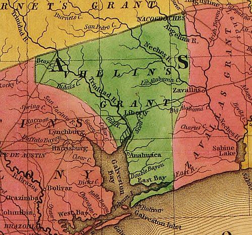
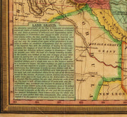
Texas 1835 by J. H. Young
HIST790
Regular price
$39.95
-12 in stock
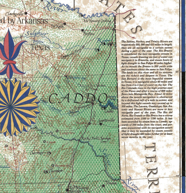
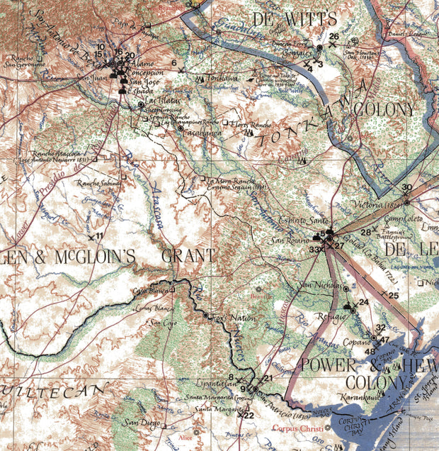
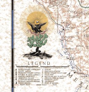
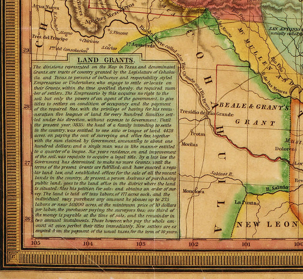
This striking map produced just before Texas declared it's independence from Mexico shows colonies and land grants, the Neuces River as the border between Texas and Mexican states, Indian Territory attached to Arkansas, Santa Fe area, towns, rivers, and roads. The three text boxes discuss at some length the land grant system (Land Grants), the physical nature, political environment and emigrant status (Remarks on Texas), and the nature and navigability of Texas rivers (Texas Rivers). This beautiful reproduction is printed on heavy parchment style paper and is excellent for framing.
28"W x23"H
Interested in a framed version of this map? Click HERE