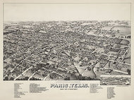
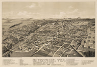
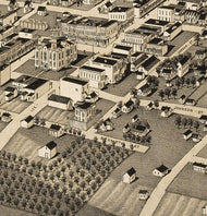
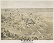
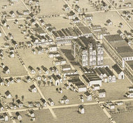
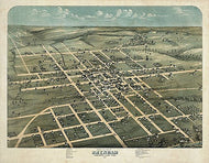
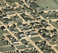
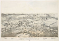
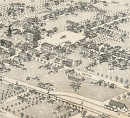
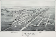
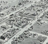
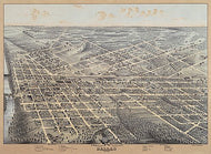
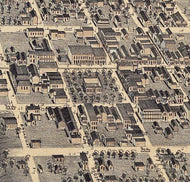
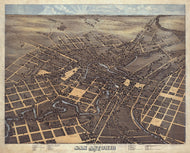
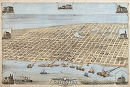
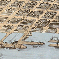
This wonderful full-color bird's eye view shows street names and features excellent drawings of several important buildings and Baylor University (lower left). It also has building and church directories that are referenced to the buildings shown on the map. This beautiful reproduction is printed on heavy, acid-free stock and is excellent for framing.
34" W x 20"H
Texas 1945, Texas Highway Department
HIST330
Regular price
$39.95
-3 in stock
This is the official map published by the then Texas Highway Department (now Texas Department of Transportation) in 1945. It is highly detailed and features insets of major cities and towns as well as a listing of Texas state parks referenced to symbols on the map. This beautiful and interesting reproduction is excellent for framing.
35" x 35"
Texas 1839, General Land Office of the Republic
HIST310
Regular price
$39.95
-6 in stock
Compiled from Surveys on record in the General Land Office of the Republic, to the year 1839. This map shows rivers, mountainous and forested areas, colonies, counties, towns, routes and trails--including the Old San Antonio Road, proposed railroads, forts, battlegrounds, and Indian tribes and villages and features an inset: Map of the Rio Grande and Country West to the Pacific. This beautiful reproduction is printed on heavy parchment style paper and is excellent for framing.
23" x 31"
Interested in a framed version of this map? Click HERE
Tabula Mexicae et Floridae 1710
HIST300
Regular price
$39.95
-4 in stock
Although the text is in Latin, there is much that can be learned from this wonderful map from the early 18th century. It shows the extent of New Spain and Florida, New France, the American colonies, and the West Indies as well as rivers, towns, and trade routes. This beautiful reproduction is printed on heavy parchment style paper and is excellent for framing.
18" x 24"
Interested in a framed version of this map? Click HERE
Railroad and County Map of Texas 1893
HIST290
Regular price
$39.95
-5 in stock
This extremely detailed map shows rivers, mountainous areas, counties, cities, towns, forts, roads, and railroads. Stops along the railroads are also given. This beautiful reproduction is printed on heavy parchment style paper and is excellent for framing.
26" x 30"
Interested in a framed version of this map? Click HERE
Neue Karte de Staates Texas 1881
HIST280
Regular price
$39.95
-1 in stock
Although the title block is in German, this excellent map depicts all place and feature names in English. Counties and principle cities are shown as well as rivers and major creeks, forts, railroads and mountains. This beautiful reproduction is printed on heavy parchment style paper and is excellent for framing. Interesting note: San Antonio is labeled with the feminine "San Antonia".
23" x 31"
Mapa de los Estados Unidos de Mejico 1828
HIST270
Regular price
$39.95
-3 in stock
This map, in Spanish, covers the entirety of Mexico as it was in 1828 including what is now Texas, New Mexico, and California. It shows rivers, lakes, mountainous areas, mines, cities, towns, missions, forts, and Indian tribes, ruins, and villages. It features an inset map, 'Carta de los Caminos & c. desde Vera Cruz y Alvardo a Mejico (Map of the Roads and etc. from Vera Cruz and Alvardo to Mexico City)' as well as two tables: 1) Tabla de Distancias, 2) Tabla Estadistica (Statistics). This beautiful reproduction is printed on heavy, acid-free stock and is excellent for framing.
34"W x 24"H
Interested in a framed version of this map? Click HERE
Mexico, Texas, Old and New California 1847
HIST260
Regular price
$39.95
-3 in stock
Published during the Mexican-American War, this interesting map Shows rivers, lakes, cities, towns, routes and trails--including the Great Spanish Road to Red River and the routes of Fremont and Kearney, battlegrounds, forts, and the American Fur Depot by the Great Salt Lake [Lake Yuts]. It features a drawing of the Castle of San Juan D'Ullon and an inset: Plan of Operations at the Battle of Monterey on the 21st, 22nd, and 23rd Sept., 1846. This beautiful reproduction is printed on heavy parchment style paper and is excellent for framing.
28"W x 21"H
Interested in a framed version of this map? Click HERE
Laredo 1892 by American Publishing Co.
HIST250
Regular price
$39.95
-2 in stock
Full title: Perspective map of the city of Laredo, Texas, the Gateway to and from Mexico. This excellent bird's eye view features wonderful drawings of some of the city's more important buildings and an inset depicting 'Laredo's railway connections', and a distance chart. This beautiful reproduction is printed on heavy, acid-free stock and is perfect for framing.
34"W x 17"H
Houston & Texas Central Railroad 1867
HIST240
Regular price
$39.95
-3 in stock
Published at the close of the Civil War, this monochrome map of the South-Central US shows relief by hachures, rivers, cities and towns, counties, and the railroad network with emphasis on the main line. This beautiful reproduction is printed on heavy parchment style paper and is excellent for framing.
33" W x 25"H
Houston 1891
HIST230
Regular price
$39.95
-5 in stock
This wonderful bird's eye view depicts Houston in all it's booming glory at the end of the 19th century. It features excellent drawings of some of the more important buildings in the city as well as a directory of 'Public Buildings, Hotels, Railroads and Some of the Leading Manufacturers'. A church directory occupies the lower right-hand corner. This beautiful reproduction is printed on heavy parchment style paper and is excellent for framing.
36"W x 22"H
Interested in a framed version of this map? Click HERE
Galveston County and City 1891
HIST210
Regular price
$39.95
-1 in stock
Galveston, at the turn of the 19th century, was a growing metropolis with a population (~37,000) greater than Houston and the major trade hub of Texas. This beautiful reproduction is printed on heavy parchment style paper and is excellent for framing.
35"W x 25"H
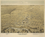
Fort Worth 1891 by Henry Wellge
HIST200
Regular price
$39.95
-3 in stock
This remarkably detailed perspective map shows Fort Worth at a time when it was emerging as a major transportation and manufacturing hub. Major street and rail line names are shown. This beautiful reproduction is printed on heavy parchment style paper and is excellent for framing.
35"W x 21"H
Interested in a framed version of this map? Click HERE
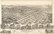
Dallas 1892
HIST190
Regular price
$39.95
-1 in stock
With the projected river and navigation improvements viewed from above the sister city of Oak Cliff. The images of buildings around the border and "business card" ads across the bottom add greatly to the historical importance of this map. This beautiful reproduction is printed on heavy, acid-free stock and is excellent for framing.
29"W x 21"H
Texas and Indian Territory 1875
HIST170
Regular price
$39.95
-2 in stock
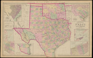
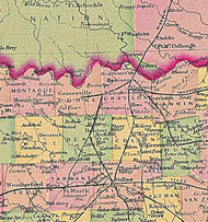
This beautiful hand-colored map is by Warner & Beers from H.H. Lloyd & Co.'s Atlas of the United States shows counties, principle cities, railroads, relief by hachures and rivers. Oklahoma was still "Indian Territory" and major tribal areas are shown. This beautiful reproduction is printed on heavy parchment style paper and is excellent for framing.
23"W x 25"H
Interested in a framed version of this map? Click HERE
Campaign map of Texas, Louisiana and Arkansas 1871
HIST150
Regular price
$39.95
-2 in stock
Full title: "Campaign map of Texas, Louisiana and Arkansas, showing all the battle fields and also the marches of Walker's Division". This Civil War map shows counties, existing and projected railroads, geographic coordinates, rivers and major creeks and towns. This beautiful reproduction is printed on heavy parchment style paper and is excellent for framing.
33"W x 24"H
Map of the United States of Mexico, Tanner 1846
HIST130
Regular price
$39.95
-5 in stock
Henry S. Tanner first published a map of Mexico in the mid-1820s and this third edition, issued in 1846 is especially interesting because that is the year the United States went to war with Mexico and a year after Texas statehood. This map seems to suggest that the national affiliation of Texas was still in dispute which may reflect the depth of political rancor in the US caused by the Mexican war. This beautiful reproduction is printed on heavy parchment style paper that is excellent for framing.
33"W x 25"H
Interested in a framed version of this map? Click HERE
Map of Texas with Parts of Adjoining States by Stephen F. Austin, 1837
HIST120
Regular price
$39.95
-5 in stock
In 1829, after spending six years exploring Texas and gleaning information from travelers and surveyors, Stephen F. Austin sent the information to Henry S. Tanner, a prominent Philadelphia publisher, who used it to created a forerunner of this map in 1830.This 1837 edition was regarded as the most accurate of the day and was copied by many other publishers and cartographers. This beautiful reproduction is printed on heavy parchment style paper that is excellent for framing.
24"W x 29"H
Interested in a framed version of this map? Click HERE
The Republic of Texas, 1844
HIST110
Regular price
$39.95
-9 in stock
Published by the United States War Department, this map was part of the accompanying documentation sent to the Senate in 1844 when the Texas annexation treaty was debated. The Republic of Texas covered much of present-day New Mexico including Santa Fe, Albuquerque and Taos as well as parts of Colorado that cover many of the popular ski resorts. Another interesting historical note: the area north of present-day Oklahoma is shown as "Proposed NE-BRAS-KA Territory". This beautiful reproduction is printed on heavy parchment style paper that is excellent for framing.
34"W x 22"H
Interested in a framed version of this map? Click HERE
1881 Lonesome Dove/Comanche Moon Wars & Great Cattle Trails Map
4 reviews
HIST090-02
Regular price
$35.00
-124 in stock
The Lonesome Dove Trail/Comanche Moon Wars & Great Cattle Trails Map is an exclusive copyrighted design based on an original 1881 US map by S.A. Mitchell. In addition to the Lonesome Dove trail and place names, this map has most of the Texas locations and place names from Larry McMurtrys great "Comanche Moon" novel which follows Gus & Call during their Texas Ranger days before the Civil War and is the preface to Lonesome Dove. The Chisholm, Great Western, Goodnight-Loving, Shawnee and the other major overland cattle trails are also shown in their correct positions.
The map is printed on heavy (65lb) parchment style paper that is excellent for framing. Or for you can treat yourself or someone else to a canvas gallery wrap or framed canvas version for a more exquisite piece.