Skip to content
  • Texas Maps
    • Road Atlases
    • Wall Maps
    • Folded Maps
  • City Maps
    • Texas City Wall Maps
    • Street Guides
    • Folded Maps
  • Historical Maps
    • Texas
    • Topographic
    • County
    • War
  • Topographic Maps
    • Any Current US Topographic Map
    • Current Texas Topographic Maps
    • Historical Texas Topographic Maps
  • Classroom Maps
    • Earth Sciences
    • Educational
    • Historical
  • Outdoor Maps
    • Fishing Maps
    • Birding Maps
    • Current Topo Maps
  • Decorative Maps
    • Historical
    • Reference
  • Everything Else
    • Other State
      • Other State Historical Maps
    • USA
      • USA Historical Maps
      • USA Road Atlases
      • USA Wall Maps
    • Country Maps
    • World
      • World Wall Maps
    • Globes
    • Custom
      • Custom Design Maps
  • Log in
Cart
Texas Map Store | Have a question? | email: truenorth@gvtc.com
  • My Account
    • Login
    • Contact Us
  • View Cart
Texas Map Store Texas Map Store Texas Map Store Texas Map Store
Log in Search Cart
  • Texas Maps
    • Road Atlases
    • Wall Maps
    • Folded Maps
  • City Maps
    • Texas City Wall Maps
    • Street Guides
    • Folded Maps
  • Historical Maps
    • Texas
    • Topographic
    • County
    • War
  • Topographic Maps
    • Any Current US Topographic Map
    • Current Texas Topographic Maps
    • Historical Texas Topographic Maps
  • Classroom Maps
    • Earth Sciences
    • Educational
    • Historical
  • Outdoor Maps
    • Fishing Maps
    • Birding Maps
    • Current Topo Maps
  • Decorative Maps
    • Historical
    • Reference
  • Everything Else
    • Other State
      • Other State Historical Maps
    • USA
      • USA Historical Maps
      • USA Road Atlases
      • USA Wall Maps
    • Country Maps
    • World
      • World Wall Maps
    • Globes
    • Custom
      • Custom Design Maps
Home / Harris Co

Harris Co

Harris Co

New maps are being added to this category - please check back often!
Click on the map name or image for a LARGER IMAGE AND MORE INFO.

  • View all
  • Texas Topographic Maps. Texas Topographic Maps: Brazoria Co
  • Texas Topographic Maps. Texas Topographic Maps: Chambers Co
  • Texas Topographic Maps. Texas Topographic Maps: Fort Bend Co
  • Texas Topographic Maps. Texas Topographic Maps: Galveston Co
  • Texas Topographic Maps. Texas Topographic Maps: Harris Co
  • Texas Topographic Maps. Texas Topographic Maps: Waller Co
Quick view
Houston Heights 1915, USGS
$29.95
Quick view
Seabrook 1929, USGS
Seabrook 1929, USGS
$29.95
Quick view
Cypress 1915, USGS
Cypress 1915, USGS
$29.95
Quick view
La Porte 1916, USGS
La Porte 1916, USGS
$29.95
Quick view
Pearland 1929, US Army Corps of Engineers
$29.95
Quick view
Louetta 1916, USGS
Louetta 1916, USGS
$29.95
Quick view
Sugarland 1915, US Army Corps of Engineers
$29.95
Quick view
Park Place 1915, USGS
$29.95
Quick view
Morgan Point 1916, USGS
$29.95
Quick view
Hillendahl 1915, USGS
$29.95
Quick view
Deepwater 1915, USGS
$29.95
Quick view
Burnett Bay 1916, USGS
$29.95
Quick view
Brookshire 1915, US Army Corps of Engineers
$29.95
Quick view
Rose Hill 1916, USGS
$29.95
Quick view
Waller 1916, USGS
Waller 1916, USGS
$29.95
Quick view
Satsuma 1916, USGS
Satsuma 1916, USGS
$29.95
Quick view
Humble 1916, USGS
Humble 1916, USGS
$29.95
Quick view
Swanson 1916, USGS
Swanson 1916, USGS
$29.95
Quick view
Katy 1915, USGS
Katy 1915, USGS
$29.95
1 2 3 Next
Houston Heights 1915, USGS

Houston Heights 1915, USGS

HST0014

Regular price $29.95
-4 in stock

COUNTY: Harris; SCALE: 1:31,680
This is a high-resolution reproduction printed on 24 lb. bond paper.
PLEASE NOTE: This map does not cover the entire county. The principle county within which the map coverage lies is listed first with partial coverage as noted.

22"W x 30"H

Seabrook 1929, USGS
Seabrook 1929, USGS

Seabrook 1929, USGS

HST0348

Regular price $29.95
-7 in stock

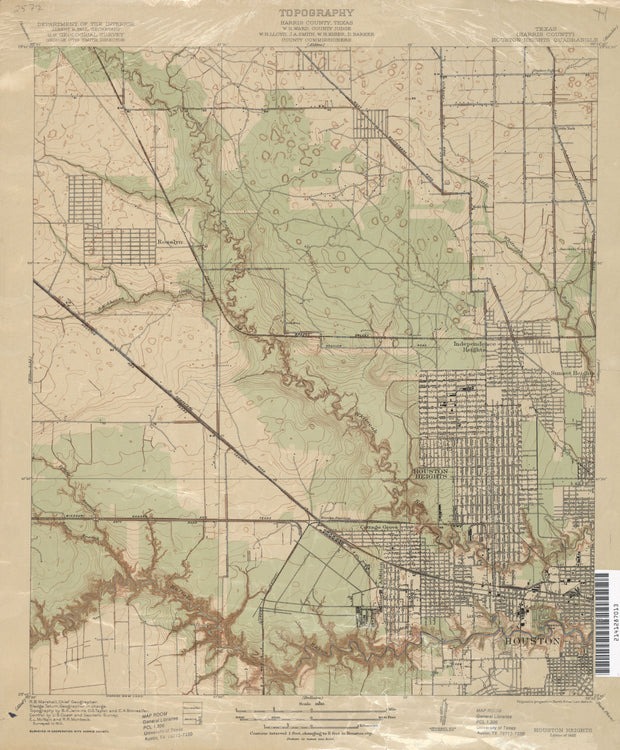
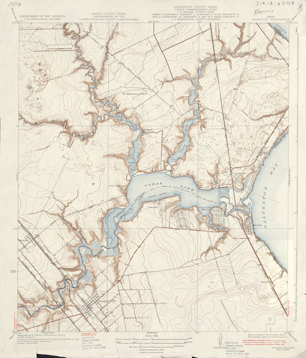
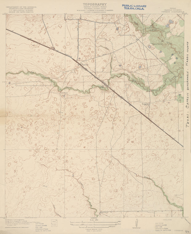
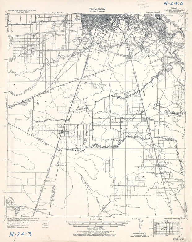
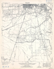
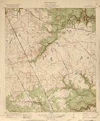
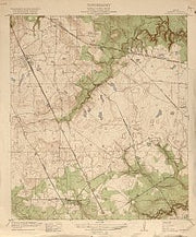
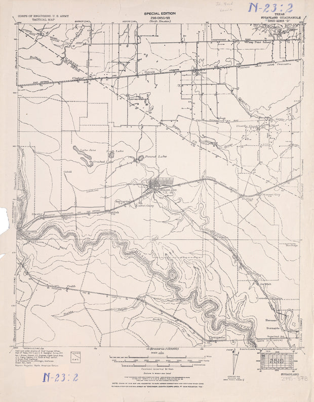
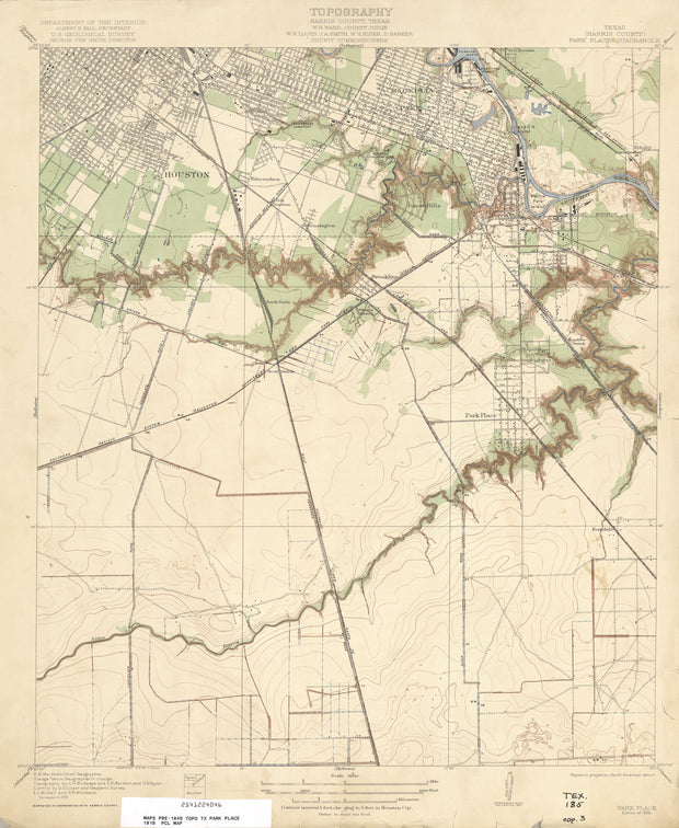
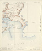
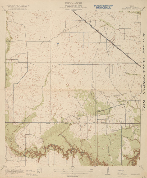
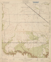
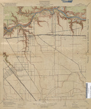
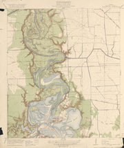
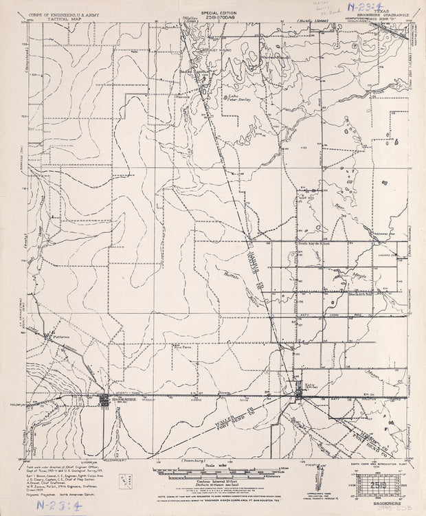
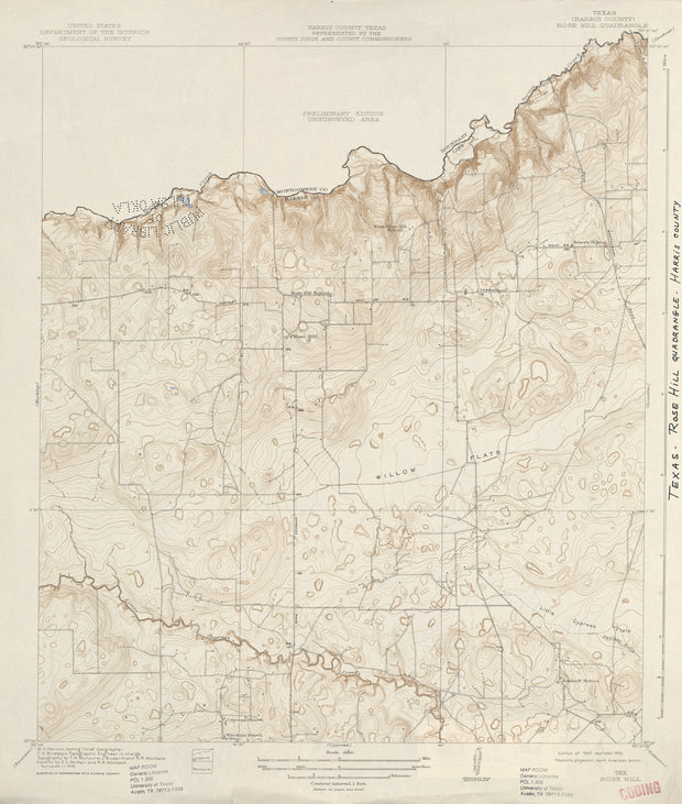
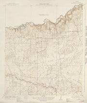
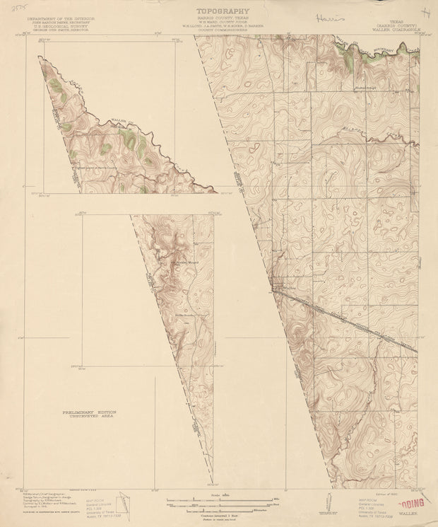
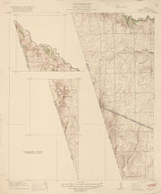
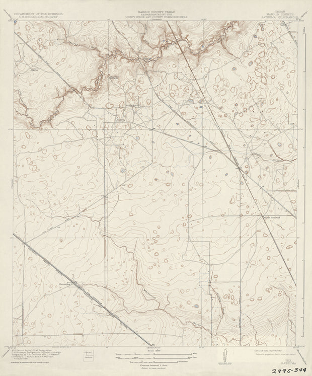
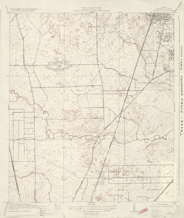
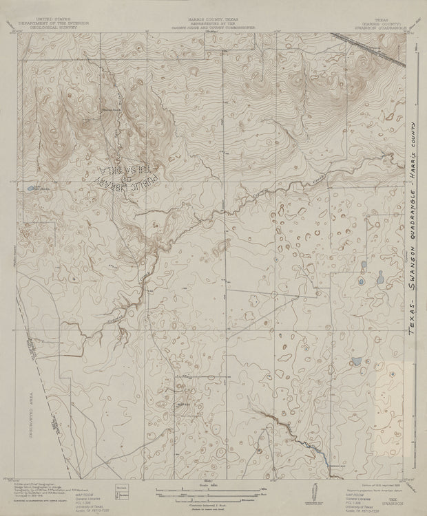
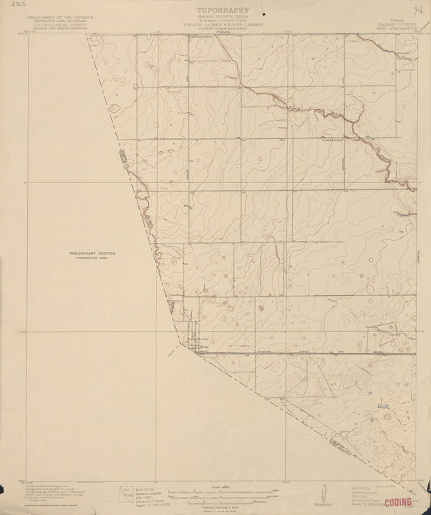
COUNTY: Harris (partial Chambers, Galveston); SCALE: 1:31,680
This is a high-resolution reproduction printed on 24 lb. bond paper.
PLEASE NOTE: This map does not cover the entire county. The principle county within which the map coverage lies is listed first with partial coverage as noted.

22"W x 30"H
Cypress 1915, USGS
Cypress 1915, USGS

Cypress 1915, USGS

HST0025

Regular price $29.95
-1 in stock

COUNTY: Harris; SCALE: 1:31,680
This is a high-resolution reproduction printed on 24 lb. bond paper.
PLEASE NOTE: This map does not cover the entire county. The principle county within which the map coverage lies is listed first with partial coverage as noted.

22"W x 30"H

La Porte 1916, USGS
La Porte 1916, USGS

La Porte 1916, USGS

HST0035

Regular price $29.95
0 in stock

COUNTY: Harris; SCALE: 1:31,680
This is a high-resolution reproduction printed on 24 lb. bond paper.
PLEASE NOTE: This map does not cover the entire county. The principle county within which the map coverage lies is listed first with partial coverage as noted.

22"W x 30"H

Pearland 1929, US Army Corps of Engineers

Pearland 1929, US Army Corps of Engineers

HST0902

Regular price $29.95
-1 in stock

COUNTY: Harris (partial Brazoria, Fort Bend); SCALE: 1:62,500
This is a high-resolution reproduction printed on 24 lb. bond paper.
PLEASE NOTE: This map does not cover the entire county. The principle county within which the map coverage lies is listed first with partial coverage as noted.

22"W x 30"H
Louetta 1916, USGS
Louetta 1916, USGS

Louetta 1916, USGS

HST0969

Regular price $29.95
0 in stock

COUNTY: Harris; SCALE: 1:31,680
This is a high-resolution reproduction printed on 24 lb. bond paper.
PLEASE NOTE: This map does not cover the entire county. The principle county within which the map coverage lies is listed first with partial coverage as noted.

22"W x 30"H
Sugarland 1915, US Army Corps of Engineers

Sugarland 1915, US Army Corps of Engineers

HST0946

Regular price $29.95
0 in stock

COUNTY: Fort Bend (partial Harris); SCALE: 1:62,500
This is a high-resolution reproduction printed on 24 lb. bond paper.
PLEASE NOTE: This map does not cover the entire county. The principle county within which the map coverage lies is listed first with partial coverage as noted.

22"W x 30"H
Park Place 1915, USGS

Park Place 1915, USGS

HST0039

Regular price $29.95
0 in stock

COUNTY: Harris; SCALE: 1:31,680
This is a high-resolution reproduction printed on 24 lb. bond paper.
PLEASE NOTE: This map does not cover the entire county. The principle county within which the map coverage lies is listed first with partial coverage as noted.

22"W x 30"H

Morgan Point 1916, USGS

Morgan Point 1916, USGS

HST0037

Regular price $29.95
0 in stock

COUNTY: Harris; SCALE: 1:31,680
This is a high-resolution reproduction printed on 24 lb. bond paper.
PLEASE NOTE: This map does not cover the entire county. The principle county within which the map coverage lies is listed first with partial coverage as noted.

22"W x 30"H

Hillendahl 1915, USGS

Hillendahl 1915, USGS

HST0030

Regular price $29.95
0 in stock

COUNTY: Harris; SCALE: 1:31,680
This is a high-resolution reproduction printed on 24 lb. bond paper.
PLEASE NOTE: This map does not cover the entire county. The principle county within which the map coverage lies is listed first with partial coverage as noted.

22"W x 30"H

Deepwater 1915, USGS

Deepwater 1915, USGS

HST0026

Regular price $29.95
0 in stock

COUNTY: Harris; SCALE: 1:31,680
This is a high-resolution reproduction printed on 24 lb. bond paper.
PLEASE NOTE: This map does not cover the entire county. The principle county within which the map coverage lies is listed first with partial coverage as noted.

22"W x 30"H

Burnett Bay 1916, USGS

Burnett Bay 1916, USGS

HST0022

Regular price $29.95
0 in stock

COUNTY: Harris; SCALE: 1:31,680
This is a high-resolution reproduction printed on 24 lb. bond paper.
PLEASE NOTE: This map does not cover the entire county. The principle county within which the map coverage lies is listed first with partial coverage as noted.

22"W x 30"H

Brookshire 1915, US Army Corps of Engineers

Brookshire 1915, US Army Corps of Engineers

HST0768

Regular price $29.95
0 in stock

COUNTY: Waller/Harris (partial Fort Bend); SCALE: 1:62,500
This is a high-resolution reproduction printed on 24 lb. bond paper.
PLEASE NOTE: This map does not cover the entire county. The principle county within which the map coverage lies is listed first with partial coverage as noted.

22"W x 30"H
Rose Hill 1916, USGS

Rose Hill 1916, USGS

HST0322

Regular price $29.95
0 in stock

COUNTY: Harris; SCALE: 1:31,680
This is a high-resolution reproduction printed on 24 lb. bond paper.
PLEASE NOTE: This map does not cover the entire county. The principle county within which the map coverage lies is listed first with partial coverage as noted.

22"W x 30"H
Waller 1916, USGS
Waller 1916, USGS

Waller 1916, USGS

HST0044

Regular price $29.95
0 in stock

COUNTY: Harris; SCALE: 1:31,680
This is a high-resolution reproduction printed on 24 lb. bond paper.
PLEASE NOTE: This map does not cover the entire county. The principle county within which the map coverage lies is listed first with partial coverage as noted.


22"W x 30"H

Satsuma 1916, USGS
Satsuma 1916, USGS

Satsuma 1916, USGS

HST0040

Regular price $29.95
0 in stock

COUNTY: Harris; SCALE: 1:31,680
This is a high-resolution reproduction printed on 24 lb. bond paper.
PLEASE NOTE: This map does not cover the entire county. The principle county within which the map coverage lies is listed first with partial coverage as noted.

22"W x 30"

Humble 1916, USGS
Humble 1916, USGS

Humble 1916, USGS

HST0033

Regular price $29.95
0 in stock

COUNTY: Harris; SCALE: 1:31,680
This is a high-resolution reproduction printed on 24 lb. bond paper.
PLEASE NOTE: This map does not cover the entire county. The principle county within which the map coverage lies is listed first with partial coverage as noted.

22"W x 30"H

Swanson 1916, USGS
Swanson 1916, USGS

Swanson 1916, USGS

HST0043

Regular price $29.95
0 in stock

COUNTY: Harris; SCALE: 1:31,680
This is a high-resolution reproduction printed on 24 lb. bond paper.
PLEASE NOTE: This map does not cover the entire county. The principle county within which the map coverage lies is listed first with partial coverage as noted.

22"W x 30"H

Katy 1915, USGS
Katy 1915, USGS

Katy 1915, USGS

HST0034

Regular price $29.95
0 in stock

COUNTY: Harris; SCALE: 1:31,680
This is a high-resolution reproduction printed on 24 lb. bond paper.
PLEASE NOTE: This map does not cover the entire county. The principle county within which the map coverage lies is listed first with partial coverage as noted.

22"W x 30"H


Texas Map Store

Powered by Shopify


True North Publishing dba Texas Map Store has been publishing and selling maps for Texas since 1997. We continually strive to produce the most accurate and up-to-date maps available. We heartily welcome your suggestions, so please feel free to call, write or email any time.

More Stuff

  • Custom Maps
  • Purchase Orders
  • Tax Exempt Purchases
  • Contact Us
  • About Us
  • Shipping
  • Refunds and returns
  • Privacy Policy
  • Terms of Service

Categories

  • Texas Maps
  • City Maps
  • Historical Maps
  • Topographic Maps
  • Classroom Maps
  • Outdoor Maps
  • Decorative Maps
  • Everything Else

Join TMS Newsletter

Sign-up for Discounts, Coupons, New Product Arrivals and Recent News.

Texas Map Store

Powered by Shopify

  • american express
  • apple pay
  • diners club
  • discover
  • google pay
  • master
  • paypal
  • visa

All of our maps have a Free Shipping Option!