Skip to content
  • Texas Maps
    • Road Atlases
    • Wall Maps
    • Folded Maps
  • City Maps
    • Texas City Wall Maps
    • Street Guides
    • Folded Maps
  • Historical Maps
    • Texas
    • Topographic
    • County
    • War
  • Topographic Maps
    • Current
    • Historical
  • Classroom Maps
    • Earth Sciences
    • Educational
    • Historical
  • Outdoor Maps
    • Fishing Maps
    • Birding Maps
    • Current Topo Maps
  • Decorative Maps
    • Historical
    • Reference
  • Everything Else
    • Other State
      • Other State Historical Maps
    • USA
      • USA Historical Maps
      • USA Road Atlases
      • USA Wall Maps
    • World
      • World Wall Maps
    • Globes
    • Custom
      • Custom Design Maps
  • Log in
Cart
Texas Map Store | Have a question? | email: truenorth@gvtc.com
  • My Account
    • Login
    • Contact Us
  • View Cart
Texas Map Store Texas Map Store Texas Map Store Texas Map Store
Log in Search Cart
  • Texas Maps
    • Road Atlases
    • Wall Maps
    • Folded Maps
  • City Maps
    • Texas City Wall Maps
    • Street Guides
    • Folded Maps
  • Historical Maps
    • Texas
    • Topographic
    • County
    • War
  • Topographic Maps
    • Current
    • Historical
  • Classroom Maps
    • Earth Sciences
    • Educational
    • Historical
  • Outdoor Maps
    • Fishing Maps
    • Birding Maps
    • Current Topo Maps
  • Decorative Maps
    • Historical
    • Reference
  • Everything Else
    • Other State
      • Other State Historical Maps
    • USA
      • USA Historical Maps
      • USA Road Atlases
      • USA Wall Maps
    • World
      • World Wall Maps
    • Globes
    • Custom
      • Custom Design Maps
Home / Irving

Irving

Irving

Click the product image or name for MORE INFO.

  • View all
  • City/ County Folded Maps
  • City/ County Street Guide
  • City/County Street Maps. City/County Street Maps: Addison
  • City/County Street Maps. City/County Street Maps: Allen
  • City/County Street Maps. City/County Street Maps: Carrollton
  • City/County Street Maps. City/County Street Maps: Cedar Hill
  • City/County Street Maps. City/County Street Maps: Dallas
  • City/County Street Maps. City/County Street Maps: Desoto
  • City/County Street Maps. City/County Street Maps: Duncanville
  • City/County Street Maps. City/County Street Maps: Farmers Branch
  • City/County Street Maps. City/County Street Maps: Frisco
  • City/County Street Maps. City/County Street Maps: Garland
  • City/County Street Maps. City/County Street Maps: Grand Prairie
  • City/County Street Maps. City/County Street Maps: Irving
  • City/County Street Maps. City/County Street Maps: Lewisville
  • City/County Street Maps. City/County Street Maps: Mesquite
  • City/County Street Maps. City/County Street Maps: Plano
  • City/County Street Maps. City/County Street Maps: Richardson
  • Mapsco. Mapsco: Street Guides
  • Rand McNally. Rand McNally: Folded Maps
  • TX City / County Maps. TX City / County Maps: Dallas/Dallas Co.

Quick view
Dallas Street Guide by Mapsco, 2020
$49.95
Quick view
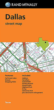
Dallas Street Map by Rand McNally
$12.95
Quick view
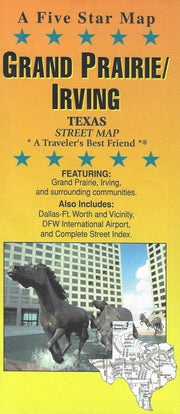
Grand Prairie/Irving by Five Star Maps
$9.95
Dallas Street Guide by Mapsco, 2020

Dallas Street Guide by Mapsco, 2020

MPBK012

Regular price $49.95
-4 in stock


This 65th edition 2020 Dallas Street Guide by Mapsco is essential for navigating Dallas and 55 surrounding communities. Back by popular demand are the original Mapsco Grids and the popular Mapsco Index which includes Zip Codes, Map Grids and Block Number Ranges. This new version includes extensive updates to the cartography from the previous edition as well as many other updates, additions and revisions to places of interest from the previous year. This Mapsco atlas is still one of the most trusted navigation tools on the market. Each street guide contains easy-to-read street-level detailed maps and a comprehensive street index, with block numbers, zip codes, city/county names, and Mapsco grid listings.

Before braving the roads of Dallas and its 55 surrounding communities, make sure your vehicle is stocked with our most up-to-date Dallas Mapsco Street Guide. Includes the following surrounding towns and communities: Addison, Allen, Balch Springs, Carrollton, Cedar Hill*, Cockrell Hill, Combine*, Coppell, Cross Roads, Dallas, Desoto, Duncanville, Fairview, Farmers Branch, Flower Mound*, Forney, Frisco, Garland, Glenn Heights*, Grand Prairie*, Hackberry, Heath, Hebron, Hickory Creek*, Highland Park, Highland Village*, Hutchins, Irving, Lake Dallas, Lakewood Village, Lancaster*, Lewisville, Lincoln Park, Little Elm, Lucas*, McKinney*, Mesquite, Murphy, New Hope*, Oak Point, Parker, Plano, Prosper, Richardson, Rockwall, Rowlett, Sachse, St. Paul, Seagoville*, Shady Shores*, Sunnyvale, The Colony, University Park, Wilmer and Wylie.
* Indicates Partial Coverage.

If you need the big picture, see Mapsco's excellent Dallas wall maps!


Dallas Street Map by Rand McNally

Dallas Street Map by Rand McNally

FOLD015

Regular price $12.95
-6 in stock

Rand McNally's folded map for Dallas is a must-have for anyone traveling in and around this part of Texas, offering unbeatable accuracy and reliability at a great price. Our trusted cartography shows all Interstate, U.S., state, and county highways, along with clearly indicated parks, points of interest, airports, county boundaries, and streets. The easy-to-use legend and detailed index make for quick and easy location of destinations. You'll see why Rand McNally folded maps have been the trusted standard for years.

  • Regularly updated
  • Full-color maps
  • Clearly labeled Interstate, U.S., state, and county highways
  • Indications of parks, points of interest, airports, county boundaries, schools, shopping malls, downtown & vicinity maps
  • Easy-to-use legend
  • Detailed & full street index
  • Convenient folded size
  • Copyright 2017
Communities covered: Addison, Carrollton, Cockrell Hill, Farmers Branch, Grand Prairie, Highland Park, Irving, and University Park.

Insets include: Downtown Dallas

Grand Prairie/Irving by Five Star Maps

Grand Prairie/Irving by Five Star Maps

FOLD122

Regular price $9.95
0 in stock

This folding street map of Grand Prairie/Irving from Five Star Maps features areas of interest, golf courses, parks, schools, zip codes and inset maps of the Dallas/Fort Worth Metroplex and DFW Airport.


Texas Map Store

Powered by Shopify


True North Publishing dba Texas Map Store has been publishing and selling maps for Texas since 1997. We continually strive to produce the most accurate and up-to-date maps available. We heartily welcome your suggestions, so please feel free to call, write or email any time.

More Stuff

  • Custom Maps
  • Tax Exempt Purchases
  • Contact Us
  • About Us
  • Shipping
  • Refunds and returns
  • Privacy Policy
  • Terms of Service

Categories

  • Texas Maps
  • City Maps
  • Historical Maps
  • Topographic Maps
  • Classroom Maps
  • Outdoor Maps
  • Decorative Maps
  • Everything Else

Join TMS Newsletter

Sign-up for Discounts, Coupons, New Product Arrivals and Recent News.

Texas Map Store

Powered by Shopify

  • american express
  • diners club
  • discover
  • jcb
  • master
  • paypal
  • visa

Everything Ships Free!

Thank you for visiting Texas Map Store where all items include a Free Shipping Option.

Tip: Try the Quickview when browsing maps