Skip to content
Close menu
Texas Maps
Road Atlases
Wall Maps
Folded Maps
City Maps
Texas City Wall Maps
Street Guides
Folded Maps
Historical Maps
Texas
Topographic
County
War
Topographic Maps
Any Current US Topographic Map
Current Texas Topographic Maps
Historical Texas Topographic Maps
Classroom Maps
Earth Sciences
Educational
Historical
Outdoor Maps
Fishing Maps
Birding Maps
Current Topo Maps
Decorative Maps
Historical
Reference
Everything Else
Other State
Other State Historical Maps
USA
USA Historical Maps
USA Road Atlases
USA Wall Maps
Country Maps
World
World Wall Maps
Globes
Custom
Custom Design Maps
Log in
Cart
Translation missing: en.cart.general.close
My Account
Login
Contact Us
View Cart
Log in
Search
Site navigation
Cart
Search
"Close (esc)"
Texas Maps
Road Atlases
Wall Maps
Folded Maps
City Maps
Texas City Wall Maps
Street Guides
Folded Maps
Historical Maps
Texas
Topographic
County
War
Topographic Maps
Any Current US Topographic Map
Current Texas Topographic Maps
Historical Texas Topographic Maps
Classroom Maps
Earth Sciences
Educational
Historical
Outdoor Maps
Fishing Maps
Birding Maps
Current Topo Maps
Decorative Maps
Historical
Reference
Everything Else
Other State
Other State Historical Maps
USA
USA Historical Maps
USA Road Atlases
USA Wall Maps
Country Maps
World
World Wall Maps
Globes
Custom
Custom Design Maps
Home
/
The Woodlands
The Woodlands
The Woodlands
Click the product image or name for
MORE INFO
.
View all
City/ County Street Guide
City/County Street Maps. City/County Street Maps: Conroe
City/County Street Maps. City/County Street Maps: Montgomery County
City/County Street Maps. City/County Street Maps: The Woodlands
Key Maps. Key Maps: Atlases
TX City / County Maps. TX City / County Maps: Montgomery Co.
Quick view
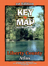
Liberty County Atlas by Key Maps, Wire-o version
$36.95
Quick view
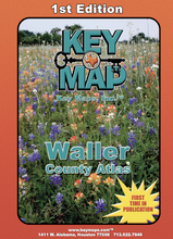
Waller County Atlas by Key Maps, Wire-o version
$36.95
Liberty County Atlas by Key Maps, Wire-o version
Regular price
$36.95
-3 in stock
Entire coverage area of Liberty County. Trusted by Emergency Responders, detailed Streets and Key Map Grid System.
Reviews
Ask a question
Name
Email
Message
"Close (esc)"
Waller County Atlas by Key Maps, Wire-o version
Regular price
$36.95
-3 in stock
Entire coverage area of Waller County. Trusted by Emergency Responders, detailed Streets and Key Map Grid System.
Reviews
Ask a question
Name
Email
Message
"Close (esc)"
"Close (esc)"