-82 in stock
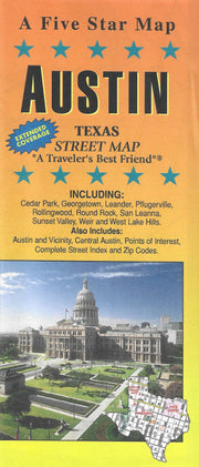
Rand McNally's folded map for Austin is a must-have for anyone traveling in and around this part of Texas, offering unbeatable accuracy and reliability at a great price. Features all Interstate, U.S., state and county highways and streets, along with clearly indicated parks, points of interest, airports and county boundaries. The easy-to-use legend and detailed index make for quick and easy location of destinations.
Communities covered: Cedar Park, Leander, Pflugerville, Rollingwood, Round Rock, Sunset Valley, and West Lake Hills plus downtown enlargement.
Insets include: Austin & Vicinity, Downtown Austin, and a Mileage & Driving Times Map.