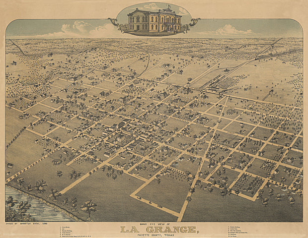
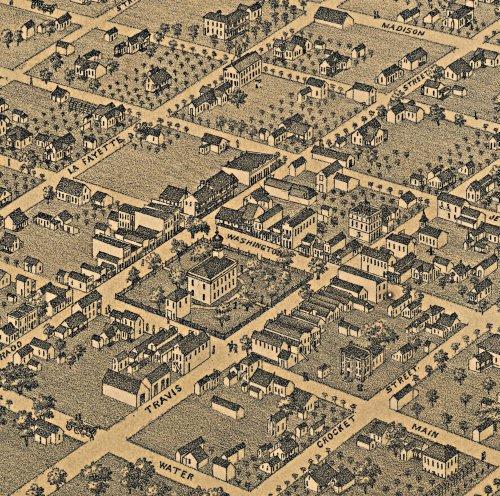
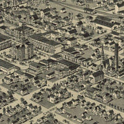
This great bird's eye view has wonderful images of prominent buildings as well as labeled streets and a legend on the bottom locating 16 churches, businesses and public buildings. This beautiful reproduction is printed on heavy parchment style paper and is excellent for framing.
30"W x 21"H
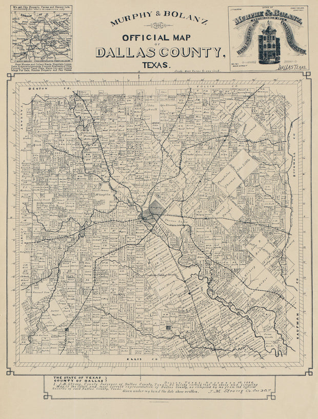
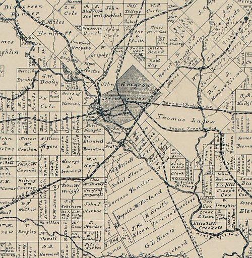
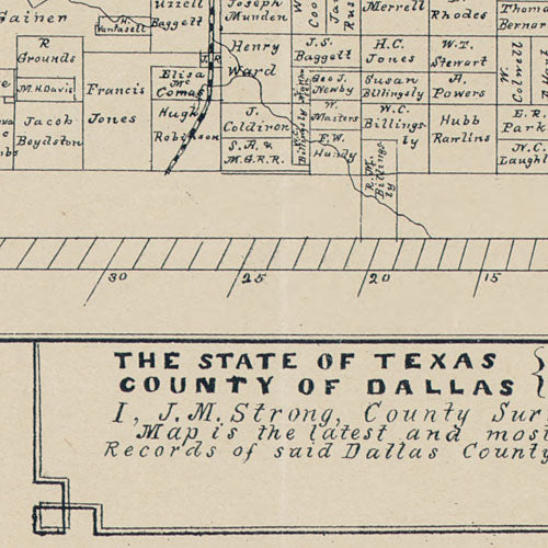
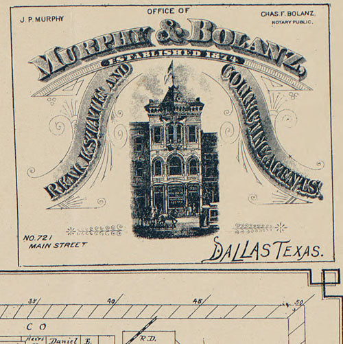
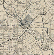
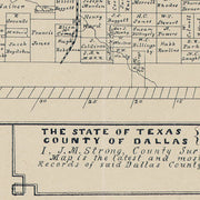
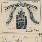
Official map of Dallas County 1886 by Murphy & Bolanz
1 review
HIST610
Regular price
$39.95
-9 in stock
This ownership map carries the statement "Dallas, Texas, November 1st, 1886. I, J.M. Strong, County Surveyor of Dallas County, Texas, do hereby certify that the above and foregoing map is the latest and most correct representation of Dallas County, as compiled by me from the official records of said Dallas County, Texas." This perfectly preserved reproduction is printed on heavy parchment style paper and is excellent for framing.
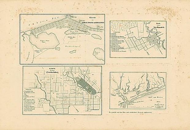
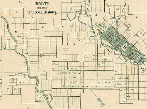
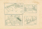
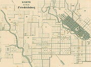
This map consists of four insets, three of which are plats of German towns, showing lots, blocks by numbers, streets, rivers, creeks, wharfs, and bayous with a key to some buildings. Insets: 1) Karte von Indian Point od Indianola, 2) Karte der Stadt Neu Braunfels, 3) Karte der Stadt Friedrechsburg, 4) Hafen von Indian Point oder Indianola. This beautiful reproduction is printed on heavy, acid-free stock and is excellent for framing.
19"W x 13"H
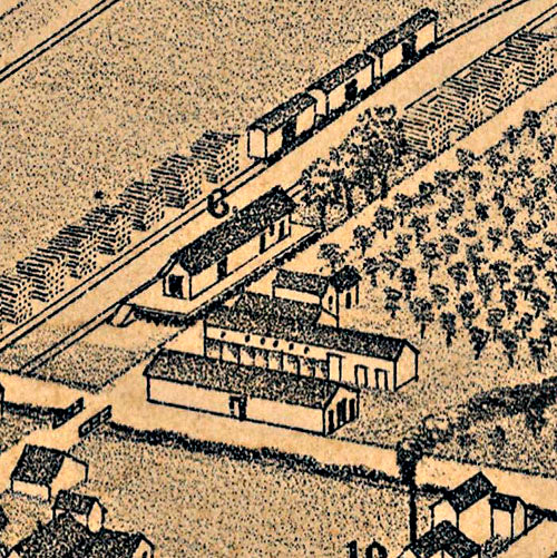
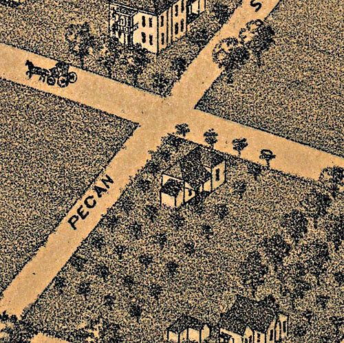
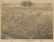
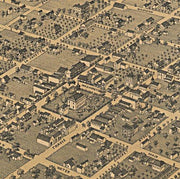
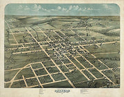
La Grange 1880 by Augustus Koch
HIST590
Regular price
$39.95
-1 in stock
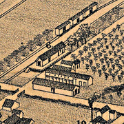
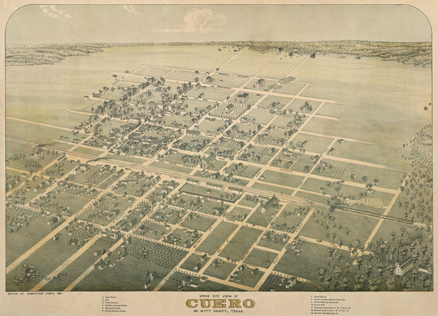
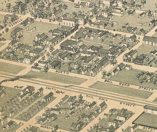
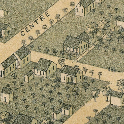
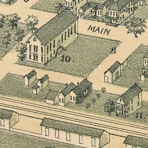
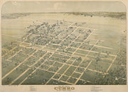
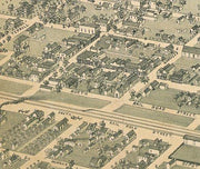
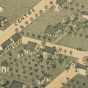
This great bird's eye view has labeled streets and a legend along the bottom locating 12 churches, businesses and public buildings. This beautiful reproduction is printed on heavy parchment style paper and is excellent for framing.
23"W x 19"H
Cuero 1881 by Augustus Koch
HIST580
Regular price
$39.95
0 in stock
This great bird's eye view has labeled streets and a legend along the bottom locating 18 churches, businesses and public buildings. This beautiful reproduction is printed on heavy parchment style paper and is excellent for framing.
26"W x 18"H
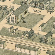
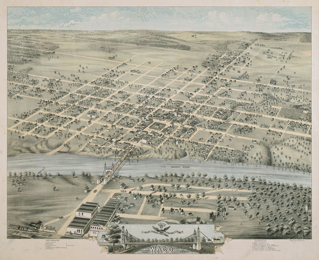
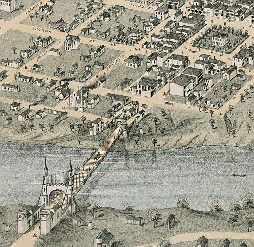
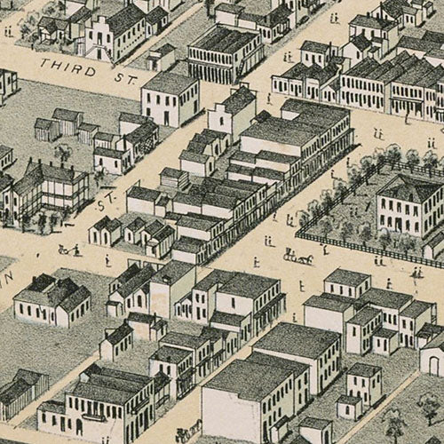
Waco 1873 by Herman Brosius
HIST570
Regular price
$39.95
0 in stock
This colorful bird's eye view has labeled streets and a legend along the bottom that locates 15 churches, businesses and schools, including "Waco University" which would later merge with Baylor Univ. upon it's move from Independence, TX. This beautiful reproduction is printed on heavy parchment style paper and is excellent for framing.
26"W x 21"H
Interested in a framed version of this map? Click HERE
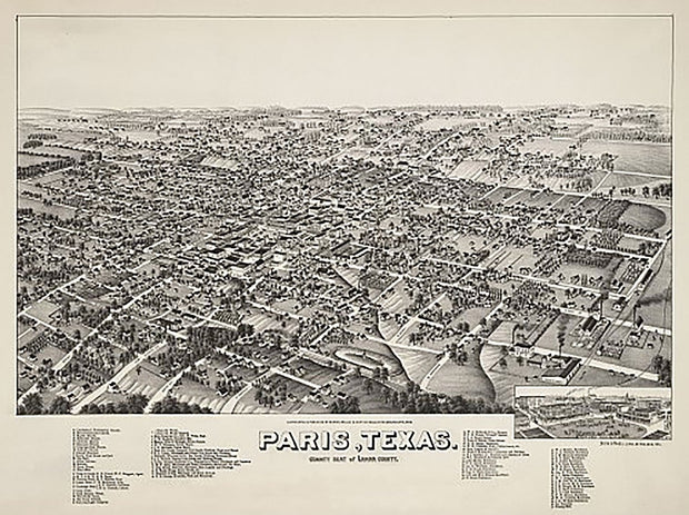
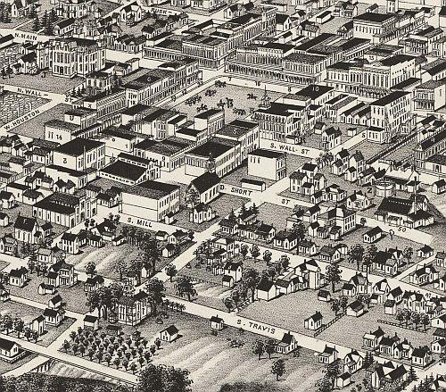
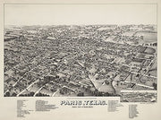
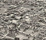
Paris 1885 by Henry Wellge
HIST550
Regular price
$39.95
0 in stock
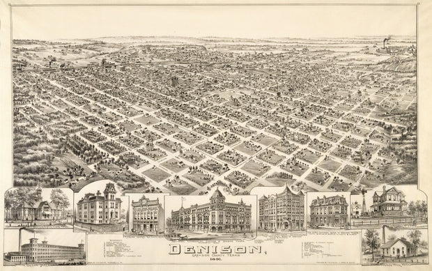
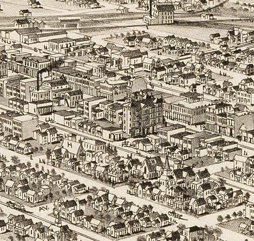
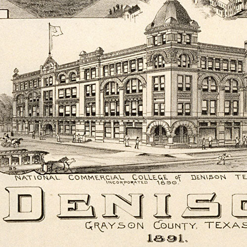
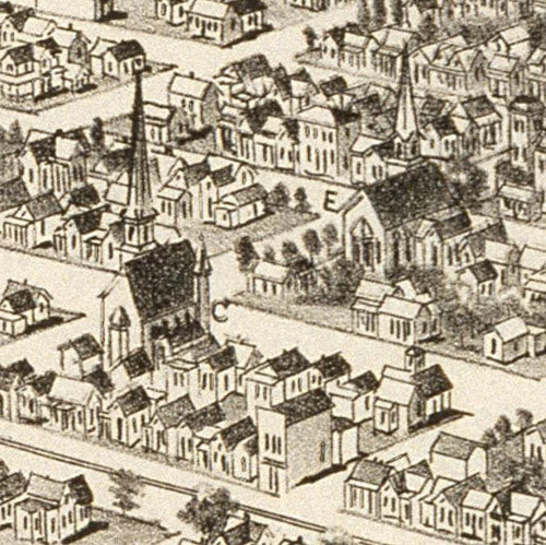
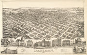
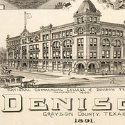
This wonderful bird's eye view has labeled streets and a legend on the bottom that lists 77 churches, businesses, public buildings and, unique for this type of map, private residences! This beautiful reproduction is printed on heavy, acid-free stock and is excellent for framing.
26"W x 18"H
Denison 1891 by T.M. Fowler
HIST540
Regular price
$39.95
0 in stock
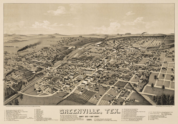
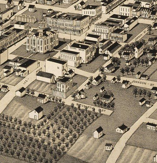
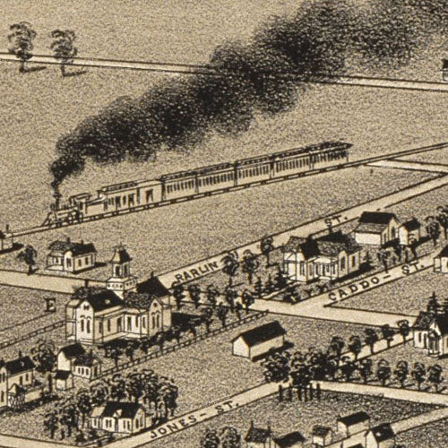
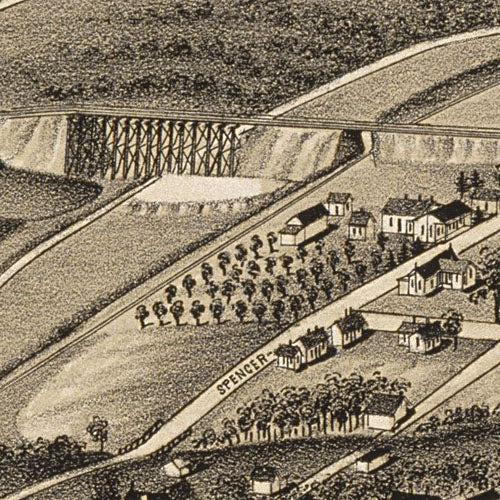
The beautifully drawn buildings and houses across the bottom of this bird's eye view make it especially attractive. The streets are labeled and there is an extensive legend across the bottom locating many churches, businesses and government buildings. This beautiful reproduction is printed on heavy parchment style paper and is excellent for framing.
35"W x 21"H
Greenville 1886 by Henry Wellge
HIST530
Regular price
$39.95
0 in stock
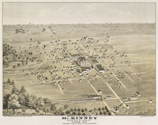
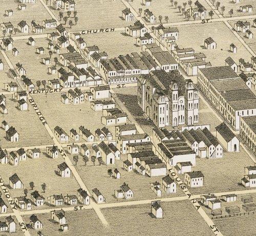
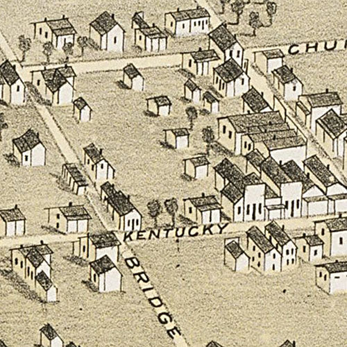
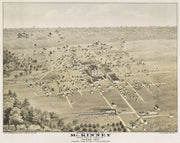
This great bird's eye view has streets labeled and an extensive legend across the bottom locating 49 churches, businesses and government buildings. This beautiful reproduction is printed on heavy parchment style paper and is excellent for framing.
26"W x 18"H
McKinney 1876 by D. D. Morse
HIST520
Regular price
$39.95
-3 in stock
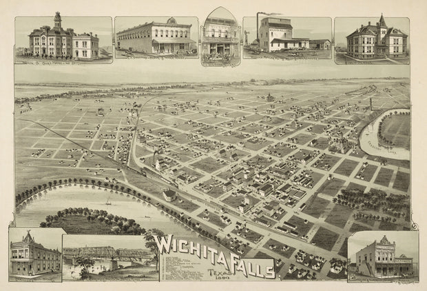
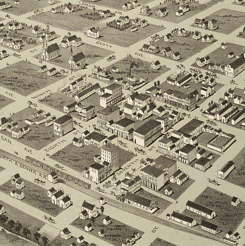
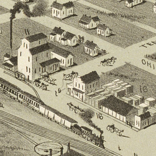
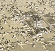
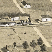
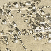
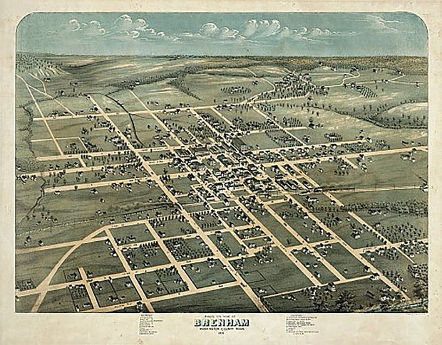
This great bird's eye view has streets labeled and lists the population at 2000. Interesting note: The intersection of Tennessee and Virginia streets shown on the map is the center of town to this day. This beautiful reproduction is printed on heavy parchment style paper and is excellent for framing.
24"W x 19"H
Brenham 1873 by Augustus Koch
HIST510
Regular price
$39.95
-3 in stock
This great bird's eye view has streets labeled and a legend across the bottom locating 19 churches, businesses and government buildings. This beautiful reproduction is printed on heavy, acid-free stock and is excellent for framing.
24"W x 19"H
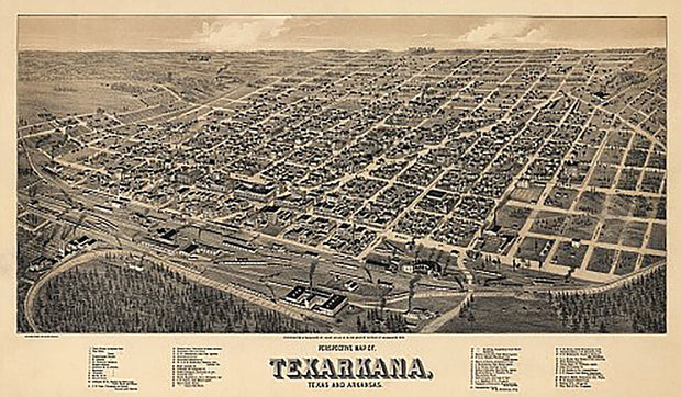
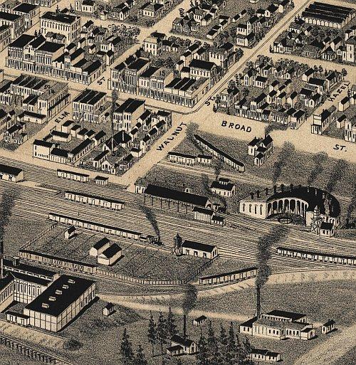
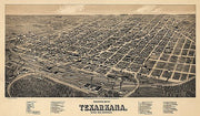
Texarkana 1888 by Beck & Pauli
HIST500
Regular price
$39.95
0 in stock
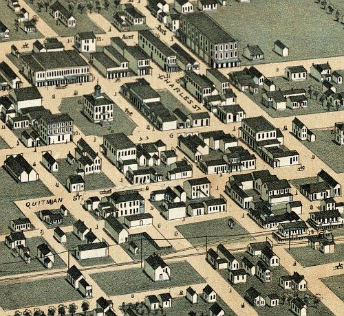
Although Texarkana sits astride the border of Texas and Arkanasa, the original surveyors thought the city would also be on the border of Louisiana, hence the ANA in the name. This great bird's eye view has streets labeled and a legend along the bottom that locates 55 churches, businesses and government buildings. This beautiful reproduction is printed on heavy, acid-free stock and is excellent for framing.
26"W x 13"H
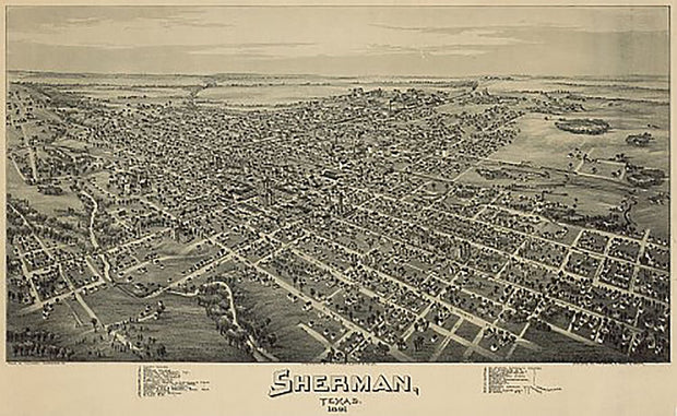
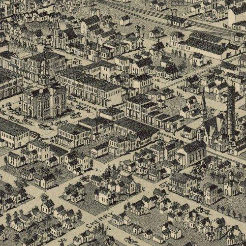
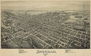
Sherman 1891 by Fowler & Moyer
HIST490
Regular price
$39.95
-1 in stock
This great bird's eye view has streets labeled and a legend across the bottom locating 32 businesses, churches and government buildings. This beautiful reproduction is printed on heavy, acid-free stock and is excellent for framing.
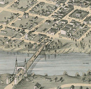
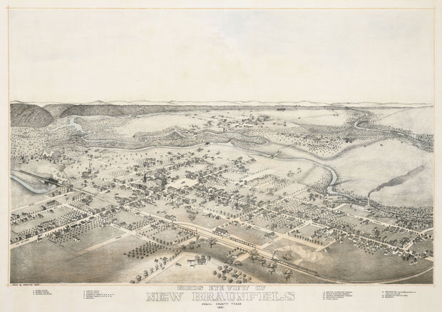
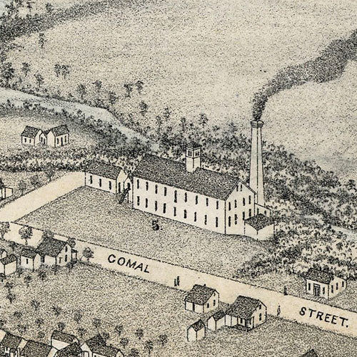
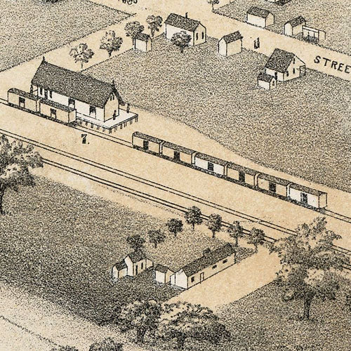
Established by German immigrants in 1845, by the time this map was drawn New Braunfels had grown into a thriving community, at one point being the fourth largest city in Texas. This excellent bird's eye view has streets labeled and a legend across the bottom listing prominent churches, businesses and government buildings. This beautiful reproduction is printed on heavy parchment style paper and is perfect for framing.
30"W x 20"H
Interested in a framed version of this map? Click HERE
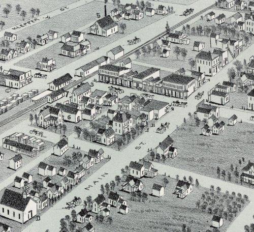
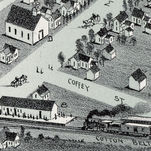
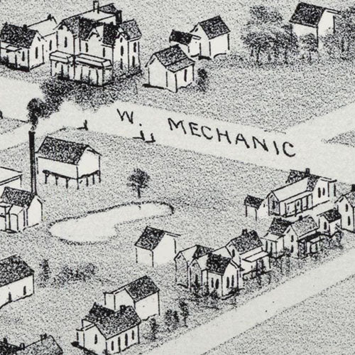
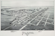
Plano 1891 by Fowler & Moyer
HIST470
Regular price
$39.95
-1 in stock
This bird's eye view has streets labeled and a legend across the bottom listing churches, businesses and prominent buildings. This beautiful reproduction is printed on heavy parchment style paper and is excellent for framing.
27"W x 17"H
Interested in a framed version of this map? Click HERE
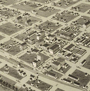
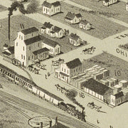
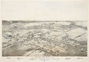
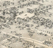
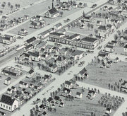
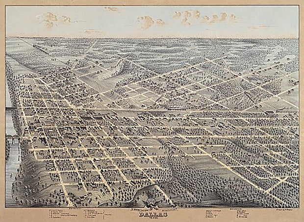
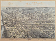
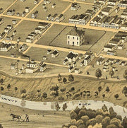
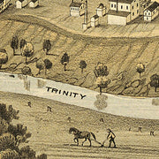
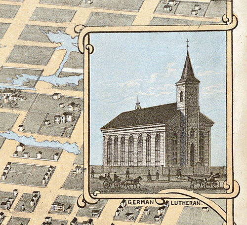
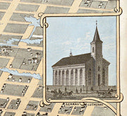
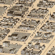
Dallas 1872 by Herman Brosius
HIST460
Regular price
$39.95
-1 in stock
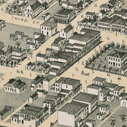
In the years after the Civil War, Dallas was already showing signs of a bustling hub of commerce. This great bird's eye view has labeled streets and a legend across the bottom listing 22 prominent churches, businesses and public buildings. This beautiful reproduction is printed on heavy, acid-free stock and is excellent for framing.
39"W x 24"H
Interested in a framed version of this map? Click HERE
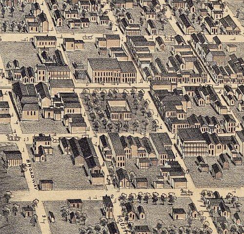
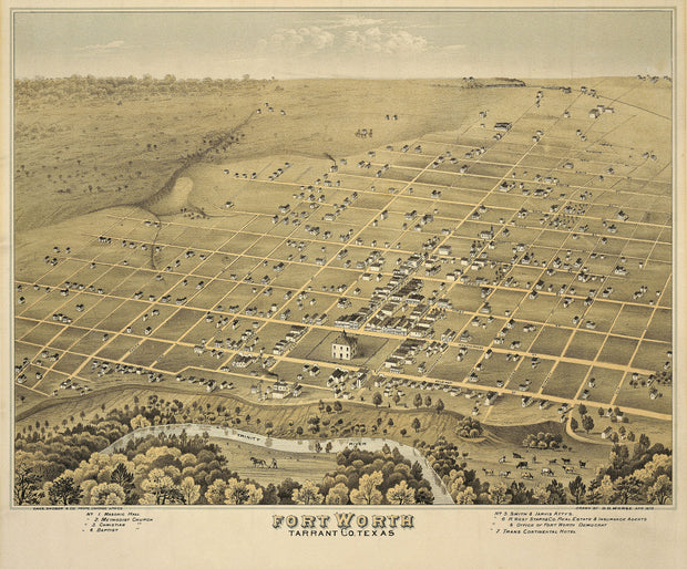
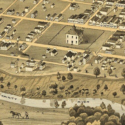
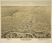
Fort Worth 1876 by D.D. Morse
HIST450
Regular price
$39.95
-1 in stock
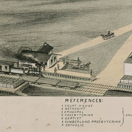
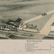
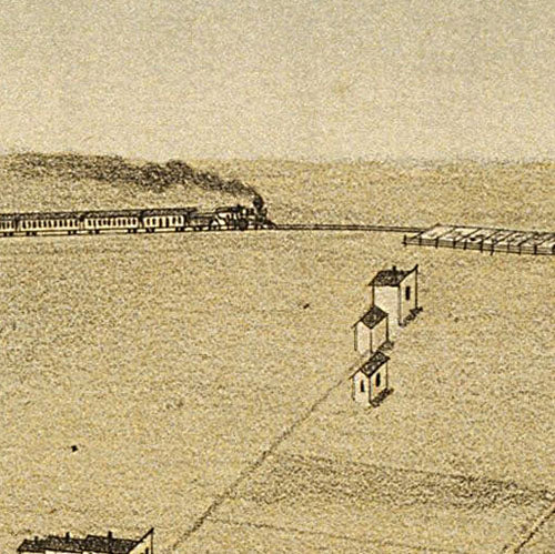
A decade after the Civil War, Fort Worth was not unlike many other sleepy outposts on the Texas prairie. In 1876 the Texas & Pacific Railway came to town and ushered in an era of astonishing growth. All of the streets are labeled on this excellent bird's eye view and a legend across the bottom identifies seven prominent businesses and churches. This beautiful reproduction is printed on heavy parchment style paper and is perfect for framing.
24"W x 21"H
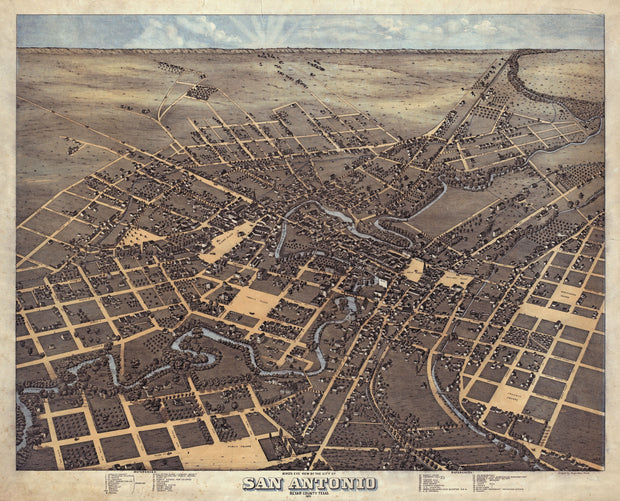
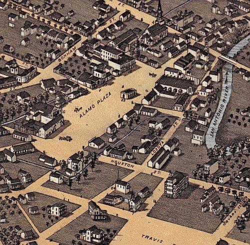
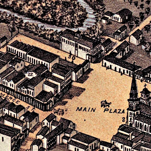
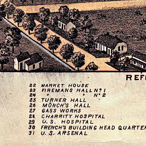
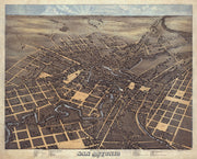
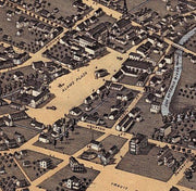
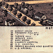
San Antonio 1873 by Augustus Koch
HIST440
Regular price
$39.95
-6 in stock
This wonderful bird's eye view shows how familiar this historic city would be to a time traveler from today. The Menger Hotel, The Alamo, Main Plaza, San Fernando Cathedral, Travis Park - they are all there. This beautiful reproduction is printed on heavy parchment style paper and is excellent for framing.
29"W x 24"H
Interested in a framed version of this map? Click HERE
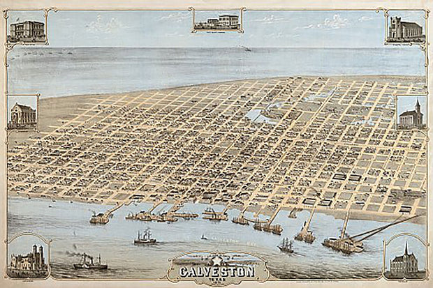
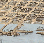
Galveston 1871 by Camille Drie
HIST430
Regular price
$39.95
-3 in stock
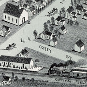
In the decades after the Civil War, Galveston emerged as Texas' premier city. It's location on the natural harbor of Galveston Bay made it the center of trade in Texas, and one of the largest cotton ports in the nation, in competition with New Orleans. This beautiful reproduction is printed on heavy parchment style paper and is excellent for framing.