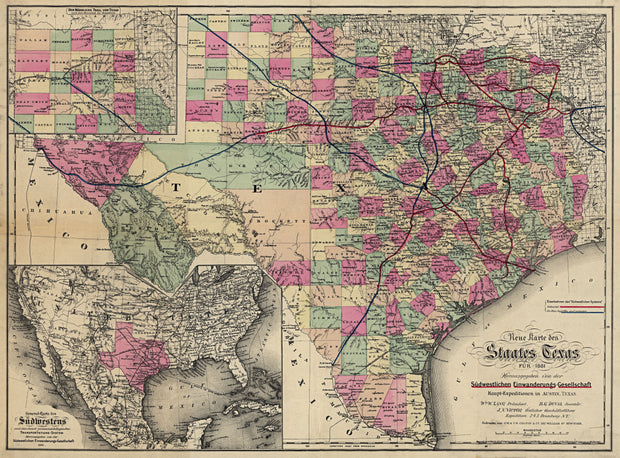
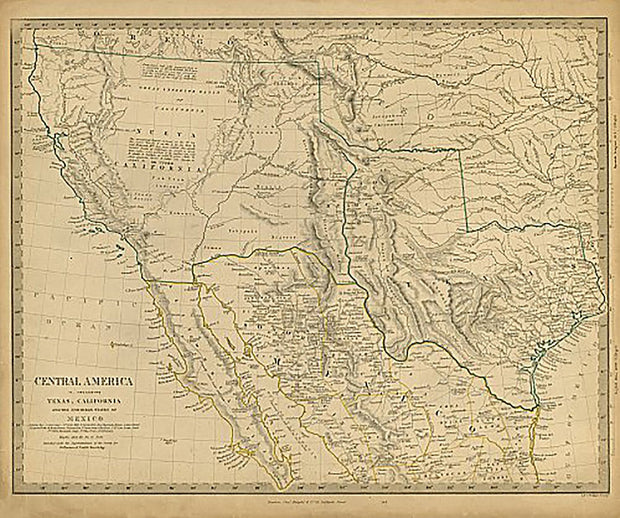
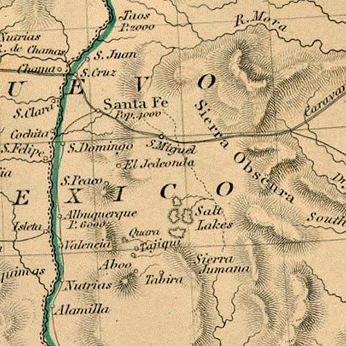
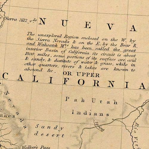
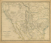
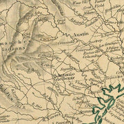
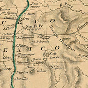
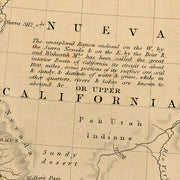
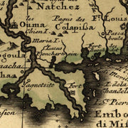
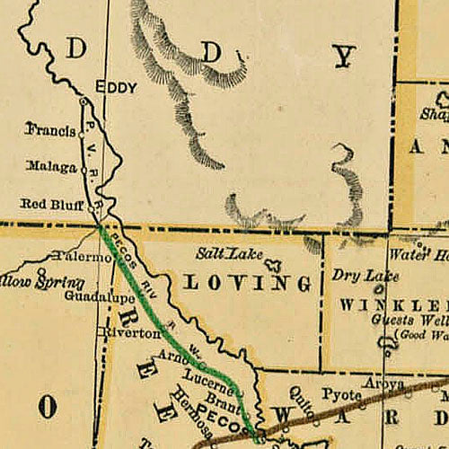
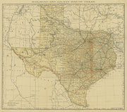
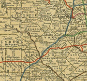
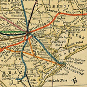
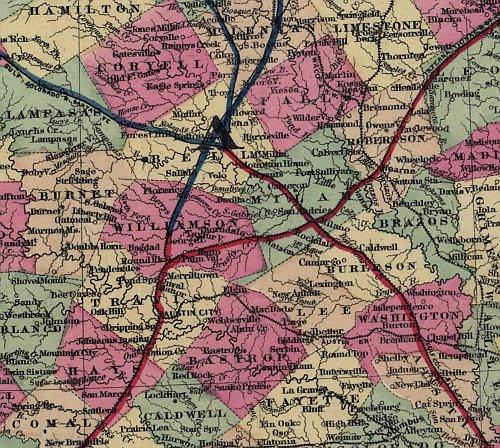
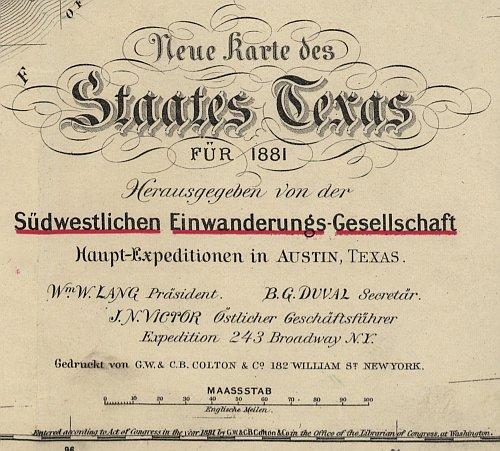
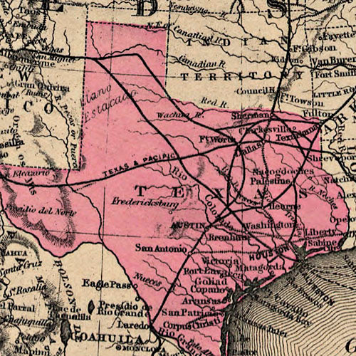
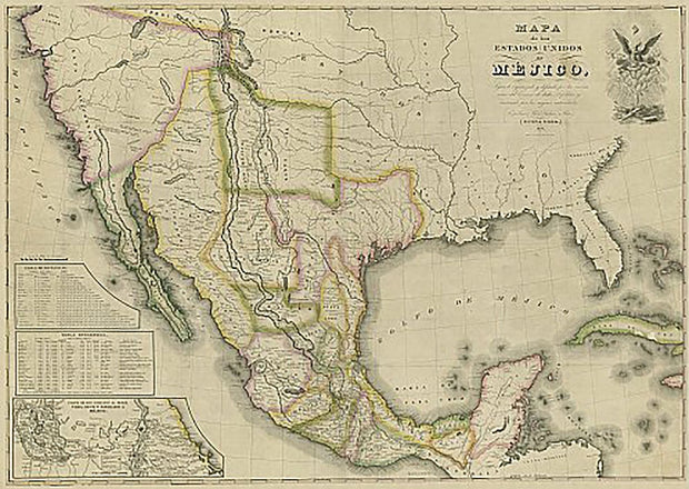
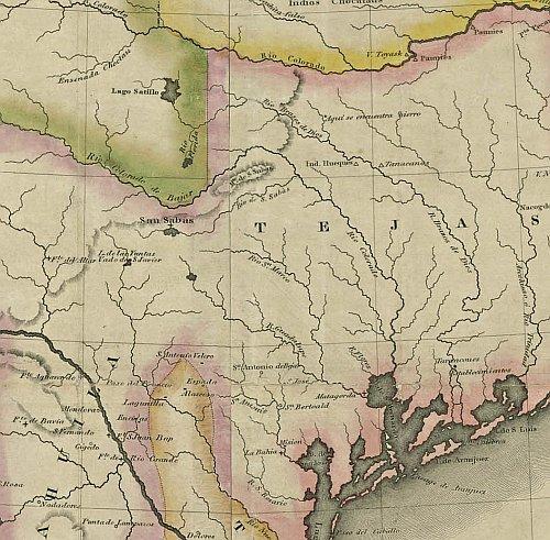
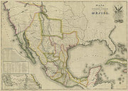
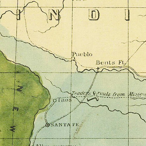
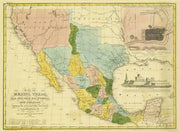
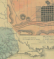
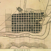
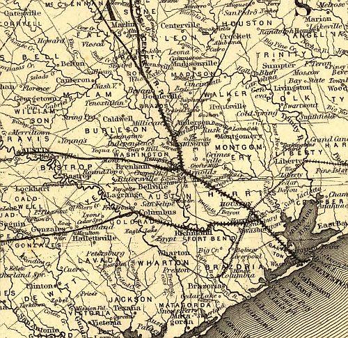
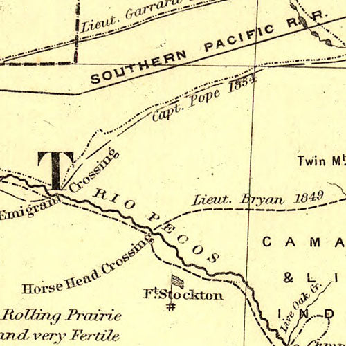
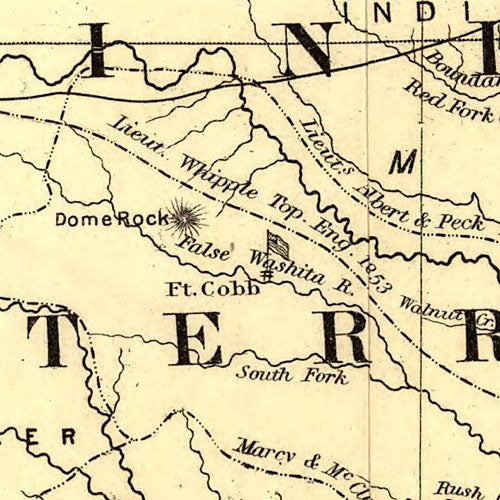
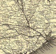
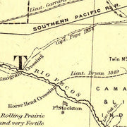
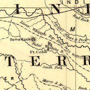
This is the official map published by the then Texas Highway Department (now Texas Department of Transportation) in 1922. This excellent reproduction is printed on heavy, acid-free bond and is excellent for framing.
31" x 33"
Plano 1891 by Fowler & Moyer
HIST470
Regular price
$39.95
-1 in stock
This bird's eye view has streets labeled and a legend across the bottom listing churches, businesses and prominent buildings. This beautiful reproduction is printed on heavy parchment style paper and is excellent for framing.
27"W x 17"H
Interested in a framed version of this map? Click HERE
Central America* Including Texas, California and Northern Mexico, 1846
HIST410
Regular price
$39.95
0 in stock
This map by Charles Knight, published by the "Society for the Diffusion of Useful Knowledge in London, shows what would become the Southwestern United States at a time when the independent Republic of Texas claimed sovereignty despite the objections of Mexico. This beautiful reproduction is printed on heavy, acid-free stock and is excellent for framing. *Central America in the title refers to the central part of North America, not Central America as we know it today.
29"W x 26"H
Interested in a framed version of this map? Click HERE
1876 Cattle Trails Map, Longhorn Edition
HIST080A-01
Regular price
$49.95
-11 in stock
An exclusive design featuring a stunning 1876 S.A Mitchell map featuring early cattle trails of Texas, Indian Territory and New Mexico overlaid with a beautiful longhorn painted by renowned artist Diane Fifer. The map features the trademark grapevine border coupled with effective but subtle handwash coloring and is printed on heavy (65lb) art quality acid free parchment paper that is excellent for framing or select canvas at checkout for a beautiful, gallery quality print on matte canvas.
36"W x 24"H
La Grange 1880 by Augustus Koch
HIST590
Regular price
$39.95
-1 in stock
This great bird's eye view has labeled streets and a legend along the bottom locating 12 churches, businesses and public buildings. This beautiful reproduction is printed on heavy parchment style paper and is excellent for framing.
23"W x 19"H
San Marcos 1881 by Augustus Koch
HIST810
Regular price
$39.95
-3 in stock
Settled in 1846 at the headwaters of the San Marcos river, by 1881 when the International-Great Northern Railroad (lower right) arrived, San Marcos was on its way to becoming a center for commerce and education. Every street is labeled on this bird's eye view and an index across the bottom identifies 10 schools, churches and public buildings. This beautiful reproduction is printed on heavy parchment style paper and is excellent for framing.
26"W x 18"H
Schulenburg 1881 by Augustus Koch
HIST640
Regular price
$39.95
0 in stock
This great bird's eye view has labeled streets and a legend along the bottom locating 8 churches, businesses and public buildings. This beautiful reproduction is printed on heavy, acid-free stock and is excellent for framing.
27"W x 18"H
Laredo 1892 by American Publishing Co.
HIST250
Regular price
$39.95
-1 in stock
Full title: Perspective map of the city of Laredo, Texas, the Gateway to and from Mexico. This excellent bird's eye view features wonderful drawings of some of the city's more important buildings and an inset depicting 'Laredo's railway connections', and a distance chart. This beautiful reproduction is printed on heavy, acid-free stock and is perfect for framing.
34"W x 17"H
Victoria 1873 by Herman Brosius
HIST760
Regular price
$39.95
-1 in stock
This wonderful bird's eye view has labeled streets and a legend on the bottom that lists 22 churches, businesses, public buildings and, unique for this type of map, private residences! This beautiful reproduction is printed on heavy, acid-free stock and is excellent for framing.
28"W x 23"H
Insets of German Communities in Texas 1850
HIST600
Regular price
$39.95
-1 in stock
This map consists of four insets, three of which are plats of German towns, showing lots, blocks by numbers, streets, rivers, creeks, wharfs, and bayous with a key to some buildings. Insets: 1) Karte von Indian Point od Indianola, 2) Karte der Stadt Neu Braunfels, 3) Karte der Stadt Friedrechsburg, 4) Hafen von Indian Point oder Indianola. This beautiful reproduction is printed on heavy, acid-free stock and is excellent for framing.
19"W x 13"H
El Paso 1886 by Augustus Koch
HIST390
Regular price
$39.95
-4 in stock
At the turn of the 19th century, El Paso was a bustling border town with two major rail yards. This great bird's eye view has most streets labeled and a legend across the bottom listing 12 prominent businesses, churches and government buildings. This beautiful reproduction is printed on heavy parchment style paper and is excellent for framing.
23" x 32"
Waco 1892
HIST350
Regular price
$39.95
0 in stock
This wonderful full-color bird's eye view shows street names and features excellent drawings of several important buildings and Baylor University (lower left). It also has building and church directories that are referenced to the buildings shown on the map. This beautiful reproduction is printed on heavy, acid-free stock and is excellent for framing.
34" W x 20"H
Waco 1886 by Henry Wellge
HIST650
Regular price
$39.95
0 in stock
This great bird's eye view has labeled streets and an amazingly comprehensive legend along the bottom locating well over 100 churches, businesses, private residences and public buildings. This beautiful reproduction is printed on heavy parchment style paper and is excellent for framing.
33"W x 23"H
Denison 1891 by T.M. Fowler
HIST540
Regular price
$39.95
0 in stock
The beautifully drawn buildings and houses across the bottom of this bird's eye view make it especially attractive. The streets are labeled and there is an extensive legend across the bottom locating many churches, businesses and government buildings. This beautiful reproduction is printed on heavy parchment style paper and is excellent for framing.
35"W x 21"H
Worley's Map of Greater Dallas 1905
HIST710
Regular price
$39.95
0 in stock
The advertising on this great map (see detail) is as interesting as the street info and a comprehensive index of "Streets", "Block Numbers" and "Additions" across the bottom give it added interest. This excellent reproduction is printed on heavy acid-free stock and is perfect for framing.
23'W x 29'H
A Map of New Spain 1810
HIST400
Regular price
$39.95
-8 in stock
Drawn by Alexander von Humbolt, this great map dates from the period just after the Louisiana Purchase in 1803 when little was known about the "provincia" of Texas. Interesting note: longitude is shown as degrees "West from Paris". This beautiful reproduction is printed on heavy parchment style paper and is excellent for framing.
23" x 31"
Interested in a framed version of this map? Click HERE
Texarkana 1888 by Beck & Pauli
HIST500
Regular price
$39.95
0 in stock
Although Texarkana sits astride the border of Texas and Arkanasa, the original surveyors thought the city would also be on the border of Louisiana, hence the ANA in the name. This great bird's eye view has streets labeled and a legend along the bottom that locates 55 churches, businesses and government buildings. This beautiful reproduction is printed on heavy, acid-free stock and is excellent for framing.
26"W x 13"H
Paris 1885 by Henry Wellge
HIST550
Regular price
$39.95
0 in stock
This wonderful bird's eye view has labeled streets and a legend on the bottom that lists 77 churches, businesses, public buildings and, unique for this type of map, private residences! This beautiful reproduction is printed on heavy, acid-free stock and is excellent for framing.
26"W x 18"H
Cuero 1881 by Augustus Koch
HIST580
Regular price
$39.95
0 in stock
This great bird's eye view has labeled streets and a legend along the bottom locating 18 churches, businesses and public buildings. This beautiful reproduction is printed on heavy parchment style paper and is excellent for framing.