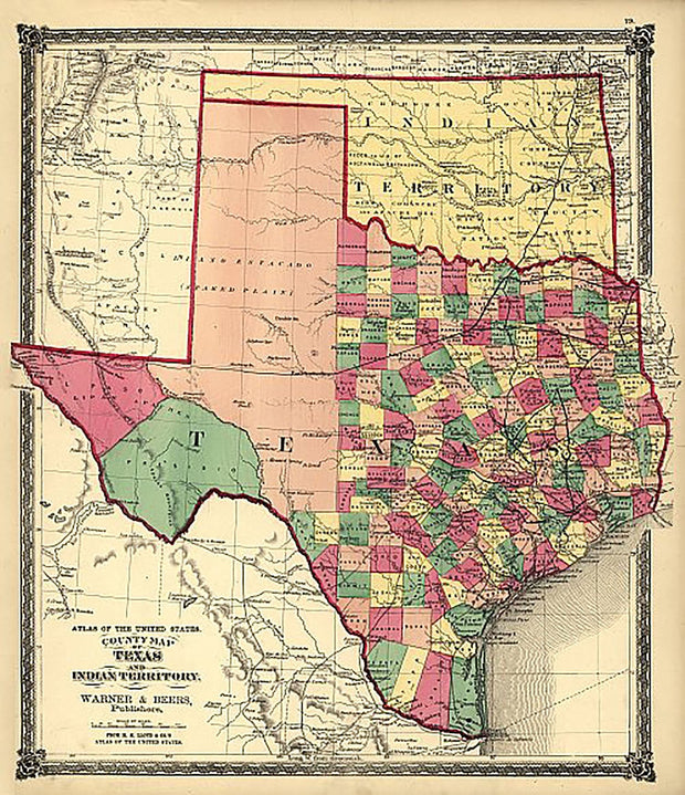
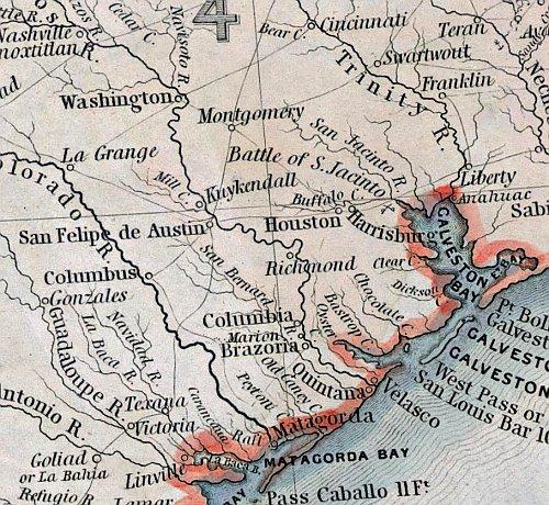
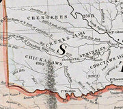
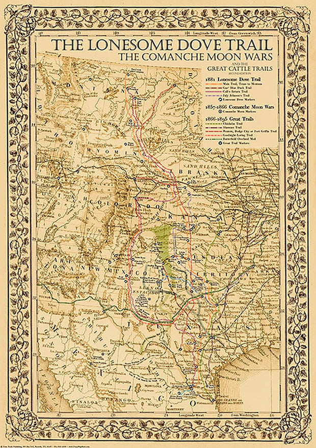
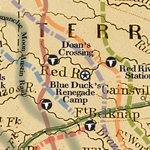
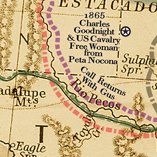
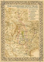
This colorful bird's eye view has labeled streets and a legend along the bottom that locates 15 churches, businesses and schools, including "Waco University" which would later merge with Baylor Univ. upon it's move from Independence, TX. This beautiful reproduction is printed on heavy parchment style paper and is excellent for framing.
26"W x 21"H
Interested in a framed version of this map? Click HERE
Greenville 1886 by Henry Wellge
HIST530
Regular price
$39.95
0 in stock
This great bird's eye view has streets labeled and an extensive legend across the bottom locating 49 churches, businesses and government buildings. This beautiful reproduction is printed on heavy parchment style paper and is excellent for framing.
26"W x 18"H
1860 Pre-Civil War County Map of Texas by S.A. Mitchell
HIST050
Regular price
$39.95
-5 in stock
The intricate border on this beautiful hand-colored map make it stand out as one of the most popular early maps available. Just prior to the Civil War, Texas was growing fast, pushing railroads westward to accommodate her booming commerce and population growth. This excellent reproduction is printed on heavy parchment style paper is perfect for framing.
28"W x 23"H
Interested in a framed version of this map? Click HERE
1855 Texas County Map by J.H. Colton
HIST560
Regular price
$39.95
-6 in stock
In the decade after statehood Texas was developing fast with most of the counties in the eastern half of the state having been established with little change according to present-day boundaries. This beautiful reproduction is printed on heavy parchment style paper and is excellent for framing.
26"W x 21"H
Interested in a framed version of this map? Click HERE
A New Map of Texas, Oregon and California with the Regions Adjoining, 1846
HIST100
Regular price
$39.95
-3 in stock
This is a beautiful reproduction of one of the most important maps of it's day. Published by Samuel A. Mitchell at a time when war was imminent with Mexico, it is one of the first maps to depict Texas as a state. Useful as well as informative, it was published as a pocket map and depicts all of the important emigrant trails including the Oregon Route, Fremont's Route, Lewis & Clarkes Route, the Great Spanish Trail from P. Angelos to Santa Fe, and the Caravan Route to Santa Fe. It was even reportedly used by Brigham Young in 1847 on his trek to The Great Salt Lake. The map is printed on heavy parchment style paper that is excellent for framing.
26"W x 28"H
Interested in a framed version of this map? Click HERE
1846 Texas "Stovepipe" Map by Augustus Mitchell
HIST160
Regular price
$39.95
-6 in stock
In 1846 when this historic Texas reproduction map was published by S.A. Mitchell, Sr. the boundaries of the state were still unsettled. The "stovepipe" extension reaching to the 42nd parallel is shown and the boundaries around El Paso in far west Texas are still unresolved and would be until 1850. The area west of Dallas and Fort Worth was almost entirely wild and the llano Estacado atop the Caprock was largely unknown territory. This early map also shows Indian Territory which had been formed in the 1830's as well as Taos and Santa Fe which had been claimed by the Texas Repulic. This is one of the few early maps that shows the entire state of Texas without truncation, which adds greatly to visual appeal.
20"W x 26'H
1872 Texas Counties and Indian Territory Map
HIST060
Regular price
$48.00
Sale price
$39.95
-5 in stock
This reproduction is from The National Atlas of the United States copyrighted in 1872 and published in 1876 by Warner & Beers. In this transitional period, the railroads had only reached as far west as Dallas & Austin. There are a number of projected but never built fantasy railroads shown as well as major Indian war trails, the military roads connecting the frontier forts and many now-forgotten place names. In addition, a very large part of Indian Territory and New Mexico is shown in full color and detail. This is one of the few Texas maps that shows Wigefarth County in the lower Panhandle next to Indian Territory. This county was in existence for only a short time. The map features an intricate border coupled with effective but subtle handwash coloring and is printed on heavy parchment style paper that is excellent for framing.
23"W x 26"H
1876 County Map of Texas by S.A. Mitchell
HIST070
Regular price
$48.00
Sale price
$39.95
-2 in stock
In 1876 when this superb folio map of Texas was published by the S.A. Mitchell Co., the frontier was still in flux and the western counties including those on the barren and little known Llano Estacado had not yet been formed from the early territories. This reproduction brings out many normally hard to see features. In this transitional period, the railroads had only reached as far west as Fort Worth & San Antonio. Shown are the major Indian war trails, the military roads still connecting all the frontier forts and many now-forgotten place names. In addition, a very large part of Indian Territory and New Mexico is shown in full color and detail. The map features the trademark grapevine border coupled with effective but subtle hand wash coloring and is printed on heavy parchment style paper that is excellent for framing.
34"W x 24"H
Interested in a framed version of this map? Click HERE